Willkommen bei MapFox
+++ Buchhändleranfragen willkommen! Tel. 0431-666 75 99 +++
Warenkorb
Artikel: 0 - € 0.00
Zur Kasse
Impressum Kontakt Versandkosten AGB
Europe - Voyage en train Landkarte Cartotrain
<< Europa - allgemein
<< Reisen allgemein: Eisenbahn
 
Cover

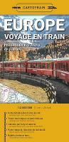
Übersichtskarte der Eisenbahnlinien in Europa.

Discover and explore Europe by train!

Find all the railway lines in Europe that you can travel on. Distinction is made between high-speed lines, conventional lines, and slow lines: cross the country in just a few hours or enjoy the natural landscapes unfolding gently - the choice is yours!

More than 300 tourist and heritage lines: from historic steam trains to 1950s railcars, and picturesque narrow-gauge lines - there`s something for everyone, young and old alike?

Around 12,000 stations in nearly 40 countries - no other railway map of Europe has ever offered such a comprehensive view of the network. Major routes between metropolises or small forest and mountain lines? there’s so much to discover.

The map covers the entire European continent: from Portugal to Armenia, and from Sicily to the North Cape in Norway. Includes detailed zoom-ins on Switzerland and some densely populated areas of Germany and England.

The map also includes ferry services, so you can continue your journey even further! Where land-based rail links are missing, a few complementary bus routes have been added.

Map of night trains in Europe. What would long-distance train travel be without night services?

The back of the map features a mapped inventory of night trains across Europe!

The map also contains some practical information, and a background map showing forests, lakes, natural areas, and active volcanoes?

English - French

Kartenausschnitt

Europe - Voyage en train Landkarte Cartotrain
EAN / ISBN: 9782959394461
Preis: EUR 17.90

Bestellartikel: versandfertig in ca. 3-7 Tagen. Dieser Artikel wird speziell für Sie bestellt. Keine Rücknahme!
Produkt EUR Anzahl Bestellen
Europe - Voyage en train Landkarte Cartotrain 17.90
Versandkostenfrei in Deutschland ab 30,- Bestellwert

incl. MwSt.

Stichworte, die bei der Suche nützlich sein könnten:
Europa - Eisenbahn - Europa - Europakarten - Europa Landkarten - Europa Straßenkarten - Europe maps - Eisenbahn-Landkarten

Zuletzt angesehene Artikel:

CoverEurope - Voyage en train Landkarte Cartotrain

CoverM4242 Juupajoki Topographische Karte 1:25.000 EUREF (Peruskartta) Maanmittauslaitos / Lantmäteriverket Finnland - ProjektNord

CoverPeneda-Gerês Nationalpark Wanderkarte 1:50.000 - wasserfest
Parque Nacional da Peneda-Gerês AdventureMaps - Portugal

CoverSchleswig - Flensburg ADFC-Regionalkarte 1:75.000 BVA Bielefelder Verlag

CoverUSA - Kanada Süd 1:3 Mio. Auto- + Freizeitkarte
USA, Southern Canada Etats-Unis, Canada du Sud - Estados Unidos de America, Canada freytag & berndt

CoverS532 Murtovaara Topographische Karte 1:50.000 EUREF-FIN (Maastokarttat) Maanmittauslaitos / Lantmäteriverket Finnland - ProjektNord

Cover6945 Zwiesel Topographische Landkarte Bayern 1:25.000 - Normalausgabe - ProjektNord (geplottete Ausgabe) - Grundlage amtliche Topographische Karte Bayern DTK25

Noch kein Cover vorhandenMountain Walks Kinder Scout Vertebrate Publishing

CoverRadfernwegekarte & Biketouren Alpen - Übersichtskarte 1:500.000 inklusive Bikeparks und Alpenpässe - KOMPASS-Karten

Noch kein Cover vorhandenMittelsudeten 1:40.000 - Wanderkarte, Fahrradkarte, Radwanderkarte Polen (LAMINIERTE Ausgabe)
Sudety Srodkowe - wodoodporna PLAN Galileos - Polen

CoverIndien Süd 1:1.2 Mio. Landkarte Reise-Know-How Verlag - world mapping project

Cover2933 Gusborn Topographische Karte 1:25.000 Landesvermessungsamt Brandenburg (gefaltet)

CoverDolenjska - Gorjanci - Kocevski Rog - Bergwanderkarte Slowenien 1:50.000 Wanderkarte Planinska Zveza Slovenije

CoverHeiligenhafen 1:35.000 - Großenbrode - Oldenburg in Holststein - Weißenhäuser Strand - mit Ostseeküsten-Radweg - Rad- und Wanderkarte - grünes herz

CoverZwischen Alghero und Sassari (12) Topographische Wanderkarte Sardinien 1:60.000 (deu./engl./ital.)
Carta turistica e dei sapori tra Alghero e Sassari Edizioni Abies

Cover08W BAD NIEUWESCHANS (West) Topographische Karte der Niederlande 1:50.000 Topografische Dienst (Plotausgabe)

CoverG15 Oberviechtach - Schönsee - Treffelstein - Tiefenbach - Winklarn - Teunz - Dieterskirchen Wander- und Radkarte. UTM. GPS - Landesamt für Vermessung und Geoinformation Bayern - ATK25 Topographische Karte 1:25.000 (Atkis) Bayern Landesvermessungsamt Bayern - Wanderkarte - Radwanderkarte

CoverSlowakei: Weg der Helden (E8) OutdoorHandbuch (Band 308) - von Jörn und Petra Kaufhold Conrad-Stein-Verlag

CoverNord-Ostpreußen Mitte 1:100.000 Russische Ortsnamen in Kyrillisch und Latein, Verzeichnis aller Orte und Wohnplätze, Historische Ortsnamen, Ortsnamen 1928 / 1938-1945 - Blochplan

Cover3752 Müllrose Sonderausgabe mit Wanderwegen - Topographische Wanderkarte Brandenburg 1:25.000 ProjektNord