Willkommen bei MapFox
+++ Buchhändleranfragen willkommen! Tel. 0431-666 75 99 +++
Warenkorb
Artikel: 0 - € 0.00
Zur Kasse
Impressum Kontakt Versandkosten AGB
Mont-Blanc Granite 4 (englisch) - Géant, Cirque Maudit, Vallée Blanche - a rock climbing guide - JMEditions
A rock climbing guide to Géant, Cirque Maudit and Vallée Blanche in the Mont-Blanc massif
<< Frankreich: Wanderführer und Reiseführer allgemein
 
Cover

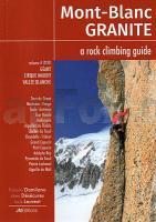
This forth volume in the the Mont Blanc Granite series describes the best rock climbs in the glacial basin of the upper Vallee Blanche and the Cirque Maudit as well as the classic routes on, and around, the Dent du Geant.

Elegant lines, huge walls and mostly excellent rock are just some of the reasons why these high-mountain crags are becoming increasingly popular. Each area is served by a strategically located hut, each with its own character but all perfect base camps from which to sample the area`s delights.

As with the previous three volumes in this series, the guide is illustrated with both colour photo-topos and topo-diagrams, there`s comprehensive, and easy-to-follow, access information and a great selection of action shots... in English throughout...

Kartenbeispiel

Mont-Blanc Granite 4 (englisch) - Géant, Cirque Maudit, Vallée Blanche - a rock climbing guide - JMEditions
A rock climbing guide to Géant, Cirque Maudit and Vallée Blanche in the Mont-Blanc massif
EAN / ISBN: 9782918824398
Preis: EUR 36.90

Bestellartikel: versandfertig in ca. 2 Wochen oder länger. Dieser Artikel wird speziell für Sie bestellt. Keine Rücknahme!
Produkt EUR Anzahl Bestellen
Mont-Blanc Granite 4 (englisch) - Géant, Cirque Maudit, Vallée Blanche - a rock climbing guide - JMEditions
A rock climbing guide to Géant, Cirque Maudit and Vallée Blanche in the Mont-Blanc massif
36.90
Versandkostenfrei in Deutschland

incl. MwSt.

Stichworte, die bei der Suche nützlich sein könnten:
Vallée Blanche - Géant - Cirque Maudit - Mont Blanc Kletterführer - Mont Blanc - Frankreich Wanderführer - Frankreich Reiseführer

Zuletzt angesehene Artikel:

CoverMont-Blanc Granite 4 (englisch) - Géant, Cirque Maudit, Vallée Blanche - a rock climbing guide - JMEditions
A rock climbing guide to Géant, Cirque Maudit and Vallée Blanche in the Mont-Blanc massif

CoverU41 Topographische Karte 1:100.000 EUREF-FIN Maanmittauslaitos / Lantmäteriverket Finnland - ProjektNord

CoverA Northern Coast to Coast Walk - From St Bees Head to Robin Hood`s Bay Cicerone Großbritannien (englisch)

Noch kein Cover vorhanden342.13 Amtliche topographische Karte 1:25.000 Polen

Noch kein Cover vorhanden4155 Göhren Topographische Karte 1:25.000 Messtischblatt des Deutschen Reiches - Preußische Landesaufnahme / Reichsamt für Landesaufnahme - Faksimile ProjektNord

Cover15-424 Topographische Karte 1:25.000 der Tschechischen Republik
Zakladní mapa Ceská republika Cesky urad zememericky a katastralni - ProjektNord

CoverWellington & Palm North A4 Bookmap 210 Kiwimaps Ltd - Neuseeland

Noch kein Cover vorhanden4966 Kanth Topographische Karte 1:25.000 Messtischblatt des Deutschen Reiches - Preußische Landesaufnahme / Reichsamt für Landesaufnahme - Faksimile ProjektNord

Cover132 Gleinalpe - Leoben - Voitsberg 1:50.000 - Wanderkarte / Radwanderkarte / Wintersportkarte Österreich - GPS - Freytag & Berndt

CoverWanderkarte Südliches Siegerland Wandern im 3-Länder-Eck - von Herausgeber: Gemeinde Burbach, Gemeinde Wilnsdorf, Gemeinde Neunkirchen ; Kartographie: mr-kartographie, Ingenieurbüro und Verlag - Verlag grünes herz

CoverFalk Stadtplan Extra Standardfaltung Kassel + Umgebungskarte

CoverDormagen Topographische Wanderkarte Nordrhein-Westfalen mit Wanderwegen und Radwegen 1:25.000 - ProjektNord

Cover23-24 Topographische Karte 1:50.000 der Tschechischen Republik
Zakladní mapa Ceská republika - Cesky urad zememericky a katastralni - ProjektNord

CoverSüdtirol Reiseführer Michael-Müller-Verlag - Reiseführer

Cover0890 Kunzen Topographische Karte 1:25.000 Messtischblatt des Deutschen Reiches - Preußische Landesaufnahme / Reichsamt für Landesaufnahme - Faksimile ProjektNord

Noch kein Cover vorhanden144.23 Amtliche topographische Karte 1:25.000 Polen

CoverHirschberg Touristenführer (polnisch) Illustrierter Stadtführer mit Karten
Jelenia Góra przewodnik PLAN Galileos - Polen

Noch kein Cover vorhanden332.34 Amtliche topographische Karte 1:25.000 Polen

CoverLonely Planet Weltreise - Mit Lonely Planet durch alle Länder der Erde Bildband

Noch kein Cover vorhanden144.42 Amtliche topographische Karte 1:25.000 Polen