| << ANTICA - historische Landkarten auf Pergament |
||
Zuletzt angesehene Artikel:
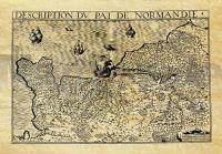
 | La Normandie en 1620 Historische Landkarte auf Pergament (Faksimile) - 50 x 37,5 cm - PLANO gerollt Antica |
 | Nuuksio - Luukkaa 1:20.000 *** SCHNÃPPCHEN *** Wanderkarte Genimap / Karttakeskus - Finnland |
 | Sandezer Beskiden 1:50.000 Laminierte touristische Landkarte Beskid Sądecki - comfort!map ExpressMap Polen |
 | Kanuland 1:100.000 Kanufahren in Dalsland-Nordmarken - einem der schönsten Seesysteme Europas - von Stenström, Jonas - Naturcentrum AB |
 | Turin Provinzialautokarte - StraÃenkarte 1:150.000 - Italien Torino - Carta stradale della Provincia - Italia L.A.C. GlobalMap Italien |
 | Märkische Schweiz 1:75.000 wasserfest und reiÃfest - Grünes Herz |
 | Mt. Dikti - Mt. Selena 1:35.000 (Blatt 11.15) Topografische Bergwanderkarte - Griechenland |
 | 51 Mittleres Elstertal Topographische Karte Thüringen 1:50.000 - Thüringer Landesvermessungsamt - Wanderkarte mit Wanderwegen |
 | Lettland Physische Landkarte 1:400.000 - POSTER Latvija - Fiziogeografiska karte Jana Seta |
 | Things to do in Moer & Gone Places A guide to over 100 South Africa´s outdoor secrets - Activities - Accomodation - Amenities - Sights - MapStudio Südafrika |
 | Radwege rund um Pilsen 1:75.000 Radwanderkarte Tschechien Cyklotrasy Plzeňsko - Cyklomapa Mapcentrum Ceske Budejovice - Tschechien |
 | Monte Amiata 1:25.000 (MA) - Topographische Wanderkarte - Italien - Club Alpino Italiano CAI Carta escursionistica del Monte Amiata MAPTREK Italia |
 | Weserbergland-Weg (Blatt 819) 1:50.000 Wanderkarte Wandern, Rad. GPS-genau. ReiÃfest, wetterfest - KOMPASS-Karten |
 | Zürich Oberland (Blatt 10) 1:50.000 Topographische Skitourenkarte der Schweiz - SNOW TRAIL MAP |
 | Oberengadin (Blatt 5) 1:50.000 Topographische Skitourenkarte der Schweiz - SNOW TRAIL MAP |
 | Auckland & Nordinsel 1:12.500 / 1:650.000 Neuseeland Landkarte / Stadtplan Auckland & North Island ITMB International Travel Maps (engl.) |
 | 61 Paderborner Land - Nordteil Topographische Wanderkarte 1:25.000 Land Nordrhein-Westfalen / Gepmap Medienagentur |
 | 6009 Strassenkarte der Schweiz 1:200.000 Topographische Landeskarte der Schweiz (doppelseitig) - swisstopo |
 | Wandertouren im Vänerland Wanderführer (schwedischsprachig) Vandringsturer i Vänerland Vildmarksbiblioteket Schweden |
 | 29 Tessin Süd - Lugano - Lago Maggiore 1:60.000 Topographische Wanderkarte Tessin Sottoceneri Schweiz - Kümmerly & Frey |


