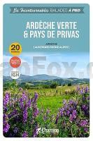
| << Frankreich: Wanderführer - französischsprachig << Chamina - Wanderführer (französischsprachig) |
  | |
Zuletzt angesehene Artikel:
![]() | Ardèche verte et pays de Privas Wanderführer (französisch) Chamina - Frankreich |
![]() | 4333 04 Kakkaravaara Topographische Karte 1:20.000 (Maastokartta / Peruskartta / Grundkarta) Maanmittauslaitos / Lantmäteriverket Finnland - ProjektNord |
![]() | 110-1 MEDINA DE POMAR Amtliche topographische Landkarte 1:25.000 Spanien (M.T.N.) 110-1 Mapa Topográfico Nacional de Espana (MTN25) Instituto Geográfico Nacional - CNIG Spanien |
![]() | Die Erde politisch 1:60 Mio. mit Flaggen (53 x 68 cm) WANDKARTE mit Metallleisten - Craenen BVBA (englisch) |
![]() | 4352 Spremberg - Sellessen Topographische Karte 1:25.000 Landesvermessungsamt Brandenburg (gefaltet) |
![]() | Heuvelland - Wanderkarte 1:33.333 Noorbeek, Slenaken, Vaals Wandelregiokaart Nederland ANWB - Niederlande |
![]() | 2840 Wittstock/Dosse Sonderausgabe mit Wanderwegen - Topographische Wanderkarte Brandenburg 1:25.000 ProjektNord |
![]() | 4414 Soest - Wanderkarte mit Wanderwegen (geplottete Ausgabe) ProjektNord - Grundlage Amtliche topographische Karte 1:25.000 Landesvermessungsamt Nordrhein-Westfalen |
![]() | DuMont Reise-Handbuch Nordspanien und der Jakobsweg von Golder, Marion |
![]() | 101 Lissabon - Reiseführer von Iwanowski Geheimtipps- und Top-Ziele - von Barbara Claesges und Claudia Rutschmann - Iwanowski`s Reisebuchverlag |
![]() | NL 33-02-19 West (4219-West) Donnersbachwald Österreichische Karte 1:25.000 mit Wegmarkierungen (topographische Wanderkarte - UTM) - BEV - Österreich - Vergrößerung (ÖK25V) |
![]() | Hooking Up - The Ultimate Big Wall and Aid Climbing Manual Kletterführer - Fabio Elli/Peter Zarbrok - Versante Sud . |
![]() | Shorter treks in thr Pyrenees - 7 great one and two week circular treks Wanderführer - Cicerone (englisch) |
![]() | 4148-NO Topographische Karte 1:10.000 - Landesvermessungsamt Brandenburg |
![]() | 17 Bouillon - Rochehaut - Herbeumont 1:25.000 - 730 km Wanderwege Touristische Landkarte und Wanderkarte, Radwanderkarte, Reitkarte - Mini Ardenne - Belgien |
![]() | 392 Amtliche topographische Landkarte 1:50.000 Spanien (M.T.N.) 392 Mapa Topográfico Nacional de Espana (MTN50) Instituto Geográfico Nacional - CNIG Spanien |
![]() | 2042 04 Karkkila Topographische Karte 1:20.000 (Maastokartta / Peruskartta / Grundkarta) Maanmittauslaitos / Lantmäteriverket Finnland - ProjektNord |
![]() | L8514 Laufenburg (Baden) Topographische Landkarte 1:50.000 - Landesvermessungsamt Baden-Württemberg |
![]() | 31-a Topographische Landkarte Georgien 1:50.000 Geoland Maps Georgien |
![]() | Julische Alpen (Nr. 5966) Wanderführer mit Extra-Tourenkarte, 55 Touren, GPX-Daten zum Download - KOMPASS-Karten |


