| << Frankreich: Wanderführer - französischsprachig << FFRP - Fédération française de randonnée pédestre - Frankreich |
  | |
Zuletzt angesehene Artikel:
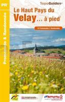
![]() | Haut-Pays du Velay à pied 27 promenades & randonnées - Réf. P436 Topographischer Wanderführer - FFRP (Fédération française de randonnée pédestre) Frankreich |
![]() | Föhr 1:25.000 Touristische Karte - Verlag Kartenwerk |
![]() | 4803 Wegberg (geplottete Ausgabe) Amtliche topographische Karte 1:25.000 Landesvermessungsamt Nordrhein-Westfalen |
![]() | 58 Karlovec / Karlovac - Topographische Landkarte Slowenien 1:50.000 - Amtliche Kartengrundlage ProjektNord |
![]() | 214.12 Amtliche topographische Karte 1:25.000 Polen |
![]() | 3254 Neudamm Topographische Karte 1:25.000 Messtischblatt des Deutschen Reiches - Preußische Landesaufnahme / Reichsamt für Landesaufnahme - Faksimile ProjektNord |
![]() | DuMont direkt Budapest von Eickhoff, Matthias |
![]() | Monte Catillo - Monti Lucretili - Monti Navegna e Cervia (Blatt 5) Topographische Wanderkarte 1:25.000 Edizioni Il Lupo |
![]() | 212.11 Amtliche topographische Karte 1:25.000 Polen |
![]() | 112.21 Witonia Amtliche topographische Karte 1:25.000 Polen |
![]() | Texas - Straßenkarte USA Road Guide 1:1 Mio (Blatt 9) - Hallwag |
![]() | Great Lakes - Straßenkarte USA Road Guide 1:1 Mio (Blatt 3) - Hallwag |
![]() | Falk Stadtplan Extra Standardfaltung München 1:20.000 |
![]() | Canal de Garonne - cycling guide 300 km Bordeaux to Toulouse Radwanderführer - Cicerone (englisch) |
![]() | L3926 Bad Salzdetfurth Amtliche topographische Karte 1:50.000 Landesvermessungsamt Niedersachsen |
![]() | 2262 Bad Polzin Topographische Karte 1:25.000 Messtischblatt des Deutschen Reiches - Preußische Landesaufnahme / Reichsamt für Landesaufnahme - Faksimile ProjektNord |
![]() | 253 Lleyn Peninsula West / Pen Llyn Ardal Orllewinol - Wanderkarte Großbritannien 1:25.000 EXPLORER MAP - Active Map LAMINIERT - Ordnance Survey |
![]() | 12 Retezat-Gebirge Wanderkarte Rumänien 1:50.000 *** SCHNÄPPCHEN *** Muntii Retezat Dimap |
![]() | CityTrip München CityTrip - Stadtführer Reise-Know-How Verlag |
![]() | 1089 Bledau Topographische Karte 1:25.000 Messtischblatt des Deutschen Reiches - Preußische Landesaufnahme / Reichsamt für Landesaufnahme - Faksimile ProjektNord |


