Willkommen bei MapFox
+++ Buchhändleranfragen willkommen! Tel. 0431-666 75 99 +++
Warenkorb
Artikel: 0 - € 0.00
Zur Kasse
Impressum Kontakt Versandkosten AGB
A Pilgrim`s Guide to the Camino Inglés: Ferrol & Coruña - Santiago - The English Way also known as the Celtic Camino by John Brierley Caminoguides - Findhorn Press
<< Caminoguides - Jakobsweg
<< Jakobsweg
 
Cover

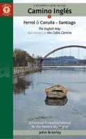
Camino Inglés: This ancient route was popular with pilgrims arriving by sea from England, Ireland and Northern Europe in the medieval period. It all but faded from memory but is quietly coming back to life and now ready to welcome pilgrims seeking a more solitary way along the rugged rías of Northern Galicia. It was previously combined with the route to Finisterre which was described as the road less travelled but that acclaim has now passed to the English way (or Celtic way) that starts in Ferrol or A Coruña and now fully merits its own edition.

Few pilgrims walking the Camino Inglés commence in A Coruña which, at less than 100 km, does not entitle the pilgrim to a compostela unless they have walked an extra 25 km in their own country or combine it with the route from Ferrol. This provides an opportunity to visit the only site in Galicia directly linked with the life of Jesus - his first miracle in Cana of Galilee. By combining two distinct starting points we also come to understand the variety of pathways that the caminos de Santiago offer us, inviting further exploration.

This guidebook also seeks to find a balance between the outer and inner journey, between the practical and spiritual, which is why it is subtitled A Practical & Mystical Manual - that we might find a place to eat and sleep at the end of a hard day’s walk but also, and crucially, that we might find the courage to dive into the mystery of our own soul awakening.

A Pilgrim`s Guide to the Camino Inglés: Ferrol & Coruña - Santiago - The English Way also known as the Celtic Camino by John Brierley Caminoguides - Findhorn Press
EAN / ISBN: 9781912216369
Preis: EUR 19.90

Bestellartikel: versandfertig in ca. 2 Wochen oder länger. Dieser Artikel wird speziell für Sie bestellt. Keine Rücknahme!
Produkt EUR Anzahl Bestellen
A Pilgrim`s Guide to the Camino Inglés: Ferrol & Coruña - Santiago - The English Way also known as the Celtic Camino by John Brierley Caminoguides - Findhorn Press 19.90
Versandkostenfrei in Deutschland ab 20,- Bestellwert

incl. MwSt.

Stichworte, die bei der Suche nützlich sein könnten:
Englischer Camino - Jakobsweg - Camino Inglés - Camino de Santiago - Jakobsweg Spanien - Celtic Camino - Jakobsweg - Camino de Santiago - Santiago de Compostela - Camino Primitivo - Camino Portugués - Camino Portugues - Camino Portugués - John Brierley - Findhorn Press - Jakobsweg - Santiago-de-Compostela - Santiago de Compostela - Santiago de Compostella

Zuletzt angesehene Artikel:

CoverA Pilgrim`s Guide to the Camino Inglés: Ferrol & Coruña - Santiago - The English Way also known as the Celtic Camino by John Brierley Caminoguides - Findhorn Press

CoverDrentsche Aa, Hondsrug North - Wanderkarte 1:33.333 Wandelregiokaart Nederland ANWB - Niederlande

Cover5303 Roetgen - Wanderkarte mit Wanderwegen (geplottete Ausgabe) ProjektNord - Grundlage Amtliche topographische Karte 1:25.000 Landesvermessungsamt Nordrhein-Westfalen

Noch kein Cover vorhanden1618 Garding - Gestern und Heute - Historische Überlagerung 1932-1950 Topographische Landkarte 1:25.000 im Vergleich - Landesvermessungsamt Schleswig-Holstein / ProjektNord

CoverAmur Oblast - 1:1 Mio.
Amurska Oblastj Topografische Karte der Russischen Föderation - Russland

CoverRepublik Baschkortostan (Süd) 1:100.000 - Russland
Республика Башкортостан - Топографичечкий атлас (2) FGUP Уралаэрогеодезия

CoverDreiländereck Südliche Vogesen - Oberrhein (Freizeitregion) 1:75.000 Rad- und Freizeitkarte - GeoMap Medienagentur

Noch kein Cover vorhanden4968 Breslau (Süd) Topographische Karte 1:25.000 Messtischblatt des Deutschen Reiches - Preußische Landesaufnahme / Reichsamt für Landesaufnahme - Faksimile ProjektNord

Cover69 Hjörleifshöfdi Topographische Karte Island 1:100.000 - Ferdakort
69 HJÖRLEIFSHÖFÐI - Atlaskort - Ferðakort

Cover2021 08 Halikko Topographische Karte 1:20.000 (Maastokartta / Peruskartta / Grundkarta) Maanmittauslaitos / Lantmäteriverket Finnland - ProjektNord

CoverFournoi / Mini Orange Blue Regionale Wanderkarte 1:35.000 Orama - Griechenland

Noch kein Cover vorhanden2028 Pronstorf - Gestern und Heute - Historische Überlagerung 1953-1956 Topographische Landkarte 1:25.000 im Vergleich - Landesvermessungsamt Schleswig-Holstein / ProjektNord

Cover3621 Stadthagen Topographische Wanderkarte 1:25.000 Niedersachsen mit Wanderwegen - ProjektNord

CoverNL 32-06-06 (2106) Sand in Taufers Österreichische Karte 1:50.000 mit Wegmarkierungen (topographische Wanderkarte - UTM) - BEV - Österreich

Cover5014 Hilchenbach - Wanderkarte mit Wanderwegen (geplottete Ausgabe) ProjektNord - Grundlage Amtliche topographische Karte 1:25.000 Landesvermessungsamt Nordrhein-Westfalen

CoverHistorische WELTKARTE 1867 - CHART OF THE WORLD ON MERCATORS PROJECTION (1 Blatt - Vor- und Rückseite) - Historische Landkarte Constructed by Hermann Berghaus and Fn. v. Stülpnagel, Gotha. Engraved by Eberhardt an by Will Weiler - von Hermann Berghaus - PLANO gerollt - Verlag Rockstuhl

Noch kein Cover vorhandenNL 33-02-30 Ost (4230-Ost) Ilz Österreichische Karte 1:25.000 mit Wegmarkierungen (topographische Wanderkarte - UTM) - BEV - Österreich - Vergrößerung (ÖK25V)

Cover4520 Warburg - Wanderkarte mit Wanderwegen (geplottete Ausgabe) Topographische Landkarte Hessen 1:25.000 - ProjektNord (geplottete Ausgabe)

Cover31/5S Innsbruck - Umgebung - mit Skirouten Winterwanderkarte Alpenvereinskarte Österreich 1:50.000 - Deutscher Alpenverein

CoverHalberstadt - Aschersleben - Blankenburg - Oschersleben - Quedlinburg Rad- und Wanderkarte mit Ausflugszielen, Einkehr- & Freizeittipps, wetterfest, reissfest, abwischbar, GPS-genau. 1:50000 - von - Freytag-Berndt und ARTARIA PUBLICPRESS