Willkommen bei MapFox
+++ Buchhändleranfragen willkommen! Tel. 0431-666 75 99 +++
Warenkorb
Artikel: 0 - € 0.00
Zur Kasse
Impressum Kontakt Versandkosten AGB
Walks to Waterfalls - Yorkshire Dales Wanderführer - Neil Coates - Northern Eye Books
Top 10 Walks Series, Yorkshire Dales Walks to the finest waterfalls in the Yorkshire Dales
<< Großbritannien: Wanderführer + Kletterführer
 
Cover

One of six books in the new Yorkshire Dales: Top 10 Walks series. Handy, pocket-sized, full colour walking guides written by experts, for under a fiver. The perfect impulse buy.

Other titles in the series include: Dales & Valleys, Fell Walks, Waterside Walks, Pub Walks and History Walks.

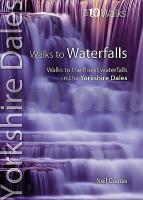
This attractive and cleverly structured guide gives walkers ten of the finest walks to waterfalls in the Yorkshire Dales National Park in a popular pocketable format. With clear information, an overview and introduction for each walk, expertly written numbered directions, large scale Ordnance Survey maps, superb, eye-grabbing panoramic photographs, and interpretation of points of interest along the way, these guides set a new standard in clarity and ease-of-use.

Featured walks include: Aysgarth & Cauldron Falls, Janet`s Foss & Goredale Scar, Catrigg Force, Kidson & Currack Forces, The Strid & Posforth Gill, Mill & Whitfield Gills, Ingleton Waterfalls, Linton Falls & Ghaistrill`s Strid, Uldale Force and Hardraw Force.

Kartenausschnitt

Kartenbeispiel

Walks to Waterfalls - Yorkshire Dales Wanderführer - Neil Coates - Northern Eye Books
Top 10 Walks Series, Yorkshire Dales Walks to the finest waterfalls in the Yorkshire Dales
EAN / ISBN: 9781908632111
Preis: EUR 14.90

Bestellartikel: versandfertig in ca. 1-3 Wochen. Dieser Artikel wird speziell für Sie bestellt. Keine Rücknahme!
Produkt EUR Anzahl Bestellen
Walks to Waterfalls - Yorkshire Dales Wanderführer - Neil Coates - Northern Eye Books
Top 10 Walks Series, Yorkshire Dales Walks to the finest waterfalls in the Yorkshire Dales
14.90
Versandkostenfrei in Deutschland ab 30,- Bestellwert

incl. MwSt.

Stichworte, die bei der Suche nützlich sein könnten:
Yorkshire Dales - Yorkshire Dales Reiseführer - Yorkshire Dales Wanderkarte - Yorkshire Dales Wanderführer - Großbritannien - Großbritannien Wanderführer - Großbritannien Trekkingführer - Großbritannien Klettern - Großbritannien Kletterführer

Zuletzt angesehene Artikel:

CoverWalks to Waterfalls - Yorkshire Dales Wanderführer - Neil Coates - Northern Eye Books
Top 10 Walks Series, Yorkshire Dales Walks to the finest waterfalls in the Yorkshire Dales

Cover049 Südtiroler Weinstraße - Bozen, Kaltern - Strada del Vino - Bolzano, Caldaro Topographische Wanderkarte 1:25.000 - Casa Editrice Tabacco - Italien

CoverSchneifel - Ahreifel 1:50.000 - Wanderkarte mit Broschüre (Blatt 836) - Schleiden, Prüm, Daun, Eifelsteig - 4in1 Wanderkarte mit Aktiv Guide - KOMPASS

Cover0/14 Inylchek - Tien Shan West - Kyrgyzstan 1:100.000 - Trekkingkarte Alpenvereinskarte - DAV Deutscher Alpenverein

CoverCaribbean Islands Explorer 1:4 Mio. / Landkarte Landkarte der Karibischen Inseln mit Karte 1:1.1 Mio. von den Inseln unter dem Winde und den Inseln über dem Winde (Antillen)
Visitor`s Map of the Caribbean Islands and Map of the Leeward and Windward Islands Nigel Sitwell - Ocean Explorer Maps

Cover47 Askersund 1:50.000 (wasserfest) Topographische Wanderkarte - Sverigeserien Topo50 - Schweden Kartförlaget

CoverGolf von Neapel - Halbinsel Sorrent, Pompei - Vesuv Landkarte 1:150.000 - (Blatt 901)
Golfo di Napoli - Peninsola Sorrentina - Pompei - Vesuvio - Carta turistica e stradale Edizioni Multigraphic - Italien

CoverGoslar - Der Stadtführer Ein Führer durch die alte Stadt der Kaiser, Bürger und Bergleute - Dr. Kroker, Angelika; Stöber, Martin; Dr. Titz-Matuszak, Ingeborg - Schmidt-Buch-Verlag

CoverParque Natural do Sudoeste Alentejano e Costa Vicentina (3) - Nordteil mit Wanderwegen und Radwegen - Wanderkarte - Fahrradkarte 1:50.000 Portugal - ProjektNord

CoverIstanbul Kultur-Reiseführer Alles Wissenswerte für eine gelungene Städtetour. Geschichte, Kultur, Moderne. Extra: Topkapi-Palast Besucher-Führer. Mitarbeit: Aydemir, Yavuz. Übersetzung: Willeke, Wilhelm. Herausgegeben von Kulac, Abdullah; Özel, Tarik - von Halil Ersin Avci - Main-Donau Verlag

Cover5811 Kestert - Wanderkarte mit Wanderwegen (geplottete Ausgabe) ProjektNord - Grundlage Amtliche topographische Karte Landesamt für Vermessung und Geobasisinformation Rheinland-Pfalz

CoverMTB Finale Ligure (Blatt MTB9) - Freeride Noli, Melogno Topographische Fahrradkarte 1:17.000 EdM - Edizioni del Magistero - Italien

CoverAnhalt-Zerbst Nord (Blatt 12) Topographische Kreiskarte Wandern und Radwandern 1:50.000 vom Landesvermessungsamt Sachsen-Anhalt

CoverNationalpark Los Glaciares (spanisch) Straßenkarte 1:250.000 Argentinien / Chile
Parque Nacional los Glaciares ZAGIER & URRUTY PUBLICATIONS

Cover5513 Meudt - Wanderkarte mit Wanderwegen (geplottete Ausgabe) ProjektNord - Grundlage Amtliche topographische Karte Landesamt für Vermessung und Geobasisinformation Rheinland-Pfalz

Cover6012 Stromberg - Wanderkarte mit Wanderwegen (geplottete Ausgabe) ProjektNord - Grundlage Amtliche topographische Karte Landesamt für Vermessung und Geobasisinformation Rheinland-Pfalz

CoverEnglands Südwestküste: South West Coast Path - 46 Etappen auf dem beliebten Weitwanderweg von Somerset nach Devon, Cornwall und Dorset. Mit GPS-Tracks - von Kreutner, Edith - Rother Bergverlag

CoverSchwerte - Ruhr-Höhenweg Topographische Wanderkarte Nordrhein-Westfalen mit Wanderwegen und Radwegen 1:25.000 - ProjektNord

Cover45-557 Hintertaunus Mitte 1:25.000 - Wanderkarte mit Radwegen, Bad Camberg, Brechen, Glashütten, Hünfelden, Hünstetten, Idstein, Selters, Villmar, Waldems - NaturNavi

Noch kein Cover vorhanden26 Duhnen - Varendorfsche Karte 1789-1792 Topographisch Militärische Charte des Herzogtums Holstein - Reproduktion 1:25.000