| << Schottland << Großbritannien: Wanderführer + Kletterführer |
||
|
||
Zuletzt angesehene Artikel:
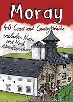
 | Moray - 40 Wanderungen entlang der Küste und auf dem Land Englischsprachiger Wanderführer - Paul and Helen Webster - POCKET MOUNTAINS LTD Moray - 40 Coast & Country Walks - Includes Nairn and North Aberdeenshire |
 | P3443 Ekola Topographische Karte 1:25.000 EUREF (Peruskartta) Maanmittauslaitos / Lantmäteriverket Finnland - ProjektNord |
 | L4131 Espoo Topographische Karte 1:25.000 EUREF (Peruskartta) Maanmittauslaitos / Lantmäteriverket Finnland - ProjektNord |
 | 421 Ellon & Inverurie - Wanderkarte Großbritannien 1:25.000 EXPLORER MAP - Active Map LAMINIERT - Ordnance Survey |
 | Serra de Boumort (west / ost) 2 Wanderkarte 1:20.000 - Serra de Boumort (ouest / est) - mapes excursionistes Editorial Piolet - Spanien |
 | Entdeckertouren mit dem Wohnmobil: Rumänien (Band 80) Wohnmobil, Camping, Reisen, Urlaub - von Christian Winkler - Womo |
 | Eisenbahn-Reisekarte Europa 1:4.5 Mio. Europe Railway Travel Map freytag & berndt |
 | C3526 Celle - Topographische Karte 1:100.000 Landesvermessungsamt Niedersachsen |
 | W266 Waldshut-Tiengen - Wanderkarte 1:25.000 Hochheim (Ost), Klettgau - von LGL - Landesamt für Geoinformation und Landentwicklung Baden-Württemberg (LGL) |
 | Il Cammino di Santiago de Compostela Teil 2 - 1:50.000 - da Terradillos de Los Templarios a Finisterre - Wanderkartenatlas - Geo4 Map - Italien |
 | Mosel - Ferienregion Schweich an der Römischen Weinstraße mit Meulenwald (Blatt 30) 1:25.000 inkl. Moselsteig-Etappen, Moselsteig-Seitensprüngen & Mountainbikerouten : Mosel Weinkulturland - Eifelverein e.V. |
 | Europaradweg R1 - Euroroute Teil 5: Sankt Petersburg - Moskau ready to go: Tourguide, Karten, GPS-Tracks und Online-Update - von Kaden, Detlef - IS.RADWEG |
 | 34-231 Lednice Topographische Karte 1:25.000 der Tschechischen Republik Zakladní mapa Ceská republika - Cesky urad zememericky a katastralni - ProjektNord |
 | Vosges du Nord - Mont Stainte-Odile - le Donon 1:75.000 (Blatt 27) touristische Wanderkarte Tourisme et Randonnée TOP75 - IGN Frankreich |
 | Erzgebirge 1:125.000 Bikerkarte + Touristische Landkarte Sachsen KKV - Kartographische Kommunale Verlagsgesellschaft |
 | 1005 Naturpark Pfälzerwald Mitte 1:40.000 Rad- und Wanderkarte Rundwanderwege mit Beschreibung auf der Rückseite GW Rheingau-Taunus-Kartographie |
 | Entdeckertouren mit dem Wohnmobil: Mecklenburg-Vorpommern - Teil 2: Der Osten, Vorpommern mit den Inseln Rügen und Usedom (Band 88) Die Anleitung für einen Erlebnisurlaub. Tipps, Tricks, Touren, tolle Strände. Alle Plätze mit präzisen GPS-Daten von Holtkamp, Stefanie - Womo |