 Mull is the second largest island of the Inner Hebrides. Perhaps best known for the colourful harbour of Tobermory at the northern end of the island, Mull has become very popular as a holiday destination, most particularly among wildlife enthusiasts. In this volume you will find the best walking routes on Mull and the neighbouring islands of Iona and Ulva, both easily reached by short ferry journeys. Mull includes some of the wildest coastal scenery in the country as well as many grand mountains, pretty villages and stunning sandy beaches.  Kartenausschnitt Kartenausschnitt
Kartenbeispiel
|
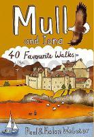
Mull and Iona: 40 Favourite Walks Walking / Hiking Guide - POCKET MOUNTAINS LTD
EAN / ISBN: 9781907025099
Preis: EUR 11.90
|
| 
