| << Irland: Wanderkarten verschiedener Verlage |
  | |
|
||
Zuletzt angesehene Artikel:
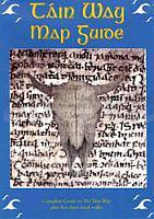
![]() | Tain Way (Halbinsel Cooley, Irland) Wanderkarte 1:50.000 Inkl. Führer - East West Mapping The Tain Way Map Guide (near Cooley & Carlingford) - folded map in plastic sleeve |
![]() | KOMPASS Radvergnügen Bremen & Weser 21 ½ Feierabend-Rides, Tagestouren & Wochenend-Bikeaways - von Joost-Krüger, Jens - KOMPASS-Karten |
![]() | 45 Touren und Trips für das Deutschland-Ticket Biken, Wandern, Baden, SUPen - KOMPASS-Karten |
![]() | Umgebung von Paris 1:100.000 Straßenkarte Frankreich zoom (Blatt 106) Michelin Environs de Paris |
![]() | Radfernwegekarte & Biketouren Alpen - Übersichtskarte 1:500.000 inklusive Bikeparks und Alpenpässe - KOMPASS-Karten |
![]() | Michigan (Mid) - Captial Area regionale Straßenkarte 1:128.000 (Michigan - USA) Michigan (Mid) - Captial Area regional map GM Johnson |
![]() | Waldkirch, Kandel, St.Peter, St. Märgen (Nr. 884) - Wanderkarte 1:25.000 Elzach - Glottertal - Simonswald KOMPASS |
![]() | 2416SB Melun - Mormant Amtliche Topographische Wanderkarte Frankreich 1:25.000 - série bleue (IGN) |
![]() | 3726 Hohenhameln Topographische Wanderkarte 1:25.000 Niedersachsen mit Wanderwegen - ProjektNord |
![]() | 2826 Egestorf Topographische Wanderkarte 1:25.000 Niedersachsen mit Wanderwegen - ProjektNord |
![]() | 1315SB Brécey - Ducey - Avranches GPS Amtliche Topographische Wanderkarte Frankreich 1:25.000 - série bleue (IGN) |
![]() | Picos de Europa - Zona norte: Macizo Occidental o Cornión - Wanderkarte 1:25.000 Prames - Spanien |
![]() | 3726 Hohenhameln Amtliche topographische Karte 1:25.000 Landesvermessungsamt Niedersachsen |


