Willkommen bei MapFox
+++ Buchhändleranfragen willkommen! Tel. 0431-666 75 99 +++
Warenkorb
Artikel: 0 - € 0.00
Zur Kasse
Impressum Kontakt Versandkosten AGB
The Ridgeway (Avebury to Livinghoe Beacon) Wanderführer englisch Trailblazer
<< Großbritannien: Wanderführer + Kletterführer
<< Trailblazer Guides
 
Cover

Übersicht der Trailblazer Wanderführer Großbritannien

The Ridgeway: Avebury to Ivinghoe Beacon (British Walking Guide)

- 53 maps
- 46 colour photos,
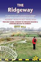
- 4pp colour flower & butterfly guide

An 87-mile (139km) National Trail, the Ridgeway runs from Overton Hill near Avebury in Wiltshire to Ivinghoe Beacon in Buckinghamshire. Part of this route follows Britain’s oldest road, dating back millennia. Taking 5-7 days, this is not a difficult walk and the rewards are many: rolling countryside, Iron Age forts, Neolithic burial mounds, white horses carved into the chalk downs and picturesque villages.

With accommodation, pubs and restaurants in detailed guides and maps to 24 towns and villages including Marlborough and Avebury.

Includes 53 detailed walking maps

Unique mapping features

- Itineraries for all walkers
- Practical information for all budgets
- Downloadable GPS waypoints

Kartenausschnitt

The Ridgeway (Avebury to Livinghoe Beacon) Wanderführer englisch Trailblazer
EAN / ISBN: 9781912716524
Preis: EUR 24.90

Bestellartikel: versandfertig in ca. 3-7 Tagen. Dieser Artikel wird speziell für Sie bestellt. Keine Rücknahme!
Produkt EUR Anzahl Bestellen
The Ridgeway (Avebury to Livinghoe Beacon) Wanderführer englisch Trailblazer 24.90
Versandkostenfrei in Deutschland ab 30,- Bestellwert

incl. MwSt.

Stichworte, die bei der Suche nützlich sein könnten:
Livinghoe - Ridgeway (Wanderführer) - Avebury - Trailblazer - Großbritannien - Großbritannien Wanderführer - Großbritannien Trekkingführer - Großbritannien Klettern - Großbritannien Kletterführer

Zuletzt angesehene Artikel:

CoverThe Ridgeway (Avebury to Livinghoe Beacon) Wanderführer englisch Trailblazer

CoverSentiero delle Orobie Occidentali (Foglio 1) 1:25.000 Ingenia Editori - Wanderkarte - Italien

CoverFour Counties Ring and Caldon Canal Map 1:50.000 Waterways Series - Heron Maps - Großbritannien

CoverComune di Massa e Cozzile 1:10.000 (MC) Wanderkarte S.EL.CA

CoverUSA / Florida 1:800.000 FLEXIMAPS Magnum Wolfgang Kunth Verlag

CoverMONTSANT. 20 Excursiones imprescindibles por el Parque Natural Wanderführer (spanischsprachig) - Editorial Piolet - Spanien

CoverTrekking in Ladakh - Eight Remote and Challenging Treks Wanderführer Himalaya - Cicerone (englisch)

CoverDänemark Ostseeküste und Fünen Reiseführer von Thilo Scheu - Reise Know-How Verlag

CoverCentral Asia - von Bradley Mayhew Reiseführer (englisch) - Lonely Planet

CoverDUMONT Reise-Taschenbuch Slowenien und Istrien Schetar-Köthe, Daniela

CoverKleiner Zschand Wanderkarte 1:10.000 - Rolf Böhm Verlag

Cover2739OT MONT-LOZERE - FLORAC Topographische Wanderkarte Frankreich 1:25.000 TOP 25 IGN

CoverPretoria Straßenatlas 1:20.000 mit Reiseführer (Spiralo)
Pretoria Street Guide Atlas MapStudio Südafrika

Noch kein Cover vorhanden157.2 Amtliche topographische Karte 1:50.000 Polen

CoverSüdschweden - Südnorwegen 1:875.000 Landkarte Reise-Know-How Verlag - world mapping project