Willkommen bei MapFox
Wurde Ihre Bestellung bestätigt? Wenn nicht - gab es evtl. ein SERVER-Problem! Bitte kontaktieren Sie uns! +++ Buchhändler-Anfragen erwünscht +++
Warenkorb
Artikel: 0 - € 0.00
Zur Kasse
Impressum Kontakt Versandkosten AGB
Discover the Western Isles - Wanderkarte (wasserfest) Visitor Map - Footprint Maps - Stirling Surveys
<< Schottland
<< Großbritannien: Wanderkarten, Radwanderkarten und MTB-Karten
<< Stirling Surveys - Footprint Maps
 
Cover

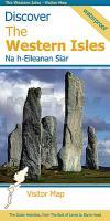
This map is the perfect companion to take for exploring the Western Isles. It is packed with information on where to find the best that this chain of islands has to offer visitors.

Each island has its own unique identity and there is a wide range of contrasting wild landscapes: from magnificent coastlines with some of the finest beaches in Europe, to high rocky mountains rising from windswept moorland.

There are also many important historic sites to visit, some of which are world famous, spanning the long human occupation of these islands.

Kartenausschnitt

Kartenbeispiel

Discover the Western Isles - Wanderkarte (wasserfest) Visitor Map - Footprint Maps - Stirling Surveys
EAN / ISBN: 9781871149869
Preis: EUR 13.90

Bestellartikel: versandfertig in ca. 1-3 Wochen. Dieser Artikel wird speziell für Sie bestellt. Keine Rücknahme!
Produkt EUR Anzahl Bestellen
Discover the Western Isles - Wanderkarte (wasserfest) Visitor Map - Footprint Maps - Stirling Surveys 13.90
Versandkostenfrei in Deutschland ab 30,- Bestellwert

incl. MwSt.

Stichworte, die bei der Suche nützlich sein könnten:
Western Isles Wanderkarte - Harris - Schottland Wanderkarte - North Uist - Äußere Hebriden - Großbritannien Wanderkarte - Hebriden - Barra - Lewis - Benbecula - Outer Hebrides - South Uist - Schottland - Schottland Landkartenverkauf - Schottland Atlanten - Schottland Kartographie - Schottland Wanderkarten - Schottland Radwanderkarten - Schottland Kartografie - Schottland Fahrradkarten - Schottland Reiseführer - Schottland Radwanderführer - Schottlandkarten - Schottland Landkarten - Schottland Karten - Schottland Straßenkarten - Großbritannien Wanderkarten - Großbritannien Fahrradkarten - Großbritannien Mountainbike-Karten - Schottland Wanderkarten - Großbritannien Wanderkarten - Stirling Surveys - Footprint Maps - UK Hiking maps - Great Britain walking maps

Zuletzt angesehene Artikel:

CoverDiscover the Western Isles - Wanderkarte (wasserfest) Visitor Map - Footprint Maps - Stirling Surveys

Noch kein Cover vorhanden3377 Radziejow Topographische Karte 1:25.000 Messtischblatt des Deutschen Reiches - Preußische Landesaufnahme / Reichsamt für Landesaufnahme - Faksimile ProjektNord

Noch kein Cover vorhanden346.34 Amtliche topographische Karte 1:25.000 Polen

CoverNeuseeland Nelles-Reiseführer Nelles-Verlag

CoverCycling Lôn Las Cymru 250 miles through the heart of Wales Radwanderführer - Cicerone (englisch)

CoverEuropa politisch 1:6 Mio. Magnet-Markiertafel inkl. 30 bunte Steckfähnchen - freytag & berndt

CoverMN19 Giurgeu - Hasmas 1:60.000 Topographische Wanderkarte (englisch / rumänisch)
Hiking Map of the Giurgeu-Hasmas Montains - Harta de drumetie a Masivului Giurgeu-Hasmas Muntii Nostri - Schubert & Franzke - Rumänien

CoverSardinien Straßenkarte 1:200.000 Italien IGN

CoverTwente Süd - Haaksbergen Wanderkarte 1:33.333 Wandelregiokaart Nederland ANWB - Niederlande

Noch kein Cover vorhanden341.11 Police Amtliche topographische Karte 1:25.000 Polen

Cover57A WEEBOSCH Topographische Karte der Niederlande 1:25.000 (Plotausgabe)
57A WEEBOSCH Topografische Kaart van Nederland Kadaster - ProjektNord

CoverKusadasi - Selçuk - Ephesos - touristischer Stadtplan und Reiseführer (türk./engl./dt.)
Kusadasi - Selçuk - Ephesos - City Plan & Guide - Harita ve Rehberi Mepmedya Türkei

CoverC11 Kvalvågen Spitzbergen / Svalbard / Spitsbergen - Topographische Karte 1:100.000 Norsk Polarinstitutt

CoverEn Familia y con Niños. 3 - Andorra Wanderführer - Editorial Piolet - Spanien

CoverDänemark Auto- und Freizeitkarte 1:150.000 - freytag & berndt

CoverNordkorea-Handbuch - Geschichte, Kultur, Sehenswürdigkeiten - Arno Maierbrugger - Trescher Verlag

CoverL7742 Altötting (geplottete Ausgabe) Topographische Karte Bayern 1:50.000 Bayerisches Landesvermessungsamt

CoverAlaska Road & Recreation Atlas 1:316.800-1:1.267.200 - Benchmark Atlas USA

CoverRubbelposter Welt Erlebniskarte 100 x 70 cm - von Schönhoff, Doris Krüger, Dirk - K & S druckbunt Verlag

CoverKosovo & Westbalkan 1:300.000 / 1:1.4 Mio. Landkarte - ITMB International Travel Reference Maps (engl.)
Kosovo and the Western Balkans