Willkommen bei MapFox
Wurde Ihre Bestellung bestätigt? Wenn nicht - gab es evtl. ein SERVER-Problem! Bitte kontaktieren Sie uns! +++ Buchhändler-Anfragen erwünscht +++
Warenkorb
Artikel: 0 - € 0.00
Zur Kasse
Impressum Kontakt Versandkosten AGB
Discover The Isle of Mull - Wanderkarte (wasserfest) Visitor Map - Footprint Maps - Stirling Surveys
<< Schottland
<< Großbritannien: Wanderkarten, Radwanderkarten und MTB-Karten
<< Stirling Surveys - Footprint Maps
 
Cover

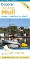
This map is the perfect companion to take exploring on the Isle of Mull; it`s packed with information on how to get there; and what to see and do - and where to go, once you`re there. The map features walking and cycling routes, wildlife and visitor attractions and where to eat, sleep and shop. As you`ll discover, Mull`s treasures include secluded beaches, wild mountains, magnificent eagles and historic castles.

Kartenausschnitt

Kartenbeispiel

Discover The Isle of Mull - Wanderkarte (wasserfest) Visitor Map - Footprint Maps - Stirling Surveys
EAN / ISBN: 9781871149852
Preis: EUR 13.90

Bestellartikel: versandfertig in ca. 1-3 Wochen. Dieser Artikel wird speziell für Sie bestellt. Keine Rücknahme!
Produkt EUR Anzahl Bestellen
Discover The Isle of Mull - Wanderkarte (wasserfest) Visitor Map - Footprint Maps - Stirling Surveys 13.90
Versandkostenfrei in Deutschland ab 30,- Bestellwert

incl. MwSt.

Stichworte, die bei der Suche nützlich sein könnten:
Großbritannien Wanderkarte - Hebriden - Innere Hebriden - Insel Mull Wanderkarte - Isle of Mull - Schottland Wanderkarte - Schottland - Schottland Landkartenverkauf - Schottland Atlanten - Schottland Kartographie - Schottland Wanderkarten - Schottland Radwanderkarten - Schottland Kartografie - Schottland Fahrradkarten - Schottland Reiseführer - Schottland Radwanderführer - Schottlandkarten - Schottland Landkarten - Schottland Karten - Schottland Straßenkarten - Großbritannien Wanderkarten - Großbritannien Fahrradkarten - Großbritannien Mountainbike-Karten - Schottland Wanderkarten - Großbritannien Wanderkarten - Stirling Surveys - Footprint Maps - UK Hiking maps - Great Britain walking maps

Zuletzt angesehene Artikel:

CoverDiscover The Isle of Mull - Wanderkarte (wasserfest) Visitor Map - Footprint Maps - Stirling Surveys

CoverPennsylvania 1:150.000 State Recreation Atlas USA National Geographic

Noch kein Cover vorhanden2582 Skarlin Topographische Karte 1:25.000 Messtischblatt des Deutschen Reiches - Preußische Landesaufnahme / Reichsamt für Landesaufnahme - Faksimile ProjektNord

CoverPorvoo - Helsinki - Loviisa 1:50.000 Wassersportkarte / Bootskarte - Karttakeskus
Waterproof map east of Helsinki! Karttakeskus - Finnland

Cover43 Leventina - Gotthard - Valle di Blenio - Wanderkarte Schweiz 1:40.000 wasserfest - Kümmerly & Frey

CoverBurkina Faso Travel Guide Reiseführer (englisch) Bradt Publications

CoverRock climbing guidebook for Bosnia and Herzegovina Kletterführer - Igor Vukic & David Lemmerer Ticket To The Moon

CoverNarvik: Frostisen & Nuorjjovárri 1:25.000 Høyfjellskart - Gebirgswanderkarte Norwegen - Calazo Förlag

Cover8131 Schongau Topographische Landkarte Bayern 1:25.000 - Normalausgabe - ProjektNord (geplottete Ausgabe) - Grundlage amtliche Topographische Karte Bayern DTK25

CoverBiella Stadtplan 1:6.000
Biella - Pianta della Citta L.A.C. GlobalMap Italien

CoverL5718 Friedberg (geplottete Ausgabe) Topographische Landkarte Hessen 1:50.000 - ProjektNord

Cover7244 Osterhofen Topographische Landkarte Bayern 1:25.000 - Normalausgabe - ProjektNord (geplottete Ausgabe) - Grundlage amtliche Topographische Karte Bayern DTK25

Cover50-543 Stromberg - Heuchelberg 1:25.000 - Wanderkarte mit Radwegen - NaturNavi

Noch kein Cover vorhanden234.31 Amtliche topographische Karte 1:25.000 Polen

Cover10177 Utsjoki Topographische Landkarte 1:50.000 Norge-serien - Nordeca Norwegen

CoverPeuran polku - Salamajärvi 1:25.000 / 1:50.000 Wanderkarte 1:25.000 - Terrängkarta Wanderkarte Finnland - Calazo Förlag

Cover24-411 Jedovnice Topographische Karte 1:25.000 der Tschechischen Republik
Zakladní mapa Ceská republika - Cesky urad zememericky a katastralni - ProjektNord

CoverS524 Posio Topographische Karte 1:50.000 EUREF-FIN (Maastokarttat) Maanmittauslaitos / Lantmäteriverket Finnland - ProjektNord

CoverFrankreich: Jakobsweg - Via Gebennensis OutdoorHandbuch - Der Weg ist das Ziel (Band 281) - Engel, Hartmann - Conrad-Stein-Verlag

CoverBad Reinerz Stadtplan 1:10.000 - Umgebungskarte 1.75.000
Duszniki Zdrój PLAN Galileos - Polen