Willkommen bei MapFox
+++ Buchhändleranfragen willkommen! Tel. 0431-666 75 99 +++
Warenkorb
Artikel: 0 - € 0.00
Zur Kasse
Impressum Kontakt Versandkosten AGB
Trekking the Kungsleden The King`s Trail through Northern Sweden Wanderführer Cicerone Großbritannien (englisch) - Mike Laing
<< Schweden: Wanderführer, Radführer und Reiseführer
<< Cicerone
<< Kungsleden
 
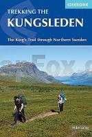
Cover

Sweden`s most famous long-distance trail, the Kungsleden (King`s Trail) traverses the land of the Sámi people and the midnight sun, stretching 460km between Abisko and Hemavan. Around half the route lies within the Arctic Circle showcasing an ever-changing landscape of snowy mountains, deep glacial valleys, open fell, expansive lakes and verdant forest. The fully waymarked trail is comprised of five continuous and distinct sections: these can be walked individually or a thru-hike will take around a month. The guide also includes the popular Abisko to Nikkaluokta circuit, which can be completed in a week, and an ascent of Kebnekaise, Sweden`s highest peak at 2098m.

In addition to clear route description and mapping, you`ll find a wealth of practical advice covering accommodation and facilities, equipment and resupply and detailed notes on how to get to and from the section start and finish-points. A Swedish and Fell Sámi glossary can be found in the appendix. Although there are plentiful opportunities for wild camping, three of the five trail sections are equipped with huts (many including a shop and a sauna) making them easily accessible to all. The remaining two sections have a more remote feel that will appeal to those intent on finding some solitude. To add further colour, there are seven mandatory lake crossings on the trail with the option of rowing or using the motorised service: full details are provided in the text.

The Kungsleden passes through five national parks, including Sarek. Other highlights include the striking Tjäktjavagge glacial valley and the famous hay meadows of Aktse, perfectly framed by the azure Lájtávrre delta and the sheer chiselled face of Skierrffe. The Kungsleden invites you to step into a new world, and it may well prove to be the start of a long and rich association involving many repeated visits.

Kartenausschnitt

Kartenbeispiel

Trekking the Kungsleden The King`s Trail through Northern Sweden Wanderführer Cicerone Großbritannien (englisch) - Mike Laing
EAN / ISBN: 9781852849825
Preis: EUR 27.90

Bestellartikel: versandfertig in ca. 3-7 Tagen. Dieser Artikel wird speziell für Sie bestellt. Keine Rücknahme!
Produkt EUR Anzahl Bestellen
Trekking the Kungsleden The King`s Trail through Northern Sweden Wanderführer Cicerone Großbritannien (englisch) - Mike Laing 27.90
Versandkostenfrei in Deutschland

incl. MwSt.

Stichworte, die bei der Suche nützlich sein könnten:
Schweden Wanderführer - Sarek Wanderführer - Kungsleden - Schweden - Hemavan - Kungsleden Wanderführer - Abisko - Schweden Wanderführer - Schweden Reiseführer - Schweden Fahrradführer - Schweden Radwanderführer - Cicerone - Cicerone Radwanderführer - Cicerone Wanderführer - Großbritannien Radwanderführer - Großbritannien Wanderführer - Cicerone Großbritannien - Schweden Wanderwege - Schwedische Fernwanderwege - Kungsleden Wanderkarte

Zuletzt angesehene Artikel:

CoverTrekking the Kungsleden The King`s Trail through Northern Sweden Wanderführer Cicerone Großbritannien (englisch) - Mike Laing

CoverMorocco Overland - 55 Routes from the Atlas to the Sahara Reiseführer für Geländewagen, Motorräder und Mountainbikes
Trailblazer Guide Trailblazer Publication

CoverItalian Lakes Sunflower Landschaften (englische Ausgabe) - Wanderungen - Autotouren - Kostenlose Updates - Wanderführer

CoverAzores Sunflower-Wanderführer - englisch - kostenlose Updates - car tours & walks

Cover926 Mengíbar Amtliche topographische Landkarte 1:50.000 Spanien (M.T.N.)
926 Mapa Topográfico Nacional de Espana (MTN50) Instituto Geográfico Nacional - CNIG Spanien

CoverBrasilien 1:7.74 Mio. Landkarte mit Kurzreiseführer (englisch)
Brasil - Map Guide DeDios Editores

CoverGuernsey with Alderney, Sark & Hem Sunflower-Wanderführer - englisch - kostenlose Updates - car tours & walks

Cover812 Valdepeñas Amtliche topographische Landkarte 1:50.000 Spanien (M.T.N.)
812 Mapa Topográfico Nacional de Espana (MTN50) Instituto Geográfico Nacional - CNIG Spanien

Cover1107-I San Bartolomé de Tirajana - Gran Canaria Amtliche topographische Landkarte 1:25.000 Spanien (M.T.N.)
1107-I Mapa Topográfico Nacional de Espana (MTN25) Instituto Geográfico Nacional - CNIG Spanien

Cover812-1 VALDEPEÑAS Amtliche topographische Landkarte 1:25.000 Spanien (M.T.N.)
812-1 Mapa Topográfico Nacional de Espana (MTN25) Instituto Geográfico Nacional - CNIG Spanien

CoverCorfu Sunflower-Wanderführer - englisch - kostenlose Updates - car tours & walks

Noch kein Cover vorhanden997 BIS-1 CALABARDINA Amtliche topographische Landkarte 1:25.000 Spanien (M.T.N.)
997bis-1 Mapa Topográfico Nacional de Espana (MTN25) Instituto Geográfico Nacional - CNIG Spanien

CoverTasmanien Straßenkarte 1:480.000 (Handymap)
Tasmania State Handy Map HEMA Maps - Australien

CoverApulien - Bari - Brindisi - Taranto 1:150.000 (Blatt AK 0627) Straßenkarte Italien freytag & berndt

CoverCrete Eastern Sunflower-Wanderführer - englisch - kostenlose Updates - car tours & walks

Cover287 Barbastro Amtliche topographische Landkarte 1:50.000 Spanien (M.T.N.)
287 Mapa Topográfico Nacional de Espana (MTN50) Instituto Geográfico Nacional - CNIG Spanien

CoverCyprus Sunflower-Wanderführer - englisch - kostenlose Updates - car tours & walks

Cover802-4 SOLANA DE LOS BARROS Amtliche topographische Landkarte 1:25.000 Spanien (M.T.N.)
802-4 Mapa Topográfico Nacional de Espana (MTN25) Instituto Geográfico Nacional - CNIG Spanien

CoverCanary Island Walks - 80 long and short walks on 9 islands Sunflower-Wanderführer - englisch - kostenlose Updates - car tours & walks

Noch kein Cover vorhanden2921SB MONTBARD - BAIGNEUX-LES-JUIFS - ALESIA GPS Amtliche Topographische Wanderkarte Frankreich 1:25.000 - série bleue (IGN)