Willkommen bei MapFox
Wurde Ihre Bestellung bestätigt? Wenn nicht - gab es evtl. ein SERVER-Problem! Bitte kontaktieren Sie uns! +++ Buchhändler-Anfragen erwünscht +++
Warenkorb
Artikel: 0 - € 0.00
Zur Kasse
Impressum Kontakt Versandkosten AGB
Lake District: Low Level and Lake Walks - Walking in the Lake District - Windermere, Grasmere and more Wanderführer (englisch) Cicerone Großbritannien
<< Großbritannien: Wanderführer + Kletterführer
<< Cicerone
 
Cover

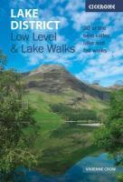
A guidebook to 30 lower-level day walks in the Lake District, exploring some of the best beauty spots and smaller fells within the national park. Mostly circular except for a few linear routes that make use of public transport links, the walks are graded according to difficulty, ensuring there is something for all levels of fitness and experience. The walks range from 7 to 17km (4-10 miles) in length and can be walked in between 2 and 6 hours. They are arranged geographically into five areas: South, Central, North and Eastern Lakes, and the Western Valleys. 1:50,000 OS maps reproduced at 1:40,000 for greater clarity GPX files available to download Detailed information on terrain, refreshments and public transport for each walk Information given on local history and archaeology Easy access from Kendal, Penrith and Keswick

Lake District: Low Level and Lake Walks - Walking in the Lake District - Windermere, Grasmere and more Wanderführer (englisch) Cicerone Großbritannien
EAN / ISBN: 9781786312273
Preis: EUR 19.90

Bestellartikel: versandfertig in ca. 3-7 Tagen. Dieser Artikel wird speziell für Sie bestellt. Keine Rücknahme!
Produkt EUR Anzahl Bestellen
Lake District: Low Level and Lake Walks - Walking in the Lake District - Windermere, Grasmere and more Wanderführer (englisch) Cicerone Großbritannien 19.90
Versandkostenfrei in Deutschland ab 30,- Bestellwert

incl. MwSt.

Stichworte, die bei der Suche nützlich sein könnten:
Lake District - Cicerone - Cicerone Radwanderführer - Cicerone Wanderführer - Großbritannien Radwanderführer - Großbritannien Wanderführer - Cicerone Großbritannien - Großbritannien - Großbritannien Wanderführer - Großbritannien Trekkingführer - Großbritannien Klettern - Großbritannien Kletterführer

Zuletzt angesehene Artikel:

CoverLake District: Low Level and Lake Walks - Walking in the Lake District - Windermere, Grasmere and more Wanderführer (englisch) Cicerone Großbritannien

CoverDuMont direkt Reiseführer Tel Aviv Mit großem Cityplan - von Fazekas, Agnes - DuMont Reiseverlag

CoverC1930 Oldenburg in Holstein Topographische Landkarte 1:100.000 Landesvermessungsamt Schleswig-Holstein

Cover5408 Bad Neuenahr-Ahrweiler Topographische Karte 1:25.000 - Landesamt für Vermessung und Geobasisinformation Rheinland-Pfalz

CoverBritish Columbia Südwest & Washington 1:800.000 Landkarte - ITMB International Travel Maps (engl.)
British Columbia SW & Washington State

Cover4444 Torgau Topographische Karte 1:25.000 Landesvermessungsamt Brandenburg (gefaltet)

CoverWoiwodschaft Schlesien 1:215.000 - laminierte Landkarte comfort!map
Wojewodztwo Slaskie ExpressMap Polen

Cover5235 Pößneck Nord Topographische Karte Thüringen 1:25.000 Landesvermessungsamt Thüringen

Cover30 Linkselbische Täler / Meißen, Wilsdruff Topografische Karte 1:25.000 mit Wanderwegen - Landesvermessungsamt Sachsen - Wanderkarte

Noch kein Cover vorhanden4845 Lommatzsch Amtliche Topographische Landkarte 1:25.000 (Präsentationsgrafik) - Landesvermessungsamt Sachsen

Cover2613-IV Saltholm Topographische Karte Dänemark 1:50.000 - Kort & Matrikelstyrelsen ProjektNord

Cover3236OTR VILLARD-DE-LANS/MONT AIGUILLE Topographische Wanderkarte Frankreich 1:25.000 (LAMINIERTE AUSGABE) TOP 25 IGN - (GPS)

Cover2511-I Damsholte Topographische Karte Dänemark 1:50.000 - Kort & Matrikelstyrelsen ProjektNord

Cover5040 Altenburg Topographische Karte Thüringen 1:25.000 Landesvermessungsamt Thüringen

Noch kein Cover vorhanden4850 Großröhrsdorf Amtliche Topographische Landkarte 1:25.000 (Präsentationsgrafik) - Landesvermessungsamt Sachsen

Noch kein Cover vorhanden5153 Waltersdorf Amtliche Topographische Landkarte 1:25.000 (Präsentationsgrafik) - Landesvermessungsamt Sachsen

CoverZugspitze - Mieminger Kette 1:50.000 - Wanderkarte mit Broschüre (Blatt 25) Ehrwald - Lermoos - Garmisch - Reutte KOMPASS

CoverCykelkartan Blad 7 Sydvästra Småland Fahrradkarte Schweden 1:90.000 - Norstedts

CoverC5150 Bautzen - Topografische Karte 1:100.000 Normalausgabe mit UTM-Gitter (WGS84) - Landesvermessungsamt Sachsen

Cover4253ETR AIGUILLES DE BAVELLA - SOLENZARA - PNR de Corse - (laminiert) Topographische Wanderkarte Frankreich 1:25.000 TOP 25 IGN