Willkommen bei MapFox
+++ Buchhändleranfragen willkommen! Tel. 0431-666 75 99 +++
Warenkorb
Artikel: 0 - € 0.00
Zur Kasse
Impressum Kontakt Versandkosten AGB
Walking the Corbetts Volume1: South of the great Glen Wanderführer Schottland - Cicerone Großbritannien (englisch)
<< Schottland
<< Cicerone
 
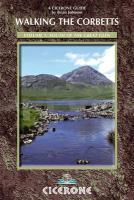
Cover

The Corbetts - Scotland’s mountains between 2500 and 2999ft in height -  are less visited but in most cases more accessible than the ever-popular Munros, and frequently offer better views when the 3000ers are shrouded in cloud. Their lower altitude also means the walks tend to be shorter meaning they can be tackled easily between breakfast and dinner and during the short daylight hours in winter.

Subsidiary summits of Munros and Corbetts between 2500 and 2999ft high with a drop of at least 30m on all sides are known as Corbett Tops.

Also mentioned in the route descriptions are Grahams, which are mountains between 2000 and 2499ft, and Donalds, which are hills over 2000ft in Southern Scotland

The routes described here are not necessarily for the peak bagger who just wants the shortest and easiest way up the mountain; they’re for the walker who wants the best, most interesting route up the wildest glen or along the most dramatic ridges.

This first volume of a two-volume guidebook to all the Scottish Corbetts describes the best ascents of the 112 Corbetts south of the Great Glen, in 95 routes.

Kartenausschnitt

Kartenbeispiel

Walking the Corbetts Volume1: South of the great Glen Wanderführer Schottland - Cicerone Großbritannien (englisch)
EAN / ISBN: 9781852846527
Preis: EUR 25.90

Bestellartikel: versandfertig in ca. 3-7 Tagen. Dieser Artikel wird speziell für Sie bestellt. Keine Rücknahme!
Produkt EUR Anzahl Bestellen
Walking the Corbetts Volume1: South of the great Glen Wanderführer Schottland - Cicerone Großbritannien (englisch) 25.90
Versandkostenfrei in Deutschland

incl. MwSt.

Stichworte, die bei der Suche nützlich sein könnten:
the Corbetts - Corbetts - Schottland - Schottland Wanderführer - Corbetts Wanderführer - Schottland - Schottland Landkartenverkauf - Schottland Atlanten - Schottland Kartographie - Schottland Wanderkarten - Schottland Radwanderkarten - Schottland Kartografie - Schottland Fahrradkarten - Schottland Reiseführer - Schottland Radwanderführer - Schottlandkarten - Schottland Landkarten - Schottland Karten - Schottland Straßenkarten - Cicerone - Cicerone Radwanderführer - Cicerone Wanderführer - Großbritannien Radwanderführer - Großbritannien Wanderführer - Cicerone Großbritannien

Zuletzt angesehene Artikel:

CoverWalking the Corbetts Volume1: South of the great Glen Wanderführer Schottland - Cicerone Großbritannien (englisch)

CoverTafelberg und Kap-Halbinsel Touristische Wanderkarte 1:55.000
Table Mountain & Cape Peninsula adventures Activity Map MapStudio Südafrika

Cover080 Cheviot Hills & Kielder Water - Wanderkarte Großbritannien 1:50.000 Active Laminiert LANDRANGER MAP - Ordnance Survey

CoverDales Way From Ilkley to Bowness-on-Windermere through the Yorkshire Dales Wanderführer - Cicerone (englisch)

CoverWhite Peak Walks (Yorkshire Dales Süd) Wanderführer (englisch) Wanderführer
White Peak Walks: The Southern Dales - 30 walks in Derbyshire and Staffordshire by Mark Richards Cicerone Großbritannien

CoverKöln - Bonn - mit angrenzendem Bergischen Land, Eifel und Siebengebirge - Rother Wanderführer - Bergverlag Rother

Cover23 Öraefajökull Atlaskort - Topographische Landkarte Island 1:100.000
Öræfajökull Forlagid - Mál og menning - Island

CoverCatalogne à pied - 22 promenades & randonnées - Espagne - Réf. IN02 Topographischer Wanderführer - FFRP (Fédération française de randonnée pédestre) Frankreich

CoverEn Família i per Nens. 2 - Catalunya Nord Wanderführer - Editorial Piolet - Spanien

CoverGIRONDE - BORDEAUX - LIBOURNE - BASSIN D`ARCACHON - PNR MÉDOC (Blatt D33) Département-Landkarte Frankreich 1:100.000
GIRONDE - BORDEAUX - LIBOURNE - BASSIN D`ARCACHON - PNR MÉDOC D33 - Carte départementale - IGN Frankreich

CoverKönigsberg Stadtplan - Stand 1931 - Rautenberg

Noch kein Cover vorhanden1324 Süderbrarup - Gestern und Heute - Historische Überlagerung 1932-1950 Topographische Landkarte 1:25.000 im Vergleich - Landesvermessungsamt Schleswig-Holstein / ProjektNord

CoverVierwaldstättersee Zentralschweiz zwischen Rigi und Gotthard - 60 Touren - Bergverlag Rother

Cover13 Apulien Reisekarte Italien 1:200.000 - Kümmerly & Frey

CoverMasuren Wanderführer Mit Ermland und Rominter Heide. 50 Touren. Mit GPS-Daten - von Gunnar Strunz - Bergverlag Rother

CoverJerusalem Reiseführer Michael-Müller-Verlag

CoverKópasker - Melrakkaslétta - Raufarhöfn - Þistilfjörður *** SCHNÄPPCHEN *** Wanderkarte 1:100.000 (Blatt 5)
Útivist & afþreying 5 Atvinnuþróunarfélag Þingeyinga - Landmælingar - Island

CoverLanguedoc - Roussillon 50 Touren - Rother Wanderführer - Bergverlag Rother

CoverNew Zealand Best Day Walks Reiseführer Lonely Planet (engl.)

CoverCALVADOS - CAEN - HONFLEUR - PLAGES DU DÉBARQUEMENT - SUISSE NORMANDE (Blatt D14) Département-Landkarte Frankreich 1:100.000
CALVADOS - CAEN - HONFLEUR - PLAGES DU DÉBARQUEMENT - SUISSE NORMANDE D14 - Carte départementale - IGN Frankreich