Willkommen bei MapFox
+++ Buchhändleranfragen willkommen! Tel. 0431-666 75 99 +++
Warenkorb
Artikel: 0 - € 0.00
Zur Kasse
Impressum Kontakt Versandkosten AGB
Walking The Ribble Way A Northern England Trail - Wanderführer North West England - Cicerone Großbritannien (englisch)
<< Großbritannien: Wanderführer + Kletterführer
<< Cicerone
 
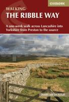
Cover

The Ribble Way traces the full length of the Ribble Valley and leads walkers through some of the finest scenery in northwest England. The route described starts from the Lancashire village of Longton, near the estuary mouth, and ends at the source of the Ribble, high on Cam Fell in the Yorkshire Dales. The 70.5 mile (113km) route does not always run right beside the river but remains within the broad confines of the valley. This is definitely an advantage as it offers walkers expansive views over the surrounding countryside.

The Ribble Way is one of the country’s shorter ?long-distance’ walks and as such, is an ideal choice for newcomers to long-distance walking. It runs through countryside for virtually its entire length, yet the path is rarely far from civilisation and only in its higher reaches does it pass through a wilder landscape. For the most part it is generally pastoral, although this does not mean that the challenge it offers should be underestimated. Countryside walking can be just as physically demanding as hillwalking, particularly after heavy rain or during the summer at the climax of vegetation growth.

For convenience the route is presented here in seven stages, but the time taken to complete the walk from end to end will depend on personal choice and ability. No stretch of the Ribble Way is overly demanding, and most reasonably fit walkers should not experience any difficulty in completing a section. However, if you are unused to walking any distance on a daily basis, it is sensible to do some training beforehand.

The Ribble Way is also very well suited to day walking, as it enjoys good public transport connections and many sections offer a wide choice of other paths from which to create a range of circular walks. Suggestions for day walkers, highlighting available transport connections and possible return routes, are given at the end of each chapter, and ?end to enders’ might find this information useful in allowing them to extend their stay to see some of the countryside beyond the Way.

Kartenausschnitt

Walking The Ribble Way A Northern England Trail - Wanderführer North West England - Cicerone Großbritannien (englisch)
EAN / ISBN: 9781786310910
Preis: EUR 24.90

Bestellartikel: versandfertig in ca. 3-7 Tagen. Dieser Artikel wird speziell für Sie bestellt. Keine Rücknahme!
Produkt EUR Anzahl Bestellen
Walking The Ribble Way A Northern England Trail - Wanderführer North West England - Cicerone Großbritannien (englisch) 24.90
Versandkostenfrei in Deutschland

incl. MwSt.

Stichworte, die bei der Suche nützlich sein könnten:
Ribble Valley - Northern England Trail - Ribble - The Ribble Way - Großbritannien - Großbritannien Wanderführer - Großbritannien Trekkingführer - Großbritannien Klettern - Großbritannien Kletterführer - Cicerone - Cicerone Radwanderführer - Cicerone Wanderführer - Großbritannien Radwanderführer - Großbritannien Wanderführer - Cicerone Großbritannien

Zuletzt angesehene Artikel:

CoverWalking The Ribble Way A Northern England Trail - Wanderführer North West England - Cicerone Großbritannien (englisch)

CoverSüddeutschland 1:415.000 Landkarten - ITMB International Travel Reference Maps (engl.)
Germany Southern

CoverReykjavik & Island Südwest 1:10.000 / 1:330.000 Landkarte - ITMB International Travel Reference Map (engl.)
Reykjavik & SW Iceland

CoverWalk! Mallorca Nord und Berge (Wanderführer englisch) *SCHNÄPPCHEN* DISCOVERY WALKING GUIDES LTD
Walk! Mallorca North and Mountains - Walking Guide - Charles Davis

Cover6: Vorarlberg - Tirol 1:175.000 - Kümmerly & Frey

CoverTraumpfade Band 2 (Rhein - Mosel - Eifel) Acht neue Premium-Rundwege an Rhein, Mosel und in der Eifel - GPS-Daten, Karten, Höhenprofile, plus 10 Extra-Touren. ideemedia

Noch kein Cover vorhanden1324 Süderbrarup - Gestern und Heute - Historische Überlagerung 1953-1956 Topographische Landkarte 1:25.000 im Vergleich - Landesvermessungsamt Schleswig-Holstein / ProjektNord

CoverGone Fishing - South Africa, Mozambique and Namibia - MapStudio Südafrika

CoverALLIER - MONTLUÇON - MOULIN - VICHY (Blatt D03) Département-Landkarte Frankreich 1:100.000
ALLIER - Carte départementale - IGN Frankreich

CoverHodmezövasarhely Stadtplan 1:14.000
Hódmezõvásárhely Hiszi-Map Ungarn

Cover074 Kelso & Coldstream - Jedburgh & Duns - Wanderkarte Großbritannien 1:50.000 LANDRANGER MAP - Ordnance Survey

CoverToscana *** SCHNÄPPCHEN *** Reiseführer Reise-Know-How Verlag

CoverParis CityTrip plus- Stadtführer Reise-Know-How Verlag

CoverKreta - Adventure ATLAS 1:50.000 Spiralo
Crete Adventure Atlas - Kriti Atlas - ΚΡΗΤΗ ΑΤΛΑΣ Anavasi - Griechenland

CoverThe Traveler´s Guide on Via Transilvanica - Reiseführer (engl.) Ann Székely - Tasuleasa Social - Rumänien

CoverBIKE: The longer road - Motoradatlas Südliches Afrika - MapStudio Südafrika

CoverRadwandern an der Pazifikküste (USA) (englisch) Bicycling the Pacific Coast - A complete route guide, Canada to Mexico THE MOUNTAINEERS BOOKS

Noch kein Cover vorhanden1821 Albersdorf - Gestern und Heute - Historische Überlagerung 1932-1950 Topographische Landkarte 1:25.000 im Vergleich - Landesvermessungsamt Schleswig-Holstein / ProjektNord

CoverPortes du Soleil: 56 MTB Routes MTB-Führer (französisch) Guide VTOPO Frankreich

CoverBritisch-Kolumbien Süd 1:800.000 Landkarte - ITMB International Travel Reference Map (engl.)
British-Columbia South - Calgary to Vancouver ITMB International Travel Maps (engl.)