Willkommen bei MapFox
+++ Buchhändleranfragen willkommen! Tel. 0431-666 75 99 +++
Warenkorb
Artikel: 0 - € 0.00
Zur Kasse
Impressum Kontakt Versandkosten AGB
The Danube Cycleway vol. 1 - Donaueschingen to Budapest Radwanderführer Cicerone Großbritannien (englisch)
<< Großbritannien: Radwanderführer
<< Cicerone
 
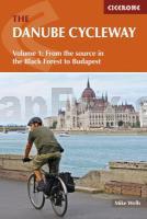
Cover

The Danube Cycle Way has become the most popular holiday cycling route in mainland Europe. It has magnificent scenery, fascinating places to visit throughout its length and a wide cultural diversity. It is not unusual to sit in a wayside bar and hear seven different languages being spoken at the same time, but not one of them is likely to be English. It is high time this changed.

This guide aims to introduce the Danube Cycle Way not only to keen long-distance cyclists but also to people who have never experienced the joys of this kind of journey. The fact that the majority of the route is on dedicated, clearly signed cycle tracks means that it is perfect for whole families to enjoy.

Although the guide divides the length of the cycle way into twenty suggested days, a plentiful amount of low-priced accommodation throughout the entire length of the route means that each day`s journey can be tailored to cyclists` needs. The way is almost free of hills, includes visits to monasteries, castles, museums, and ancient cities as well as picturesque villages, and provides adventurous cyclists with a month`s sheer pleasure. It is there, waiting to be enjoyed.

The Danube Cycleway vol. 1 - Donaueschingen to Budapest Radwanderführer Cicerone Großbritannien (englisch)
EAN / ISBN: 9781852847227
Preis: EUR 22.90

Bestellartikel: versandfertig in ca. 3-7 Tagen. Dieser Artikel wird speziell für Sie bestellt. Keine Rücknahme!
Produkt EUR Anzahl Bestellen
The Danube Cycleway vol. 1 - Donaueschingen to Budapest Radwanderführer Cicerone Großbritannien (englisch) 22.90
Versandkostenfrei in Deutschland

incl. MwSt.

Stichworte, die bei der Suche nützlich sein könnten:
Donaueschingen - Danube Cycleway - Budapest - Danube Radwanderführer - Großbritannien - Großbritannien Radwanderführer - Großbritannien Fahrradführer - Großbritannien Radführer - Cicerone - Cicerone Radwanderführer - Cicerone Wanderführer - Großbritannien Radwanderführer - Großbritannien Wanderführer - Cicerone Großbritannien

Zuletzt angesehene Artikel:

CoverThe Danube Cycleway vol. 1 - Donaueschingen to Budapest Radwanderführer Cicerone Großbritannien (englisch)

Cover023 Rosaliengebirge - Hohe Wand - Forchtenstein - Thermenregion - Wiener Neustadt 1:50.000 *** SCHNÄPPCHEN *** - Wanderkarte / Radwanderkarte Österreich - GPS - Freytag & Berndt

Cover211 Naturpark Zirbitzkogel - Grebenzen - Murau - Sölkpass 1:50.000 - Wanderkarte / Radwanderkarte Österreich - GPS - Freytag & Berndt

CoverSør-Valdres Wanderkarte Norwegen 1:50.000 (Blatt 2555) - Nordeca / UGLAND / Statens Kartverk Norwegen

CoverLissabon & Umgebung Reiseführer Michael-Müller-Verlag - Reiseführer

CoverPitztal Freeride Map 1:25.000 Topographische Skitourenkarte / Snowboardtourenkarte Österreich (dt./engl.) - FREERIDE-MAP outcomm

Cover191 Gasteiner Tal - Wagrain - Großarltal 1:50.000 - Wanderkarte / Radwanderkarte / Wintersportkarte Österreich - GPS - Freytag & Berndt

CoverTraumpfade & Traumpfädchen 1 - Rhein und Mosel Wunderschön: Die besten 21 Premium-Rund- und Spazierwanderungen an Rhein und Mosel. Praktische Pocket-Ausgabe mit App-Anbindung, GPS-Daten, Detailkarten, exakter Anfahrtsbeschreibung, Einkehr- und Erlebnistipps. ideemedia

CoverBaedeker Reiseführer Australien MAIRDUMONT

CoverWuppertal 2 - Barmen 1945 Alte Stadtpläne des Ruhrgebiets
Old maps of the Ruhr Alan Godfrey Maps

CoverRügen mit Hiddensee und Fischland-Darß-Zingst Rother Wanderführer - Bergverlag Rother

CoverMal wieder Rad fahren im Siegtal - Radtourenführer vom Rothaarkamm zum Rhein - Walder-Verlag

CoverMain-Radweg 1:75.000 Von Bayreuth nach Mainz - bikeline Radwanderführer - Esterbauer

CoverHamburg MM-City - Stadtführer Michael-Müller-Verlag - Reiseführer

CoverGard: 62 itinéraires VTT MTB-Führer (französisch) Guide VTOPO Frankreich

CoverSüdtirol - Bozen - Tyrol del Sur, Bolzano 1:150.000 (Blatt AK 0611) Autokarte Italien
Alto Adige, Bolzano - Sud-Tyrol, Bolzano Zuid-Tirol, Bozen - Southern Tyrol, Bolz freytag & berndt

CoverTop End and Gulf 1:2 Mio. - *** SCHNÄPPCHEN *** Regionale Straßenkarte Australien - HEMA Maps

CoverMidlands & Central England (Road Map Britain 5) Straßenkarte Großbritannien 1:250.000 - AA - Automobile Association

CoverMosel - mit Traumpfaden und Moselsteig-Seitensprüngen - Wanderführer von Thorsten Lensing - Bergverlag Rother

Cover1047 Sanlucar de Barrameda Amtliche topographische Landkarte 1:50.000 Spanien (M.T.N.)
1047 Mapa Topográfico Nacional de Espana (MTN50) Instituto Geográfico Nacional - CNIG Spanien