Willkommen bei MapFox
Wurde Ihre Bestellung bestätigt? Wenn nicht - gab es evtl. ein SERVER-Problem! Bitte kontaktieren Sie uns! +++ Buchhändler-Anfragen erwünscht +++
Warenkorb
Artikel: 0 - € 0.00
Zur Kasse
Impressum Kontakt Versandkosten AGB
Wales Coast Path 3 - Cardigan to Llanelli - including Pembrokeshire Coast Path National Trail - HARVEY MAPS
Wales Coast Path 3 - National Trail Map
<< Großbritannien: Wanderkarten, Radwanderkarten und MTB-Karten
<< Harvey Maps
 
Cover

The Wales Coast Path is a 1400km (870 miles) long distance trail that follows, or runs close to, the entire coastline of Wales. It is an incredibly varied trail that offers rugged and unspoilt walking, colourful seaside villages, industrial archaeology, clifftops, beaches and unique heritage sites.

4 HARVEY maps cover the whole of the route (Maps 1 and 4 will be available May 2023). Each map covers a section of the Path suitable for about 2 weeks of walking.

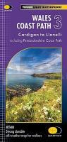
Map 3 covers the Path from Cardigan to Llanelli, and includes the whole of the Pembrokeshire Coast Path National Trail (St Dogmaels to Amroth).

The Pembrokeshire Coast Path remains a National Trail in its own right, and this map covers the entirety of this route as well as the Wales Coast Path further east to Llanelli. You will walk through some of the most beautiful parts of Wales, encountering stunning clifftop scenery, sandy beaches and rugged coastline.

Kartenausschnitt

Kartenbeispiel

Wales Coast Path 3 - Cardigan to Llanelli - including Pembrokeshire Coast Path National Trail - HARVEY MAPS
Wales Coast Path 3 - National Trail Map
EAN / ISBN: 9781851376629
Preis: EUR 26.90

sofort versandfertig Dieser Artikel ist im Normalfall sofort lieferbar.
Produkt EUR Anzahl Bestellen
Wales Coast Path 3 - Cardigan to Llanelli - including Pembrokeshire Coast Path National Trail - HARVEY MAPS
Wales Coast Path 3 - National Trail Map
26.90
Versandkostenfrei in Deutschland ab 30,- Bestellwert

incl. MwSt.

Stichworte, die bei der Suche nützlich sein könnten:
Wales Coast Path Wanderkarte - Cardigan to Llanelli Wanderkarte - Pembrokeshire Path Topographische Karte - Pembrokeshire Path Straßenkarte - Pembrokeshire Coast Path - Cardigan to Llanelli - Pembrokeshire Path Wanderkarte - Wales Coast Path - Wales Coast Path Topographische Karte - Großbritannien Wanderkarten - Großbritannien Fahrradkarten - Großbritannien Mountainbike-Karten - Harvey maps - Superwalker - Schottland Wanderkarten - Großbritannien Wanderkarten - Harvay - Harway Maps - Britsh Mountain Maps - BMC - Ultramaps - XT40 - XT25 - Great Britain walking maps - UK hiking maps - Scotland hiking maps - Harveymaps - UK Walking maps - Great Britain walking maps

Zuletzt angesehene Artikel:

CoverWales Coast Path 3 - Cardigan to Llanelli - including Pembrokeshire Coast Path National Trail - HARVEY MAPS
Wales Coast Path 3 - National Trail Map

CoverC1918 Heide Topographische Landkarte 1:100.000 Landesvermessungsamt Schleswig-Holstein

Cover9 Marken - Umbrien - Ancona - Perugia - Terni Reisekarte Italien 1:200.000 - Kümmerly & Frey
Marche - Umbria - Ancona - Perugia - Terni

CoverSchwedisch - Wort für Wort Kauderwelsch-Sprachführer (Band 028) Schweden - Reise-Know-How Verlag

Cover5612 Bad Ems Topographische Karte 1:25.000 - Landesamt für Vermessung und Geobasisinformation Rheinland-Pfalz

CoverEstland Straßenkarte 1:500.000
Eesti - maanteede kaart Jana Seta

CoverKocher-Jagst-Trail 1:35.000 - Hikeline Wanderführer Wandervergnügen im Hohenloher Land - Esterbauer

CoverFreiburg Nord 1:50.000 - Supertrail Map - Mountainbikekarte - Landkarte outcomm

Noch kein Cover vorhandenFlorida Bundesstaaten-Straßenkarte laminiert (Florida - USA)
Florida state map laminated

CoverAladaglar-Gebirge (Türkei) - Umfassender Führer (engl.) Klettern - Wandern - Skiwandern - von Recep Inge
Comprehensive guide to Aladağlar - Climbing - Trekking - Skitouring ZEYNEP TANTEKIN

Cover46 Kempten (Allgäu) - 1:35.000 Outdoorkarte - Wanderkarte Kümmerly & Frey

CoverMarsala Stadtplan 1:10.000 - Straßenkarte 1:40.000
Marsala - Pianta della Citta L.A.C. GlobalMap Italien

CoverKampanien - Basilicata 1:150.000 (Blatt AK 0628) Straßenkarte Italien freytag & berndt

Cover128 Taunton & Blackdown Hills - Wanderkarte Großbritannien 1:25.000 EXPLORER MAP - Active Map LAMINIERT - Ordnance Survey