Willkommen bei MapFox
Wurde Ihre Bestellung bestätigt? Wenn nicht - gab es evtl. ein SERVER-Problem! Bitte kontaktieren Sie uns! +++ Buchhändler-Anfragen erwünscht +++
Warenkorb
Artikel: 0 - € 0.00
Zur Kasse
Impressum Kontakt Versandkosten AGB
Wales Coast Path 2 - Caernarfon to Cardigan - including Llyn Peninsula 1:40 000 National Trail - HARVEY MAPS
Wales Coast Path 2 - National Trail Map
<< Großbritannien: Wanderkarten, Radwanderkarten und MTB-Karten
<< Harvey Maps
 
Cover

The Wales Coast Path is a 1400km (870 miles) long distance trail that follows, or runs close to, the entire coastline of Wales. It is an incredibly varied trail that offers rugged and unspoilt walking, colourful seaside villages, industrial archaeology, clifftops, beaches and unique heritage sites.

4 HARVEY maps cover the whole of the route (Maps 1 and 4 will be available May 2023). Each map covers a section of the Path suitable for about 2 weeks of walking.

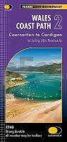
Map 2 covers the Path from Caernarfon to Cardigan.

On this stretch, you will pass through the rugged and beautiful Llyn Peninsula, take in Cardigan Bay and its wide, expansive beaches and walk across the famous Barmouth Bridge.

Kartenausschnitt

Kartenbeispiel

Wales Coast Path 2 - Caernarfon to Cardigan - including Llyn Peninsula 1:40 000 National Trail - HARVEY MAPS
Wales Coast Path 2 - National Trail Map
EAN / ISBN: 9781851376612
Preis: EUR 26.90

sofort versandfertig Dieser Artikel ist im Normalfall sofort lieferbar.
Produkt EUR Anzahl Bestellen
Wales Coast Path 2 - Caernarfon to Cardigan - including Llyn Peninsula 1:40 000 National Trail - HARVEY MAPS
Wales Coast Path 2 - National Trail Map
26.90
Versandkostenfrei in Deutschland ab 30,- Bestellwert

incl. MwSt.

Stichworte, die bei der Suche nützlich sein könnten:
Llyn Peninsula Wanderkarte - Wales National Trail - Llyn Peninsula - Wales National Trail Wanderkarte - Cardigan Wanderkarte - Caernarfon - Cardigan - Wales Coast Wanderkarte - Caernarfon Wanderkarte - Wales Coast - Großbritannien Wanderkarten - Großbritannien Fahrradkarten - Großbritannien Mountainbike-Karten - Harvey maps - Superwalker - Schottland Wanderkarten - Großbritannien Wanderkarten - Harvay - Harway Maps - Britsh Mountain Maps - BMC - Ultramaps - XT40 - XT25 - Great Britain walking maps - UK hiking maps - Scotland hiking maps - Harveymaps - UK Walking maps - Great Britain walking maps

Zuletzt angesehene Artikel:

CoverWales Coast Path 2 - Caernarfon to Cardigan - including Llyn Peninsula 1:40 000 National Trail - HARVEY MAPS
Wales Coast Path 2 - National Trail Map

Noch kein Cover vorhandenL-33-22-C Köszeg Amtliche Topographische Karte Ungarn 1:50.000

Cover3217 Barnstorf Amtliche topographische Karte 1:25.000 Landesvermessungsamt Niedersachsen

Cover3626 Hämelerwald Amtliche topographische Karte 1:25.000 Landesvermessungsamt Niedersachsen

Cover3228 Sprakensehl Amtliche topographische Karte 1:25.000 Landesvermessungsamt Niedersachsen

Cover3528 Meinersen Amtliche topographische Karte 1:25.000 Landesvermessungsamt Niedersachsen

Cover3511 Freren Amtliche topographische Karte 1:25.000 Landesvermessungsamt Niedersachsen

Cover3512 Voltlage Amtliche topographische Karte 1:25.000 Landesvermessungsamt Niedersachsen

Cover3609 Schüttorf Amtliche topographische Karte 1:25.000 Landesvermessungsamt Niedersachsen

Cover3229 Hankensbüttel Amtliche topographische Karte 1:25.000 Landesvermessungsamt Niedersachsen

Cover3118 Bassum Amtliche topographische Karte 1:25.000 Landesvermessungsamt Niedersachsen

Noch kein Cover vorhanden1620SB la Flèche.Sablé-sur-Sarthe GPS Amtliche Topographische Wanderkarte Frankreich 1:25.000 - série bleue (IGN)

Cover195 Bournemouth & Purbeck - Wimborne Minster & Ringwood - Wanderkarte Großbritannien 1:50.000 LANDRANGER MAP - Ordnance Survey

CoverGenf 1:6.700 / Schweiz-West 1:301.000 Landkarte (engl.)
Geneva and Western Switzeland ITMB International Travel Maps (engl.)

Noch kein Cover vorhanden1718SB Beaumont-sur-Sarthe / Ballon GPS Amtliche Topographische Wanderkarte Frankreich 1:25.000 - série bleue (IGN)

Noch kein Cover vorhanden1816SB Mortagne-au-Perche / Mêle-sur-Sarthe Amtliche Topographische Wanderkarte Frankreich 1:25.000 - série bleue (IGN)

Noch kein Cover vorhanden1521SB LE LION-D´ANGERS - CHÂTEAUNEUF-SUR-SARTHE GPS Amtliche Topographische Wanderkarte Frankreich 1:25.000 - série bleue (IGN)

Cover3926 Bad Salzdetfurth Amtliche topographische Karte 1:25.000 Landesvermessungsamt Niedersachsen

Noch kein Cover vorhanden1 Erzgebirge West - Kaiserwald Fahrradkarte Tschechien 1:100.000 - KCT / VKU
Krušné hory západ - Slavkovský les - cyklotusisticka mapa

Cover0063-2 ZUMAIA Topographische Landkarte 1:25.000 Spanien (Grundlage MTN25) Instituto Geográfico Nacional - CNIG Spanien - ProjektNord