Willkommen bei MapFox
Wurde Ihre Bestellung bestätigt? Wenn nicht - gab es evtl. ein SERVER-Problem! Bitte kontaktieren Sie uns! +++ Buchhändler-Anfragen erwünscht +++
Warenkorb
Artikel: 0 - € 0.00
Zur Kasse
Impressum Kontakt Versandkosten AGB
Northumberland Coast Path & Berwickshire Coastal Path - XT40 (wasserfest) Superwalker - HARVEY MAPS
<< Großbritannien: Wanderkarten, Radwanderkarten und MTB-Karten
<< Harvey Maps
 
Cover

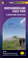
The Northumberland Coast Path stretches for 103km (64m) from Cresswell in the south to Berwick-upon-Tweed in the north. The Berwickshire Coastal Path stretches for 48km (28m) and continues this route from Berwick-upon-Tweed to Cockburnspath. These routes are part of the North Sea Trail and offer some of the finest coastal walking in the country with rugged coastline, stunning cliff scenery and panoramic views.

Kartenausschnitt

Kartenbeispiel

Northumberland Coast Path & Berwickshire Coastal Path - XT40 (wasserfest) Superwalker - HARVEY MAPS
EAN / ISBN: 9781851376681
Preis: EUR 24.90

Bestellartikel: versandfertig in ca. 3-7 Tagen. Dieser Artikel wird speziell für Sie bestellt. Keine Rücknahme!
Produkt EUR Anzahl Bestellen
Northumberland Coast Path & Berwickshire Coastal Path - XT40 (wasserfest) Superwalker - HARVEY MAPS 24.90
Versandkostenfrei in Deutschland ab 30,- Bestellwert

incl. MwSt.

Stichworte, die bei der Suche nützlich sein könnten:
Cocksburnpath - St Abbs - Berwick-upon-Tweed - Northumberland Wanderkarte - Alnmouth - Eyemouth - Northumberland Coast Path - Seahouses - Cresswell - Berwickshire Coastal Path - Amble - Lindisfarne - Großbritannien Wanderkarten - Großbritannien Fahrradkarten - Großbritannien Mountainbike-Karten - Harvey maps - Superwalker - Schottland Wanderkarten - Großbritannien Wanderkarten - Harvay - Harway Maps - Britsh Mountain Maps - BMC - Ultramaps - XT40 - XT25 - Great Britain walking maps - UK hiking maps - Scotland hiking maps - Harveymaps - UK Walking maps - Great Britain walking maps

Zuletzt angesehene Artikel:

CoverNorthumberland Coast Path & Berwickshire Coastal Path - XT40 (wasserfest) Superwalker - HARVEY MAPS

CoverPrince Edward Island 1:250.000 Touristische Landkarte
Road map GM Johnson

Cover115A06 Mush Lake Topographische Landkarte 1:50.000 - Canada - Yukon

CoverOdenwald - Spessart 1:75.000 (Blatt RK-HES08) bikeline-Radkarte Deutschland Esterbauer

Cover2 Western Scotland and the Western Isles 1:250.000 Travel Map Road - Straßenkarte - Ordnance Survey

Cover27/3-4 Watou NGI 1:25.000 Topographische Landkarte Belgien

Cover04 Monti Sibillini 1:25.000 - Wanderkarte Italien - Monti Editore - Italien

Cover417 Monadhliath Mountains North & Strathdearn - Wanderkarte Großbritannien 1:25.000 EXPLORER MAP - Ordnance Survey

Cover335 Lanark & Tinto Hills - Wanderkarte Großbritannien 1:25.000 EXPLORER MAP - Ordnance Survey

CoverAveyron 1:200.000 Carte Touristique - Carte routière - Découvertes Régionales IGN Frankreich

CoverPays de Haute-Saintonge 1:75.000 Découvertes Régionales - Kultur und Natur - IGN Frankreich

CoverMonti Liguri da Moneglia e Sestri al Passo del Bocco 1:25.000 Wanderkarte STUDIO CARTOGRAFICO ITALIANO

Cover3144OT ETANG-DE-BERRE Topographische Wanderkarte Frankreich 1:25.000 TOP 25 IGN

CoverBUEN CAMINO! Erlebniskarte Jakobsweg POSTER - Krüger & Schönhoff - K & S druckbunt Verlag

CoverDer Wanderführer Wandertouren in der hinteren Sächsischen Schweiz - von Bellmann, Michael - Bellmann, Michael

CoverPolen 1:715.000 Straßenkarte - (Papierausgabe)
Polska mapa Demart - Polen

CoverOL19 Howgill Fells and Upper Eden Valley - Wanderkarte Großbritannien 1:25.000 NEW EXPLORER MAP - Ordnance Survey

CoverDer Radtourenführer Radwandern mit Kindern in der Sächsischen Schweiz - von Bellmann, Michael - Bellmann, Michael

CoverAppennino Pavese da Varzi a Bobbio (italienisch) Wanderführer STUDIO CARTOGRAFICO ITALIANO - Italien
Itinerari dall´Oltrepo Pavese alla Val Trebbia

CoverQeqertarsuup Tunua / Disko Bugten / Disko-Bucht Historischer Führer mit topographischer Landkarte - Saga Maps