Willkommen bei MapFox
+++ Buchhändleranfragen willkommen! Tel. 0431-666 75 99 +++
Warenkorb
Artikel: 0 - € 0.00
Zur Kasse
Impressum Kontakt Versandkosten AGB
Isle of Man Wanderkarte 1:30.000 (wasserfest) HARVEY MAPS
Isle of Man - map for walking, cycling and touring - Superwalker map (waterproof)
<< Großbritannien: Wanderkarten, Radwanderkarten und MTB-Karten
<< Harvey Maps
 
Cover

Includes long distance routes, rights of way and Public Ramblage.

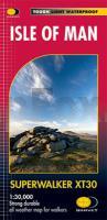
Detailed map for hillwalkers at 1:30,000 scale covering the whole island on two sides of the sheet with a generous overlap.

Excellent map for walking, cycling and touring. This is THE map to have for the Isle of Man Walking Festival.

Tough, light, durable and 100% waterproof
Genuine, original, HARVEY mapping
Opens directly to either side of the sheet
Easy to re-fold
Includes Rights of Way

Technical specification

  • Scale: 1:30,000
  • Ratio: 3.33cm = 1km
  • Flat size: 1392 x 486mm
  • Folded size: 116 x 243mm
  • Weight: 60gms
  • Area of mapping: 791sqkm
  • Double sided: yes
  • Kartenausschnitt

    Kartenbeispiel

    Isle of Man Wanderkarte 1:30.000 (wasserfest) HARVEY MAPS
    Isle of Man - map for walking, cycling and touring - Superwalker map (waterproof)
    EAN / ISBN: 9781851375912
    Preis: EUR 23.90

Bestellartikel: versandfertig in ca. 3-7 Tagen. Dieser Artikel wird speziell für Sie bestellt. Keine Rücknahme!
Produkt EUR Anzahl Bestellen
Isle of Man Wanderkarte 1:30.000 (wasserfest) HARVEY MAPS
Isle of Man - map for walking, cycling and touring - Superwalker map (waterproof)
23.90
Versandkostenfrei in Deutschland

incl. MwSt.

Stichworte, die bei der Suche nützlich sein könnten:
Millennium Way - Ballaglass Glen - Isle of Man (Great Britain) (United Kingdom) Hiking Map - Steam Heritage Trail - Isle of Man (Großbritannien) Wanderkarte - Ramsey - Großbritannien Wanderkarten - Großbritannien Fahrradkarten - Großbritannien Mountainbike-Karten - Harvey maps - Superwalker - Schottland Wanderkarten - Großbritannien Wanderkarten - Harvay - Harway Maps - Britsh Mountain Maps - BMC - Ultramaps - XT40 - XT25 - Great Britain walking maps - UK hiking maps - Scotland hiking maps - Harveymaps - UK Walking maps - Great Britain walking maps

Zuletzt angesehene Artikel:

CoverIsle of Man Wanderkarte 1:30.000 (wasserfest) HARVEY MAPS
Isle of Man - map for walking, cycling and touring - Superwalker map (waterproof)

Cover950-IV Castillejar Amtliche topographische Landkarte 1:25.000 Spanien (M.T.N.)
950-IV Mapa Topográfico Nacional de Espana (MTN25) Instituto Geográfico Nacional - CNIG Spanien

CoverTopMaps Sachsen Historische Karten - Messtischblätter 1:25.000 letzte Ausgabe vor 1945 auf DVD - Landesvermessungsamt Sachsen

Cover2937OT PRIVAS - VALS-LES-BAINS Topographische Wanderkarte Frankreich 1:25.000 TOP 25 IGN - (GPS)

Cover235T ROTKREUZ - Luzerner Mittelland - Rigi - Zug 1:50.000 Topographische Wanderkarte SAW der Schweiz - swisstopo

CoverItalien: Autobahnen und Fernstraßen 1:700.000 - Straßenkarte Italien
Autostrade e strade d´Italia Libreria Geografica - Italien

CoverÖstliche Pyrenäen - Andorra 1:150.000 Straßenkarte Spanien zoom (Blatt 146) Michelin
Pyrénées orientales, Andorra

Noch kein Cover vorhanden976-4 PUERTO DE MAZARRÓN Amtliche topographische Landkarte 1:25.000 Spanien (M.T.N.)
976-4 Mapa Topográfico Nacional de Espana (MTN25) Instituto Geográfico Nacional - CNIG Spanien

Cover1284 MONTHEY 1:25.000 Topographische Landeskarte der Schweiz - swisstopo

Cover983-3 VILLALBA DEL ALCOR Amtliche topographische Landkarte 1:25.000 Spanien (M.T.N.)
983-3 Mapa Topográfico Nacional de Espana (MTN25) Instituto Geográfico Nacional - CNIG Spanien

Cover974-3 SALIENTE ALTO Amtliche topographische Landkarte 1:25.000 Spanien (M.T.N.)
974-3 Mapa Topográfico Nacional de Espana (MTN25) Instituto Geográfico Nacional - CNIG Spanien

CoverChugach State Park, Anchorage (Blatt 764) GPS 1:75.000 / Alaska Landkarte Trails Illustrated Map wasserfest National Geographic - USA

Cover874-3 VALENCIA DE BOMBUEY Amtliche topographische Landkarte 1:25.000 Spanien (M.T.N.)
874-3 Mapa Topográfico Nacional de Espana (MTN25) Instituto Geográfico Nacional - CNIG Spanien

Cover936-3 ALQUERIA LA VACA Amtliche topographische Landkarte 1:25.000 Spanien (M.T.N.)
936-3 Mapa Topográfico Nacional de Espana (MTN25) Instituto Geográfico Nacional - CNIG Spanien

Cover359-4 TÉRMENS Amtliche topographische Landkarte 1:25.000 Spanien (M.T.N.)
359-4 Mapa Topográfico Nacional de Espana (MTN25) Instituto Geográfico Nacional - CNIG Spanien

Cover985-2 CARMONA Amtliche topographische Landkarte 1:25.000 Spanien (M.T.N.)
985-2 Mapa Topográfico Nacional de Espana (MTN25) Instituto Geográfico Nacional - CNIG Spanien

Cover844-3 SIERRA DE LA PEDRERA Amtliche topographische Landkarte 1:25.000 Spanien (M.T.N.)
844-3 Mapa Topográfico Nacional de Espana (MTN25) Instituto Geográfico Nacional - CNIG Spanien

CoverSerra de Llaberia - Mola de Colldejou - Escornalbou - Serr de Montalt Wanderkarte 1:20.000 - Editorial Piolet - Spanien

Cover242 AVENCHES 1:50.000 Topographische Landeskarte der Schweiz - swisstopo

CoverParco Storico di Monte Sole (Blatt 04 BO) Wanderkarte 1:25.000 - Medie valli del Savena e del Reno e valli del Sambro e del Setta - l´Escursionista Editore Italien