 Topographische Wanderkarte des Lake District in Cumbria (Nordwest-England) mit Höhenlinien und Angaben zu Felswänden. Die Landkarte ist wasserfest und enthält touristische Informationen. Die Kartenrückseite enthält zahlreiche geologische Informationen und Karten sowie Detailkarten der Berge Great Calva 1:40.000, Pillar und Scafell 1: 15.000 sowie des Ennerdale-Tals 1:40.000. Zudem enthält sie allgemeine Informationen zum Thema Kompass- und Kartenbenutzung und Erste-Hilfe-Maßnahmen bei Bergunfällen.  Kartenausschnitt Kartenausschnitt
Kartenbeispiel
|
Lake District Bergwanderkarte 1:40.000 (wasser- und reißfest) - HARVEY MAPS
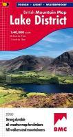
Lake District - British Mountain Map (BMC) (durable, tear-resistent and 100% waterproof)
EAN / ISBN: 9781851376865
Preis: EUR 28.90
|
|

