| << Caminoguides - Jakobsweg << Jakobsweg |
||
Zuletzt angesehene Artikel:
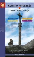
 | A Pilgrim`s Guide to the Camino Portugués Lisboa - Porto - Santiago - by John Brierley Caminoguides - Findhorn Press |
 | 5610 Bassenheim - Wanderkarte mit Wanderwegen (geplottete Ausgabe) ProjektNord - Grundlage Amtliche topographische Karte Landesamt für Vermessung und Geobasisinformation Rheinland-Pfalz |
 | 42 III Santiago do Cacém Topographische Landkarte Portugal 1:50.000 Carta Militar de Portugal Instituto Geográfico do Exército (IGeoE) - Portugal |
 | NL 32-05-06 (1106) Gargellen Ãsterreichische Karte 1:50.000 mit Wegmarkierungen (topographische Wanderkarte - UTM) - BEV - Ãsterreich |
 | Karmsundet - Ryvarden - Seekarte Norwegische Küste 1:50.000 - (Blatt 17) Den Norske Kyst Sjøkart - Hovedkart (sjø) Statens Kartverk Sjø - Norwegen |
 | Swinemüde - Misdroy Stadtplan 1:11.500 / 1:8.000 Mit Umgebungskarte 1:45.000 - PLAN - Polen Świnoujście i Międzyzdroje Plan Miasta PLAN Galileos - Polen |
 | Südamerika 1:12.5 Mio. *** SCHNÃPPCHEN *** Landkarte mit Kurzreiseführer (englisch) South America - Map Guide DeDios Editores - Argentinien |
 | 15: Otago - South Canterbury - Topographische StraÃenkarte 1:250.000 - Neuseeland (Blatt 250-15) Landkarte Timaru - Oamaru - Wanaka - Alexandra - Mit New Zealand Cycle Trails Otago - South Canterbury - Rural Road Map 1:250 Series Map 15 of 18 Kiwimaps Ltd - Neuseeland |
 | Der Südharz 1:30.000 - wasserfest - reiÃfest Wanderkarte und Fahrradkarte - von Bernhard Spachmüller Schmidt-Buch-Verlag |
 | 0233 Wörthersee und Umgebung - Klagenfurt - Karawanken 1:50.000 - Wanderkarte / Radwanderkarte / Wintersportkarte Ãsterreich - GPS - Freytag & Berndt |
 | Müritz-Nationalpark - Radwander- und Wanderkarte 1:50.000 (Nr. 173) Ausflüge im Müritz-Nationalpark um Waren, Röbel, Wesenberg, Neustrelitz und Lychen. Radwander- und Wanderkarte, Wetterfest, reiÃfest. GPS-fähig Dr. Barthel Verlag |
 | 80 Sysslebäck 1:50.000 (wasserfest) *** SCHNÃPPCHEN *** Topographische Wanderkarte - Sverigeserien Topo50 - Schweden Norstedts |
 | Skandinavien Reisehandbuch (Jahresausgabe) Norwegen, Schweden, Finnland, Dänemark, Island, Grönland, Färöer - Nordis Verlag |
 | Vietnam - Laos - Kambodscha StraÃen- und Tourismuskarte 1:1.5 Mio. (Blatt 770) - Michelin Editions des Voyages |
 | NM 33-10-18 (3318) Rohrbach in Oberösterreich Ãsterreichische Karte 1:50.000 mit Wegmarkierungen (topographische Wanderkarte - UTM) - BEV - Ãsterreich |
 | Brüssel 1:11.500 Stadtplan Belgien Bruxelles Michelin |
 | 5608 Virneburg - Wanderkarte mit Wanderwegen (geplottete Ausgabe) ProjektNord - Grundlage Amtliche topographische Karte Landesamt für Vermessung und Geobasisinformation Rheinland-Pfalz |
 | Maremma Grossetana Touristische StraÃen- und Wanderkarte 1:130.000 Maremma Grossetana L.A.C. GlobalMap Italien |
 | CC 8718 Konstanz Topographische Ãbersichtskarte 1:200.000 - Bundesamt für Kartografie und Geodäsie und Landesvermessungsämter - ProjektNord |
 | 3210 Klein BerÃen Amtliche topographische Karte 1:25.000 Landesvermessungsamt Niedersachsen |


