Willkommen bei MapFox
+++ Buchhändleranfragen willkommen! Tel. 0431-666 75 99 +++
Warenkorb
Artikel: 0 - € 0.00
Zur Kasse
Impressum Kontakt Versandkosten AGB
Pantanal Wildlife - Brazils Great Wetland Bradt wildlife guides Bradt Publications
<< Brasilien
<< Bradt Publications
 
Cover

Bradt`s fully illustrated wildlife guides focus on regions of the world particularly celebrated for their amazing and often unique species.

With spectacular photography or exclusive watercolour drawings throughout, each visitors` guide provides an introduction to the region`s principal flora and fauna alongside suggested wildlife itineraries, practical information on when to go and what to take and photography tips. Written in a deliberately engaging way, they offer something different from dry field guides, and will appeal to the interested layman as much as the wildlife devotee. Ideal as a lightweight companion to any wildlife trip they also make a handsome souvenir.

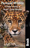
The Pantanal of Brazil, Bolivia and Paraguay is South America`s Serengeti: its wetlands are the largest on earth (they`re half the size of France) and, in the dry season, crocodiles and storks jostle to gobble the last of the dying fish. Here, the continent`s largest cat, the jaguar, lives alongside giant otters, anacondas and the
world`s largest parrot. A comprehensive introduction to the best place to watch wildlife in South America, and beautifully illustrated throughout, Bradt`s Pantanal Wildlife is the only portable book to cover all the main wildlife groups while focussing exclusively on the Pantanal.

Kartenbeispiel

Pantanal Wildlife - Brazils Great Wetland Bradt wildlife guides Bradt Publications
EAN / ISBN: 9781784777135
Preis: EUR 26.95

Bestellartikel: versandfertig in ca. 3-7 Tagen. Dieser Artikel wird speziell für Sie bestellt. Keine Rücknahme!
Produkt EUR Anzahl Bestellen
Pantanal Wildlife - Brazils Great Wetland Bradt wildlife guides Bradt Publications 26.95
Versandkostenfrei in Deutschland ab 30,- Bestellwert

incl. MwSt.

Stichworte, die bei der Suche nützlich sein könnten:
Pantanal Tierwelt - Brasilien Reiseführer - Brazils Great Wetland - Brasilien - Brazil - Bradt Publications - Bradt Reiseführer

Zuletzt angesehene Artikel:

CoverPantanal Wildlife - Brazils Great Wetland Bradt wildlife guides Bradt Publications

Noch kein Cover vorhanden2273 Czersk Topographische Karte 1:25.000 Messtischblatt des Deutschen Reiches - Preußische Landesaufnahme / Reichsamt für Landesaufnahme - Faksimile ProjektNord

Cover106K05 Topographische Landkarte 1:50.000 - Canada - Yukon North West Territories

CoverAussichtstürme der Tschechischen Republik 1:500.000
Rozhledny Ceské republiky SHOCart - Tschechien

CoverInsel Rügen, Kap Arkona, Sassnitz, Halbinsel Jasmund und Umgebung - Radwander- und Wanderkarte 1:35.000 (Nr. 181) Ausflüge im nordöstlichen Inselgebiet zwischen Altenkirchen, Glowe und Ralswiek. Radwander- und Wanderkarte, GPS-fähig. Wetterfest, reißfest. 1:35 000 Dr. Barthel Verlag

Cover4111 Ottmarsbocholt (geplottete Ausgabe) Amtliche topographische Karte 1:25.000 Landesvermessungsamt Nordrhein-Westfalen

CoverAutoatlas Weliki Nowgorod und Illmen 1:120.000 - Stadtplan 1:10.000 Karta LTD Sankt Petersburg
Welikij Nowgorod i Priilmene - atlas dlja woditelej

CoverEin deutscher Wandersommer 1400 Kilometer durch unsere wilde Heimat. Mit Sabine Wünsch - von Andreas Kieling

Cover2311-IV Mommark Topographische Karte Dänemark 1:50.000 - Kort & Matrikelstyrelsen ProjektNord

CoverL423 Hyvinkää Topographische Karte 1:50.000 EUREF-FIN (Maastokarttat) Maanmittauslaitos / Lantmäteriverket Finnland - ProjektNord

Cover07O GRONINGEN (Oost) Topographische Karte der Niederlande 1:50.000 Topografische Dienst (Plotausgabe)

CoverCamins de l`Alt Camp Wanderkarte 1:40.000 - Editorial Piolet - Spanien

CoverTromsø: Kvaløya 1:25.000 Høyfjellskart - Gebirgswanderkarte Norwegen - Calazo Förlag

Cover3612 Mettingen (geplottete Ausgabe) Amtliche topographische Karte 1:25.000 Landesvermessungsamt Nordrhein-Westfalen

CoverP3421 Björköby Topographische Karte 1:25.000 EUREF (Peruskartta) Maanmittauslaitos / Lantmäteriverket Finnland - ProjektNord

Cover3926 Bad Salzdetfurth Amtliche topographische Karte 1:25.000 Landesvermessungsamt Niedersachsen

CoverEurope Guide Reiseführer Lonely Planet (engl.)

CoverMecklenburgische Kleinseenplatte - Nautische Edition Gewässerkarte 1:50.000 (wasserfest - reißfest) - Grünes Herz

Cover2316-IV Hals Topographische Karte Dänemark 1:50.000 - Kort & Matrikelstyrelsen ProjektNord

CoverE04 Würzburg - Zellingen, Veitshöchheim, Reichenberg, Rimpar, Remlingen, Helmstadt ATK25 Topographische Karte 1:25.000 (Atkis) Bayern Landesvermessungsamt Bayern - Wanderkarte