Willkommen bei MapFox
Wurde Ihre Bestellung bestätigt? Wenn nicht - gab es evtl. ein SERVER-Problem! Bitte kontaktieren Sie uns! +++ Buchhändler-Anfragen erwünscht +++
Warenkorb
Artikel: 0 - € 0.00
Zur Kasse
Widerruf Impressum Kontakt Versandkosten AGB
Walking the Gloucestershire Way One-week hike from Chepstow to Tewkesbury - von Hughes, Dan - Cicerone Press Limited
<< Großbritannien: Wanderführer + Kletterführer
<< Cicerone
 
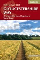
Cover


Experience the varied landscapes of Gloucestershire on the Gloucestershire Way, a 152km (94 mile) long-distance trail from Chepstow on the England-Wales border to the historic town of Tewkesbury. From the ancient streets of Chepstow and the tranquil valleys of the Severn to the majestic panoramas of May Hill and the rolling Cotswold countryside, this trail combines scenic beauty, industrial heritage, and honey-coloured villages along its route. 


Ideal for walkers of all abilities, this guidebook presents the Gloucestershire Way in eight manageable stages, offering suggested itineraries from five to ten days. Walk through the Forest of Dean´s historic woodlands, follow riverbanks and quiet lanes, and explore towns steeped in centuries of history, all framed by expansive skies and breathtaking views.


Eight stage-by-stage route descriptions covering the Gloucestershire Way from Chepstow to Tewkesbury, plus clear step-by-step directions for every stage, supported by 1:50,000 Ordnance Survey mapping for accurate navigation across woodland, river valleys, and Cotswold hills.


Each stage includes distance, estimated walking time, ascent, terrain notes, and information on key places such as Chepstow, the Forest of Dean, May Hill, Gloucester, Stow-on-the-Wold, Winchcombe, and Tewkesbury.


Comprehensive planning information with advice on accommodation, transport, seasonal considerations, and points of interest along the route, plus suggested itineraries from five to ten days.


Downloadable GPX files make it easy to follow the Gloucestershire Way using GPS devices or smartphone apps.


Historical and natural highlights described throughout, including industrial heritage in the Forest of Dean, riverside paths along the Severn, and traditional Cotswold villages with ancient churches and dry-stone walls.


Plan your Gloucestershire Way adventure with confidence using this comprehensive guidebook and enjoy a journey through woodlands, river valleys, rolling hills, and historic towns across one of England´s most diverse and inspiring landscapes.

Walking the Gloucestershire Way One-week hike from Chepstow to Tewkesbury - von Hughes, Dan - Cicerone Press Limited
EAN / ISBN: 9781786312945
Preis: EUR 25.90

Bestellartikel: versandfertig in ca. 1-3 Wochen. Dieser Artikel wird speziell für Sie bestellt. Keine Rücknahme!
Produkt EUR Anzahl Bestellen
Walking the Gloucestershire Way One-week hike from Chepstow to Tewkesbury - von Hughes, Dan - Cicerone Press Limited 25.90
Versandkostenfrei in Deutschland ab 30,- Bestellwert

incl. MwSt.

Stichworte, die bei der Suche nützlich sein könnten:
Cicerone - Cicerone Radwanderführer - Cicerone Wanderführer - Großbritannien Radwanderführer - Großbritannien Wanderführer - Cicerone Großbritannien - Großbritannien - Großbritannien Wanderführer - Großbritannien Trekkingführer - Großbritannien Klettern - Großbritannien Kletterführer

Zuletzt angesehene Artikel:

CoverWalking the Gloucestershire Way One-week hike from Chepstow to Tewkesbury - von Hughes, Dan - Cicerone Press Limited

CoverEl camino de Santiago: El camino Frances en bicicleta 1:75.000 Radwanderführer (spanischsprachig) guiasbicimap Petirrojo ediciones - Spanien

CoverVictoria Stadtplan
Victoria Street Map GM Johnson

CoverEl camino Portugués en bicicleta 1:75.000 Radwanderführer (spanischsprachig) guiasbicimap Petirrojo ediciones - Spanien

CoverTogo - Benin 1:530.000 *** SCHNÄPPCHEN *** Landkarte - ITMB International Travel Maps (engl.)

CoverProvinz Lüttich - 16 Rundwanderungen (Teil 1) Topo-Guide du Sentier de Grande Randonnée - Belgien (französisch)
Liège province - 16 randonnées en boucle - Tome 1 GRSentiers - Grote Routepaden - Belgien

CoverTour de l`Obiou 1:50.000 Topographische Wanderkarte - FFRP (Fédération française de randonnée pédestre) Frankreich

CoverAdirondack Park & New York State 1:224.000 / 1:850.000 - Landkarte - ITMB International Recreation Map

CoverLondon freedom pass - Make the most of your travel pass - 25 special days out Reiseführer (englisch) Bradt Publications

CoverKorsika (Blatt 001) französisch
Corse Michelin

CoverBraine-le-Comte Wanderkarte 1:15.000 Wanderkarte Belgien NGI Belgien

CoverSchneifel - Schnee-Eifel Topographische Wanderkarte Rheinland-Pfalz mit Wanderwegen und Radwegen 1:25.000 - ProjektNord

CoverKirn - Herrstein Topographische Wanderkarte Rheinland-Pfalz mit Wanderwegen und Radwegen 1:25.000 - ProjektNord

CoverProvence (Blatt 002) französisch - Michelin

CoverSchneifel - Belgische Eifel Topographische Wanderkarte Rheinland-Pfalz mit Wanderwegen und Radwegen 1:25.000 - ProjektNord

CoverSizilien (Blatt 020) französisch
Sicile Michelin

CoverPilgerwege und spirituelle Exerzitien in Frankreich 1:1 Mio. Straßenkarte (Blatt 831)
Chemins de pèlerinage et Retraites spirituelles en France Michelin

CoverKonz - Saarburg Topographische Wanderkarte Rheinland-Pfalz mit Wanderwegen und Radwegen 1:25.000 - ProjektNord

CoverFrankreich per Bahn 1:1 Mio. Landkarte (Blatt 832)
La France en Train Michelin

CoverRhaunen - Lützelsoon Topographische Wanderkarte Rheinland-Pfalz mit Wanderwegen und Radwegen 1:25.000 - ProjektNord
