Willkommen bei MapFox
+++ Buchhändleranfragen willkommen! Tel. 0431-666 75 99 +++
Warenkorb
Artikel: 0 - € 0.00
Zur Kasse
Impressum Kontakt Versandkosten AGB
Catalunya - Barcelona walking - Montserrat - Montseny and Sant Llorenç del Munt i l´Obac Nature Parks Wanderführer - Cicerone (englisch)
<< Spanien: Wanderführer, Radwanderführer und Reiseführer
<< Cicerone
 
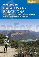
Cover

The delights of Spain`s Catalunya region are revealed in this new walking guide, which covers 32 graded walks of 6.5 to 28km across Montseny, Sant Llorenç del Munt I l-Obac, Montserrat and Penedès and Garraf - all within easy access of Barcelona. Walks are included for all abilities, from easy strolls to more demanding walks, and some of the walks are accessible by public transport.

The guide provides detailed route descriptions, 1:50,000 mapping and a route summary table to help with choosing appropriate walks. All the walks are illustrated with stunning photos. A list of local campsites and other useful contacts is included at the back, plus notes on refreshment opportunities along the routes. There`s also background information on local geology, wildlife and history, and planning details on when to go, where to stay and what to take.

While the bustling city of Barcelona has always been a popular tourist destination, only an hour away the landscape is altogether different. From lush mountains to jagged peaks, famous vineyards to magnificent views, each natural park has a different landscape and walking is the best way to explore the region.

Kartenausschnitt

Catalunya - Barcelona walking - Montserrat - Montseny and Sant Llorenç del Munt i l´Obac Nature Parks Wanderführer - Cicerone (englisch)
EAN / ISBN: 9781786310774
Preis: EUR 24.90

Bestellartikel: versandfertig in ca. 3-7 Tagen. Dieser Artikel wird speziell für Sie bestellt. Keine Rücknahme!
Produkt EUR Anzahl Bestellen
Catalunya - Barcelona walking - Montserrat - Montseny and Sant Llorenç del Munt i l´Obac Nature Parks Wanderführer - Cicerone (englisch) 24.90
Versandkostenfrei in Deutschland

incl. MwSt.

Stichworte, die bei der Suche nützlich sein könnten:
Catalunya - Katalonien Wanderführer - Catalunya - Katalonien - Tarragona - Spanien Wanderführer - Spanien Radwanderführer - Spanien Fahrradführer - Spanien Reiseführer - Cicerone - Cicerone Radwanderführer - Cicerone Wanderführer - Großbritannien Radwanderführer - Großbritannien Wanderführer - Cicerone Großbritannien

Zuletzt angesehene Artikel:

CoverCatalunya - Barcelona walking - Montserrat - Montseny and Sant Llorenç del Munt i l´Obac Nature Parks Wanderführer - Cicerone (englisch)

CoverBarcelona MM-City - Stadtführer Michael-Müller-Verlag - Reiseführer

CoverKaaresuvanto - Lätäseno - Ropinsalmi 1:50 000 Topographische Wanderkarte - Outdoor map - Genimap / Karttakeskus - Finnland
Southern part of the Arm, Lätäseno and western part of Tarvantovaara wilderness

Cover045 Stonehaven & Banchory - Wanderkarte Großbritannien 1:50.000 Active Laminiert LANDRANGER MAP - Ordnance Survey

CoverItaly Best Bike Rides Reiseführer (engl.) Lonely Planet

Cover0134-4 BASCONCILLOS DEL TOZO Topographische Landkarte 1:25.000 Spanien (Grundlage MTN25) Instituto Geográfico Nacional - CNIG Spanien - ProjektNord

Cover0264-4 TRASMIRAS Topographische Landkarte 1:25.000 Spanien (Grundlage MTN25) Instituto Geográfico Nacional - CNIG Spanien - ProjektNord

CoverWalking the Peddars Way & Norfolk - 130 mile NATIONAL TRAIL - Norfolk´s best inland and coastal scenery Wanderführer Southern England - Cicerone Großbritannien (englisch)

CoverMN22 Sureanu Gebirge 1:80.000 Topographische Wanderkarte/Radwanderkarte - Bergwanderkarte (englisch / rumänisch)
Hiking Map of the Sureanu Mountains - Harta de drumetie a Muntilor Sureanu Muntii Nostri - Schubert & Franzke - Rumänien

Cover2217 Fjerritslev - Topographische Landkarte Dänemark 1:100.000
Fjerritslev - Danmark Topografisk kort 1:100.000 Kort & Matrikelstyrelsen

Cover011 Thurso & Dunbeath - Wanderkarte Großbritannien 1:50.000 LANDRANGER MAP - Ordnance Survey

CoverCityTrip Berlin CityTrip - Stadtführer Reise-Know-How Verlag

Cover0406-4 VILLASAYAS Topographische Landkarte 1:25.000 Spanien (Grundlage MTN25) Instituto Geográfico Nacional - CNIG Spanien - ProjektNord

Cover1010 820-41) Purullena Amtliche topographische Landkarte 1:50.000 Spanien (M.T.N.)
1010 Mapa Topográfico Nacional de Espana (MTN50) Instituto Geográfico Nacional - CNIG Spanien

CoverVia Gebennensis Jakobsweg von Genf nach Le Puy-en-Velay. 18 Etappen. Mit GPS-Daten - Rother Wanderführer von Renate Florl - Bergverlag Rother

Cover0265-2 SABUGUIDO Topographische Landkarte 1:25.000 Spanien (Grundlage MTN25) Instituto Geográfico Nacional - CNIG Spanien - ProjektNord

CoverSüdgeorgien und die Shackleton Durchquerung 1:200.000 / 1:40.000 Landkarte British Antarctic Survey
South Georgia and The Shackleton Crossing

CoverOdenwald mit Bergstraße - Heidelberg - Darmstadt - von Stephanie A. Runge - Michael-Müller-Verlag

CoverGebrauchsanweisung für Sylt - von Silke von Bremen - Piper Verlag

CoverCuba *** SCHNÄPPCHEN *** Reiseführer Michael-Müller-Verlag - Reiseführer