Willkommen bei MapFox
+++ Buchhändleranfragen willkommen! Tel. 0431-666 75 99 +++
Warenkorb
Artikel: 0 - € 0.00
Zur Kasse
Impressum Kontakt Versandkosten AGB
North East Scotland (Slow Travel) including Aberdeenshire, Moray and the Cairngorms National Park - von Gibson, Rebecca - Bradt Guides
<< Schottland
<< Großbritannien: Wanderführer + Kletterführer
<< Bradt Publications
 
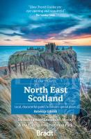
Cover

Smitten by Scotland since childhood, travel writer Rebecca Gibson moved to Moray and started exploring her new home region on foot to produce this new title in Bradt´s award-winning series of Slow travel guides to UK regions. Walkers, cyclists, wildlife lovers, families, history and folklore enthusiasts, and foodies are all catered for, with coverage of a wide range of attractions. As the only comprehensive guidebook to North East Scotland in print, it also contains all the practical information you could need to plan and enjoy time in this thrillingly diverse yet largely under-explored part of Britain. This region of mountains and coasts, ancient Caledonian pine forests and salmon-rich rivers harbours much to enthral and surprise. Long famous among hillwalkers, mountaineers and nature lovers, the Cairngorms is the UK´s largest National Park and holds five of its six tallest summits - but also abounds in fairy folklore. Balmoral Estate has been a royal residence since Queen Victoria´s reign, while Aberdeenshire - with its unique language, Doric - has Scotland´s highest density of castles and numerous Pictish stone circles among an astounding 30,000 sites of historical and archaeological interest. Between Inverness and Aberdeen lies the less-familiar region of Moray, which hosts the world´s most northerly population of bottle-nosed dolphins, Scotland´s oldest independent museum, and Forres, where Shakespeare´s Macbeth met the three witches. Here the Scots language and culture are celebrated through gatherings such as fire festivals. This guidebook´s Slow approach to travel fits with a growing ethos of sustainability in this part of Scotland, from Findhorn Ecovillage to a celebration of locally sourced, artisan and organic food alongside the well-known products of whisky, Aberdeen Angus beef and River Dee salmon. Key heritage attractions are described in intimate detail - but so too are opportunities to see some of Scotland´s most special wildlife, from pinewood-dwelling crested tits to high-altitude specialists like ptarmigan. Whether you are keen to visit castles or indulge in whisky-tastings amid Britain´s highest concentration of distilleries, to hike among Cairngorm´s remote mountains or to stride boldly along miles upon miles of coastline, discover North East Scotland with Bradt´s unique Slow guide.

North East Scotland (Slow Travel) including Aberdeenshire, Moray and the Cairngorms National Park - von Gibson, Rebecca - Bradt Guides
EAN / ISBN: 9781784779016
Preis: EUR 24.90

Bestellartikel: versandfertig in ca. 1-3 Wochen. Dieser Artikel wird speziell für Sie bestellt. Keine Rücknahme!
Produkt EUR Anzahl Bestellen
North East Scotland (Slow Travel) including Aberdeenshire, Moray and the Cairngorms National Park - von Gibson, Rebecca - Bradt Guides 24.90
Versandkostenfrei in Deutschland

incl. MwSt.

Stichworte, die bei der Suche nützlich sein könnten:
Großbritannien - Großbritannien Wanderführer - Großbritannien Trekkingführer - Großbritannien Klettern - Großbritannien Kletterführer - Bradt Publications - Bradt Reiseführer - Schottland - Schottland Landkartenverkauf - Schottland Atlanten - Schottland Kartographie - Schottland Wanderkarten - Schottland Radwanderkarten - Schottland Kartografie - Schottland Fahrradkarten - Schottland Reiseführer - Schottland Radwanderführer - Schottlandkarten - Schottland Landkarten - Schottland Karten - Schottland Straßenkarten

Zuletzt angesehene Artikel:

CoverNorth East Scotland (Slow Travel) including Aberdeenshire, Moray and the Cairngorms National Park - von Gibson, Rebecca - Bradt Guides

Noch kein Cover vorhanden1612OT CAEN/OUISTREHAM Topographische Wanderkarte Frankreich 1:25.000 TOP 25 IGN - (GPS)

CoverRepublik Baschkortostan (Nord) 1:100.000 Topographischer Atlas
Республика Башкортостан - Топографичечкий атлас - Том 1 FGUP Уралаэрогеодез

Cover2351 Rieth Amtliche Topographische Karte 1:25.000 Landesvermessungsamt Mecklenburg-Vorpommern

CoverC9 Adventdalen Spitzbergen / Svalbard / Spitsbergen - Topographische Karte 1:100.000 Norsk Polarinstitutt

CoverD9 Agardhfjellet Spitzbergen / Svalbard / Spitsbergen - Topographische Karte 1:100.000 Norsk Polarinstitutt

CoverStadtplan Belgorod 1:30.000 Stadtplan - Russland
Белгород Карта города. Rus Co. Ltd.

CoverCalizzano - Bardenito e Rocca Barbena - Provincia di Savona (Blatt SV-7) Topographische Wanderkarte 1:25.000
Carta dei Sentieri EdM - Edizioni del Magistero - Italien

CoverE9 Freemansundet Spitzbergen / Svalbard / Spitsbergen - Topographische Karte 1:100.000 Norsk Polarinstitutt

CoverL3946 Baruth/Mark Topographische Karte 1:50.000 (Regelblattschnitt) Landesvermessungsamt Brandenburg

CoverDuMont Bildband Waldorte in Mecklenburg Vorpommern - von - DuMont Reiseverlag

CoverR07 Pfronten - Vils, Nesselwang, Eisenberg, Hopferau, Tannheimer Tal ATK25 Topographische Karte 1:25.000 (Atkis) Bayern Landesvermessungsamt Bayern - Wanderkarte - Radwanderkarte

Cover3333OT MASSIF DE LA CHARTREUSE NORD Topographische Wanderkarte Frankreich 1:25.000 TOP 25 IGN - (GPS)

Cover1/2: Kiew und Umgebung - Makariw - Wischnewe Topographische Wanderkarte 1:50.000 - Ukraine
Київ та околиці №1/2 Макарів/Вишневе ukrmap Kartografija

Cover5/6: Kiew und Umgebung - Fastiw - Obuchiw Topographische Wanderkarte 1:50.000 - Ukraine
Київ та околиці №5/6 Фастів/Обухів ukrmap Kartografija

CoverSouthern Highlands & Shoalhaven (Blatt 283) Landkarte 1:25.000 - touring map - New South Wales - Australien UBD Gregory`s Universal Publishers - Australien

CoverA8 Prins Karl Forland Spitzbergen / Svalbard / Spitsbergen - Topographische Karte 1:100.000 Norsk Polarinstitutt

CoverAsturias 1:300.000 Landkarte Spanien - Planos Provinciales Serie Verde Edition Everest - Spanien

CoverSmoljan mit Skiorten Pamporowo und Tschepelare Stadtplan 1:13.000
Smolyan, Pamporovo, Chepelare Domino - Bulgarien

CoverL06 Lauingen - Syrgenstein, Bachhagel, Haunsheim, Wittislingen, Gundelfingen a.d.Donau ATK25 Topographische Karte 1:25.000 (Atkis) Bayern Landesvermessungsamt Bayern - Wanderkarte