Willkommen bei MapFox
Wurde Ihre Bestellung bestätigt? Wenn nicht - gab es evtl. ein SERVER-Problem! Bitte kontaktieren Sie uns! +++ Buchhändler-Anfragen erwünscht +++
Warenkorb
Artikel: 0 - € 0.00
Zur Kasse
Impressum Kontakt Versandkosten AGB
Pembrokeshire Coast Path - Wales Coast Path: St Dogmaels to Amroth - Brian John - Aurum Press Ltd
<< Großbritannien: Wanderführer + Kletterführer
 
Cover

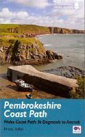
180 miles of cliff top, beach and cove around the magnificent Welsh coast, The Pembrokeshire Coast Path (Llwybr Arfordir Sir Benfro) is the 186-mile National Trail around Wales’s magnificent southern headland. Winding around the coast from St Dogmaels to Amroth, it clings to soaring cliff tops, seeks out fabulous sweeping beaches like Marloes Sands and Freshwater West, visits lovely towns like St David’s and Tenby, castles at Manorbier and Pembroke, and is rich in wildlife from teeming seabird colonies to the rare chough. It is now part of the Welsh Coast Path, fully open in 2012. Whether you’re a long-distance walker or a holiday stroller, this is the only book you need.

Kartenausschnitt

Kartenbeispiel

Pembrokeshire Coast Path - Wales Coast Path: St Dogmaels to Amroth - Brian John - Aurum Press Ltd
EAN / ISBN: 9781781315729
Preis: EUR 25.00

Dieser Titel ist momentan nicht lieferbar.
Produkt EUR Anzahl Bestellen
Pembrokeshire Coast Path - Wales Coast Path: St Dogmaels to Amroth - Brian John - Aurum Press Ltd 25.00
Versandkostenfrei in Deutschland ab 30,- Bestellwert

incl. MwSt.

Stichworte, die bei der Suche nützlich sein könnten:
Pembrokeshire Coast Path - Trefin - St.Dogmaels - Goodwick Harbour - Pembrokeshire Coast Path Wanderführer - Dale - Saundersfoot - St Dogmaels - Bosherston - Whitesands Bay - Solva - Tenby - Amroth - Little Haven - Großbritannien - Großbritannien Wanderführer - Großbritannien Trekkingführer - Großbritannien Klettern - Großbritannien Kletterführer

Zuletzt angesehene Artikel:

CoverPembrokeshire Coast Path - Wales Coast Path: St Dogmaels to Amroth - Brian John - Aurum Press Ltd

Noch kein Cover vorhanden1413-II Sorø Topographische Karte Dänemark 1:50.000 Kort & Matrikelstyrelsen / Geodætisk Institut

Noch kein Cover vorhanden1216-II Hobro Topographische Karte Dänemark 1:50.000 Kort & Matrikelstyrelsen / Geodætisk Institut

Cover351 Dunbar & North Berwick - Musselburgh & Haddington - Wanderkarte Großbritannien 1:25.000 EXPLORER MAP - Ordnance Survey

CoverTrackbook Island 77 Hochlandrouten - von Lindenblatt, Melina Göttenauer, Matthias - Experience GmbH

Cover32 MARCO POLO Freizeitkarte Odenwald - Rhein 1:100.000 wasserfest, reißfest

CoverLübeck und Umgebung ADFC-Regionalkarte 1:75.000 BVA Bielefelder Verlag

Cover39 Einsiedeln - Sihlsee Wanderkarte Schweiz 1:50.000 Hallwag

CoverLandkreis Zwickau 1:100.000 Amtliche Kreiskarte Landesvermessungsamt Sachsen

CoverMARCO POLO Karten 1:200.000 Dänemark Süd - Kolding, København, Bornholm

CoverMARCO POLO Karte Polen Süd 1:300.000 Marco Polo highlights : zoom system - MAIRDUMONT

Cover244T ESCHOLZMATT - Emmental - Entlebuch 1:50.000 Topographische Wanderkarte SAW der Schweiz - swisstopo