 National Geographic`s Trails Illustrated map of Jasper North-Jasper National Park in Alberta and British Columbia, Canada-is a two-sided, waterproof map designed to meet the needs of outdoor enthusiasts with unmatched durability and detail. This map was created in conjunction with local land management agencies and is loaded with valuable recreation information.
The front side of Jasper North map details the east side of the national park, from Rock Lake Solomon Creek Wildland Park to the north, to Whistler’s Summit to the south. The reverse side of the map details the west side of the park, extending from Mt. Terry Fox Provincial Park to the south, to Willmore Wilderness Park to the North. Insets show survival tips, safe travel in Bear Country, and what to do while visiting.  Kartenausschnitt Kartenausschnitt
Kartenbeispiel
|
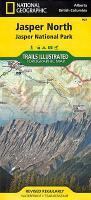
Jasper North 1:100.000 (Blatt 903) Landkarte - Trails Illustrated Map - National Parks USA National Geographic
EAN / ISBN: 9781566956611
Preis: EUR 16.95
|
|


