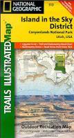
| << USA: Wanderkarten, Nationalpark-Karten << National Geographic |
  | |
Zuletzt angesehene Artikel:
![]() | Canyonlands National Park: Island in the Sky District 1:35.000 (Blatt 310) GPS / Utah (USA) Landkarte Trails Illustrated Map wasserfest National Geographic - USA |
![]() | Maori - AusspracheTrainer (Audio-CD) Kauderwelsch AusspracheTrainer auf CD Reise-Know-How Verlag |
![]() | Mårma & Nallo Högalpinkarta - Bergwanderkarte 1:25.000 Calazo Förlag Schweden |
![]() | 3 Saudlauksdalur Topographische Karte Island 1:100.000 - Ferdakort 3 SAUÐLAUKSDALUR - Atlaskort - Ferðakort |
![]() | Radwanderführer Angeln und Schlei 20 Thementouren zwischen Flensburg und Stapelholm - von Horst-Dieter Landeck - Boyens Buchverlag |
![]() | 6004 Oberweis - Wanderkarte mit Wanderwegen (geplottete Ausgabe) ProjektNord - Grundlage Amtliche topographische Karte Landesamt für Vermessung und Geobasisinformation Rheinland-Pfalz |
![]() | Q5323 Mujejärvi Topographische Karte 1:25.000 EUREF (Peruskartta) Maanmittauslaitos / Lantmäteriverket Finnland - ProjektNord |
![]() | 0207-1 SAN ISIDRO DEL PINAR Topographische Landkarte 1:25.000 Spanien (Grundlage MTN25) Instituto Geográfico Nacional - CNIG Spanien - ProjektNord |
![]() | P11 Wolfratshausen - Geretsried - Icking - Egling - Dietramszell - Königsdorf - Sauerlach *** SCHNÄPPCHEN *** ATK25 Topographische Karte 1:25.000 (Atkis) Bayern Landesvermessungsamt Bayern - Wanderkarte |
![]() | Istrien und Kvarner 1:100.000 Wanderkarte und Nautische Karte Istra, Kvarner Kartografija - Slowenien |
![]() | Der Rennsteig (Golchert) Wanderführer - Grünes Herz |
![]() | WK 239 Ibiza - Formentera 1:50.000 - Wanderkarte mit Broschüre KOMPASS |
![]() | 8234 Penzberg Topographische Landkarte Bayern 1:25.000 - Normalausgabe - ProjektNord (geplottete Ausgabe) - Grundlage amtliche Topographische Karte Bayern DTK25 |
![]() | 6139 Falkenberg Topographische Landkarte Bayern 1:25.000 - Normalausgabe - ProjektNord (geplottete Ausgabe) - Grundlage amtliche Topographische Karte Bayern DTK25 |
![]() | 2313-III Bogense - mit Wanderwegen und Fahrradrouten Topographische Fahrradkarte und Wanderkarte Dänemark 1:50.000 - Kort & Matrikelstyrelsen ProjektNord 2313-III Bogense - Topografisk Cykel- og Vandrekort Danmark |
![]() | 2949 Greiffenberg Sonderausgabe mit Wanderwegen - Topographische Wanderkarte Brandenburg 1:25.000 ProjektNord |
![]() | DuMont Bildband Atlas der Reiselust Deutschland Inspiration für ein ganzes Leben - von - DuMont Reiseverlag |
![]() | The Science of Climbing Training Vertebrate Publishing |
![]() | 0613-1 CAMARENA DE LA SIERRA Topographische Landkarte 1:25.000 Spanien (Grundlage MTN25) Instituto Geográfico Nacional - CNIG Spanien - ProjektNord |
![]() | Paderborner Hochfläche - Bürener Land Topographische Wanderkarte Nordrhein-Westfalen mit Wanderwegen und Radwegen 1:25.000 - ProjektNord |


