Willkommen bei MapFox
Wurde Ihre Bestellung bestätigt? Wenn nicht - gab es evtl. ein SERVER-Problem! Bitte kontaktieren Sie uns! +++ Buchhändler-Anfragen erwünscht +++
Warenkorb
Artikel: 0 - € 0.00
Zur Kasse
Impressum Kontakt Versandkosten AGB
Lake Mead: National Recreation Area 1:166.800 (Blatt 204) Arizona/Nevada *** SCHNÄPPCHEN *** Landkarte Trails Illustrated / A division of Ponderosa Publishing Company - USA
<< National Geographic
<< Schnäppchen - Restposten - Mängelexemplare
 
(Titelbild evtl. abweichend)
Cover

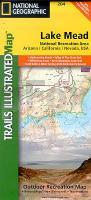
Altauflage 1995, daher zum Sonderpreis.

This Trails Illustrated topographic map is the most comprehensive and complete recreational map for the Lake Mead National Recreation Area, located in Nevada and Arizona.

Klicken Sie hier, wenn Sie diesen Artikel in der Version zum normalen Preis sehen möchten.

Kartenausschnitt

Kartenbeispiel

Lake Mead: National Recreation Area 1:166.800 (Blatt 204) Arizona/Nevada *** SCHNÄPPCHEN *** Landkarte Trails Illustrated / A division of Ponderosa Publishing Company - USA
EAN / ISBN: 9780925873040
Preis: EUR 11.90

sofort versandfertig Dieser Artikel ist im Normalfall sofort lieferbar.
Produkt EUR Anzahl Bestellen
Lake Mead: National Recreation Area 1:166.800 (Blatt 204) Arizona/Nevada *** SCHNÄPPCHEN *** Landkarte Trails Illustrated / A division of Ponderosa Publishing Company - USA 11.90
Versandkostenfrei in Deutschland ab 30,- Bestellwert

incl. MwSt.

Stichworte, die bei der Suche nützlich sein könnten:
Arizona - National Recreation Area - Lake Mead - Nevada - National Geographic - National Geographic Landkarten - Schnäppchen - Sonderangebote - Restposten

Zuletzt angesehene Artikel:

CoverLake Mead: National Recreation Area 1:166.800 (Blatt 204) Arizona/Nevada *** SCHNÄPPCHEN *** Landkarte Trails Illustrated / A division of Ponderosa Publishing Company - USA

Cover3810 Steinfurt - Wanderkarte mit Wanderwegen (geplottete Ausgabe) ProjektNord - Grundlage Amtliche topographische Karte 1:25.000 Landesvermessungsamt Nordrhein-Westfalen

Cover7039 Mintraching Topographische Landkarte Bayern 1:25.000 - Normalausgabe - ProjektNord (geplottete Ausgabe) - Grundlage amtliche Topographische Karte Bayern DTK25

Cover4117 Verl - Wanderkarte mit Wanderwegen (geplottete Ausgabe) ProjektNord - Grundlage Amtliche topographische Karte 1:25.000 Landesvermessungsamt Nordrhein-Westfalen

Cover4607 Heiligenhaus - Wanderkarte mit Wanderwegen (geplottete Ausgabe) ProjektNord - Grundlage Amtliche topographische Karte 1:25.000 Landesvermessungsamt Nordrhein-Westfalen

Cover5012 Reichshof - Wanderkarte mit Wanderwegen (geplottete Ausgabe) ProjektNord - Grundlage Amtliche topographische Karte 1:25.000 Landesvermessungsamt Nordrhein-Westfalen

Cover7131 Monheim Topographische Landkarte Bayern 1:25.000 - Normalausgabe - ProjektNord (geplottete Ausgabe) - Grundlage amtliche Topographische Karte Bayern DTK25

Cover3919 Lemgo - Wanderkarte mit Wanderwegen (geplottete Ausgabe) ProjektNord - Grundlage Amtliche topographische Karte 1:25.000 Landesvermessungsamt Nordrhein-Westfalen

Cover4305 Wesel - Wanderkarte mit Wanderwegen (geplottete Ausgabe) ProjektNord - Grundlage Amtliche topographische Karte 1:25.000 Landesvermessungsamt Nordrhein-Westfalen

CoverNeuhaus - Lauscha - Sonneberg (Blatt 16/18) Wanderkarte Thüringen 1:30.000 - Naturpark Thüringer Wald - Mit Skiloipen und Radrouten - Verlag Grünes Herz

Cover7638 Taufkirchen Vils Topographische Landkarte Bayern 1:25.000 - Normalausgabe - ProjektNord (geplottete Ausgabe) - Grundlage amtliche Topographische Karte Bayern DTK25

CoverLa Route Buissonnière - Route historique 1:250.000 *** SCHNÄPPCHEN *** Gâtinais - Puisaye - Vallée de l´Yonne - Morvan - Charolais - Vallée de l´Azergue - Culture & Environnement / Kultur und Natur - IGN Frankreich

Cover5003 Linnich - Wanderkarte mit Wanderwegen (geplottete Ausgabe) ProjektNord - Grundlage Amtliche topographische Karte 1:25.000 Landesvermessungsamt Nordrhein-Westfalen

Cover4805 Korschenbroich - Wanderkarte mit Wanderwegen (geplottete Ausgabe) ProjektNord - Grundlage Amtliche topographische Karte 1:25.000 Landesvermessungsamt Nordrhein-Westfalen

Cover3916 Halle (Westfalen) (geplottete Ausgabe) Amtliche topographische Karte 1:25.000 Landesvermessungsamt Nordrhein-Westfalen

Cover5211 Weyerbusch - Wanderkarte mit Wanderwegen (geplottete Ausgabe) ProjektNord - Grundlage Amtliche topographische Karte 1:25.000 Landesvermessungsamt Nordrhein-Westfalen

Cover7930 Buchloe Topographische Landkarte Bayern 1:25.000 - Normalausgabe - ProjektNord (geplottete Ausgabe) - Grundlage amtliche Topographische Karte Bayern DTK25

Cover5309 Königswinter - Wanderkarte mit Wanderwegen (geplottete Ausgabe) ProjektNord - Grundlage Amtliche topographische Karte 1:25.000 Landesvermessungsamt Nordrhein-Westfalen

Cover7941 Trostberg Topographische Landkarte Bayern 1:25.000 - Normalausgabe - ProjektNord (geplottete Ausgabe) - Grundlage amtliche Topographische Karte Bayern DTK25

Cover4313 Welver - Wanderkarte mit Wanderwegen (geplottete Ausgabe) ProjektNord - Grundlage Amtliche topographische Karte 1:25.000 Landesvermessungsamt Nordrhein-Westfalen