(Titelbild evtl. abweichend)
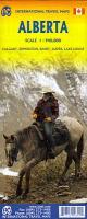 Altauflage 2010, daher zum Sonderpreis. Doppelseitig bedruckte Landkarte von Alberta (Kanada). Zusätzlich gibt es Kartenausschnitte von: Jasper 1:12.500Banff 1:12.500Lake Louis 1:33.000Edmonton 1:12.500 Calgary 1:10.000 Klicken Sie hier, wenn Sie diesen Artikel in der Version zum normalen Preis sehen möchten. Klicken Sie hier, wenn Sie diesen Artikel in der Version zum normalen Preis sehen möchten.
Kartenausschnitt
Kartenbeispiel
|
Alberta 1:1 Mio. (Kanada) *** SCHNÄPPCHEN *** Landkarte - ITMB International Travel Maps (engl.)
EAN / ISBN: 9781771290340
Preis: EUR 5.00
|
| 


