Willkommen bei MapFox
+++ Buchhändleranfragen willkommen! Tel. 0431-666 75 99 +++
Warenkorb
Artikel: 0 - € 0.00
Zur Kasse
Impressum Kontakt Versandkosten AGB
Rock Climbing Yosemite Valley 750 Best Free Climbs
<< USA: Reiseführer, Reisehandbücher
 
Cover

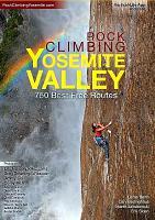
Yosemite is climbing`s Mecca. Few other areas offer such easy access to endless towering routes. The vibrant climbing community, the amiable weather, the endless recreational activities, the verdant meadows beneath the cliffs, are all just the icing on the cake. Beta for Yosemite climbs has been scarce with new routes rarely reported and guidebooks outdated. This has resulted in a few dozen popular routes staying packed with climbers, while hundreds of other awesome climbs remain anonymous. Rock Climbing Yosemite Valley brings Yosemite climbing route information in to the current era. Over 400 pages of awesome topo maps and photos - you won`t run out of world class climbs to check out for years! Info on dozens of new and previously unpublished climbs - just as good as the classics, but crowd-free! Over 100 of the best Yosemite climbing photos so picture yourself there and get stoked! Completely new maps and topos to help you spend your time climbing, not finding your way to the crag or looking for your route. Rest day beta and inside tips on what to do and where to kick back when you`re too beat to climb.

Rock Climbing Yosemite Valley 750 Best Free Climbs
EAN / ISBN: 9781532379284
Preis: EUR 65.00

Dieser Titel ist momentan nicht lieferbar.
Produkt EUR Anzahl Bestellen
Rock Climbing Yosemite Valley 750 Best Free Climbs 65.00
Versandkostenfrei in Deutschland

incl. MwSt.

Stichworte, die bei der Suche nützlich sein könnten:
Yosemite - Yosemite Valley Kletterführer - USA Reiseführer - USA Wanderführer

Zuletzt angesehene Artikel:

CoverRock Climbing Yosemite Valley 750 Best Free Climbs

Noch kein Cover vorhandenTraverse City Stadtplan 1:32.000 (Michigan - USA)
Traverse City street map American Automobile Association

CoverMarin County / San Rafael / Novato / Sausalito / Mill Valley Stadtplan 1:28.000 (Kalifornien - USA)
Marin County / San Rafael / Novato / Sausalito / Mill Valley street map GM Johnson

CoverOssola Alpinwandern Zwischen Lago Maggiore, Nufenenpass und Monte Rosa - von Kundert, Remo Volken, Marco - SAC-Verlag Schweizer Alpen-Club

Noch kein Cover vorhandenSalem / Keizer City-Stadtplan 1:32.000 laminiert (Ohio - USA)
Salem / Keizer city map laminated GM Johnson

Noch kein Cover vorhandenPlymouth / Quincy / Brockton / Bostons South Shore Towns Stadtplan 1:38.000 (Massachusetts - USA)
Plymouth / Quincy / Brockton / Bostons South Shore Towns street map GM Johnson

CoverAfrika Reiseatlas 1:3.4 Mio. - von Kairo nach Kapstadt - ITMB International Travel Maps (engl.)
Africa Overland: Cairo to Cape Town Travel Atlas

Cover13 Locarno - Bellinzona 1:50.000 MTB-Karte Landkarte - Hallwag

Cover22 Glarus 1:50.000 Mountainbike-Karte - Hallwag

Cover25 Wanderungen Taunus und Rheingau (Band: 344) von Andrea Preschl Conrad-Stein-Verlag

CoverKanu Kompakt Lippe 15 Tagestouren mit topografischen Wasserwanderkarten 1:75.000 - von Stefan Schorr - Thomas-Kettler-Verlag

CoverSaarland (Band 409) 22 Wanderungen in Natur- und Kulturlandschaften - von Thomas Darimont - Conrad-Stein-Verlag

CoverUnsere Alpenflora - von Elias Landolt, Rosmarie Hirzel - SAC Schweizer Alpenclub

CoverBuchta Pestschanaja (Baikalsee) 1:25.000 Wanderkarte Baikalsee - Russland
Бухта Песчаная VostSib AGP

CoverSaybuscher Beskiden 1:50.000 Laminierte touristische Landkarte
Beskid Zywiecki ExpressMap Polen

Noch kein Cover vorhandenButler & North Allegheny Counties Stadtplan 1:32.000 (Pennsylvania - USA)
Butler & North Allegheny Counties street map GM Johnson

Noch kein Cover vorhandenCharleston City-Stadtplan 1:32.000 laminiert (West Virginia - USA)
Charleston city map laminated GM Johnson

CoverOlympia / Lacey / Tumwater / Thurston County Stadtplan 1:32.000 (Washington - USA)
Olympia / Lacey / Tumwater / Thurston County street map GM Johnson

CoverStadtplan Wernigerode 1:7.500 / 1:15.000 Wanderkarte und Stadtplan mit Wander-Touren und Brockenkarte - von Thorsten Schmidt Schmidt-Buch-Verlag

CoverTatra - slowakischer und polnischer Teil Touristische Landkarte 1:55.000 Wanderkarte, Radwanderkarte, Freizeitkarte
Tatry Polskie i Słowackie mapa ExpressMap - Polen