| << Schottland << Großbritannien: Wanderführer + Kletterführer |
||
|
||
Zuletzt angesehene Artikel:
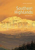
 | Southern Highlands Walking / Hiking Guide - Areas covered: Ben Lawers and Glen Lyon Fife and Kinross to Crieff and Callander, The Trossachs to the Mamlorn Hills, Loch Lomond and the Arrochar Alps to Inveraray, Hills of Crianlarich and Tyndrum - Nick Williams - POCKET MOUNTAINS LTD |
 | Wilde Rhodopen - Touristische Karte der westlichen Rhodopen 1:70.000 Topographische Wanderkarte - Divi Rodopi / ДИВИ РОДОПИ - Туристическа карта на Западни Родопи Oilaripi Bulgarien |
 | NL 33-05-05 Ost (4105-Ost) Wildon Österreichische Karte 1:25.000 mit Wegmarkierungen (topographische Wanderkarte - UTM) - BEV - Österreich - Vergrößerung (ÖK25V) |
| 2022 Wilster - Gestern und Heute - Historische Überlagerung 1953-1956 Topographische Landkarte 1:25.000 im Vergleich - Landesvermessungsamt Schleswig-Holstein / ProjektNord |
| 3462 Kwiltsch Topographische Karte 1:25.000 Messtischblatt des Deutschen Reiches - Preußische Landesaufnahme / Reichsamt für Landesaufnahme - Faksimile ProjektNord |
 | Hunsrück, Motorradkarte 1:200.000, freytag & berndt Saarland - Pfälzerwald, Toureninfos, GPX Tracks, wasserfest und reißfest - von freytag & berndt - Freytag-Berndt und ARTARIA |
 | Berlin und Umgebung - Große Wander- und Radwanderkarte 1:35.000 (Nr. 148) Ausflüge zu den Berliner Sehenswürdigkeiten. Große Radwander- und Wanderkarte, Mit den 20 grünen Hauptwegen. GPS-fähig Dr. Barthel Verlag |
 | 423-1 FERMOSELLE Amtliche topographische Landkarte 1:25.000 Spanien (M.T.N.) 423-1 Mapa Topográfico Nacional de Espana (MTN25) Instituto Geográfico Nacional - CNIG Spanien |
 | Trier und Umgebung Radkarte mit Ausflugszielen, Einkehr- & Freizeittipps, wetterfest, reissfest, abwischbar, GPS-genau. 1:100000 - von - Freytag-Berndt und ARTARIA Publicpress |
| 395-3 PINILLA DE FERMOSELLE Amtliche topographische Landkarte 1:25.000 Spanien (M.T.N.) 395-3 Mapa Topográfico Nacional de Espana (MTN25) Instituto Geográfico Nacional - CNIG Spanien |
 | Berlin - Stadtplan 1:15.000 (Nr. 228) Das Stadtgebiet zwischen Flughafen Tegel und dem Plänterwald im Maßstab 1:15000 (mit Sehenswürdigkeiten) Dr. Barthel Verlag |
 | Walking the Tour of the Lake District - A nine-day circuit of Cumbria´s fells, valleys and lakes Wanderführer Lake District - Cicerone Großbritannien (englisch) |
 | Spree-Radweg - Radwanderkarte mit Zick-Zack-Faltung 1:50.000 (Nr. 102) Vom Oberlausitzer Bergland nach Berlin zur Havel. Mit Anschluss zum Elbe-Radweg bei Bad Schandau und in den Fürst Pückler Park Bad Muskau. Radwanderkarte, Alle Radtourenvorschläge m. Entfernungsangaben in Kilometern. Wetterfest, reißfest Dr. Barthel Verlag |
 | Tarvantovaara - Kuttanen - Palojärvi 1:50 000 Topographische Wanderkarte - Outdoor map - Genimap / Karttakeskus - Finnland Eastern part of Tarvantovaara wilderness |
| 4947 Wilsdruff - Geologische Karte 1:25.000 (GK25 (N)) Grundlage Topographische Karte Sächsisches Landesamt für Umwelt, Landwirtschaft und Geologie |
 | Osthavelland, Krämer Forst und Umgebung - Radwander- und Wanderkarte 1:35.000 (Nr. 089) Ausflüge zwischen Linum, Berlin-Heiligensee, Nauen, Oranienburg und Hennigsdorf. 1:35000. Radwander- und Wanderkarte, Alle Radtourenvorschläge m. Entfernungsangaben in Kilometern Dr. Barthel Verlag |
 | Marivaara - Jaurujoki - Uittipiekk 1:50 000 Topographische Wanderkarte - Outdoor map - Genimap / Karttakeskus - Finnland Western part of Kemihaara wilderness and southern edge of Urho Kekkonen NP |