Willkommen bei MapFox
+++ Buchhändleranfragen willkommen! Tel. 0431-666 75 99 +++
Warenkorb
Artikel: 0 - € 0.00
Zur Kasse
Impressum Kontakt Versandkosten AGB
Heaphy Track Map & Kahurangi National Park 1:40.000 / 1:140.000 + Track Guide Wanderkarte - Neuseeland Geographx - Craig Potton Publishing Neuseeland
<< Neuseeland
<< Potton & Burton / Craig Potton Publishing
 
Cover

The Heaphy Track combines all of New Zealand’s magical natural beauty into one walk. Travel through expansive tussock downs, lush forests and nīkau palms to the roaring seas of the West Coast.
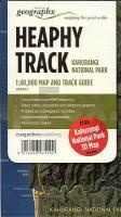
The Heaphy Track is located in Kahurangi National Park in the north-west of the South Island and is the longest Great Walk at 78.4 km. The track is well formed and takes 4-6 days to walk or 2-3 days to ride (a mountain bike trial is being held until 30 September 2013).

Features:

- Additional Kahurangi National Park 3D Map on reverse
- Award-winning relief mapping
- Track notes, elevation and distance graphic
- Printed on waterproof, durable, environmentally sustainable `Rockstock` paper.

Kartenausschnitt

Kartenbeispiel

Heaphy Track Map & Kahurangi National Park 1:40.000 / 1:140.000 + Track Guide Wanderkarte - Neuseeland Geographx - Craig Potton Publishing Neuseeland
EAN / ISBN: 9416458075100
Preis: EUR 24.90

sofort versandfertig Dieser Artikel ist im Normalfall sofort lieferbar.
Produkt EUR Anzahl Bestellen
Heaphy Track Map & Kahurangi National Park 1:40.000 / 1:140.000 + Track Guide Wanderkarte - Neuseeland Geographx - Craig Potton Publishing Neuseeland 24.90
Versandkostenfrei in Deutschland ab 30,- Bestellwert

incl. MwSt.

Stichworte, die bei der Suche nützlich sein könnten:
Heaphy Track - Neuseeland - New Zealand - Neuseeland Wanderkarte - Kahurangi National Park - Heaphy Track Wanderkarte - Neuseeland - Neuseeland Wanderkarten - Neuseeland Karten - Neuseeland Radwanderführer - Neuseeland Kartographie - Neuseeland Landkarten - Neuseeland Fahrradkarten - Neuseelandkarten - Neuseeland Atlanten - Neuseeland Landkartenverkauf - Neuseeland Reiseführer - Neuseeland Straßenkarten - Neuseeland Kartografie - Neuseeland Radwanderkarten - New Zealand - New Zealand Radwanderkarten - New Zealand Kartographie - New Zealand Landkarten - New Zealand Straßenkarten - New Zealand Fahrradkarten - New Zealandkarten - New Zealand Reiseführer - New Zealand Radwanderführer - New Zealand Kartografie - New Zealand Atlanten - New Zealand Landkartenverkauf - New Zealand Wanderkarten - New Zealand Karten - Neuseeland Wanderkarten - Neuseland Wanderführer - Neuseeland Trekkingführer - New Zealand - Neuseeland - Craig Potton Publishing - Craig Potton Landkarten - Craig Potton Trekkingkarten - Neuseeland Nationalpark-Karten - Neuseeland Karten - Neuseeland Wandern - New Zealand hiking maps - New Zealand trekking - New Zealand national parks

Zuletzt angesehene Artikel:

CoverHeaphy Track Map & Kahurangi National Park 1:40.000 / 1:140.000 + Track Guide Wanderkarte - Neuseeland Geographx - Craig Potton Publishing Neuseeland

CoverK3441 Vättlax Topographische Karte 1:25.000 EUREF (Peruskartta) Maanmittauslaitos / Lantmäteriverket Finnland - ProjektNord

CoverAfrika Nordwest 1:3.8 Mio. Landkarte - ITMB International Travel Reference Maps (engl.)
Africa Northwest

Cover2513 Kopenhagen - Topografische Landkarte Dänemark 1:100.000
København - Danmark Topografisk kort 1:100.000 Kort & Matrikelstyrelsen

CoverPreiswert durch Europa Der Interrail-Reiseführer - Interconnections

Noch kein Cover vorhanden4962 Kolbnitz Topographische Karte 1:25.000 Messtischblatt des Deutschen Reiches - Preußische Landesaufnahme / Reichsamt für Landesaufnahme - Faksimile ProjektNord

CoverFlüsse und Bahntrassen - Bergisches Land Panorama-Radwege, Siegtal, Ruhr-Sieg-Radweg und Lenneroute im Sauerland, 550 km - bikeline Esterbauer

CoverNaturpark Alentejo Südwest und Costa Vicentina Wanderkarte 1:50.000 - wasserfest
Parque Natural do Sudoeste Alentejano e Costa Vicentina AdventureMaps - Portugal

CoverSängerstadt Finsterwalde - Doberlug-Kirchhain und Umgebung Wanderkarte und Radwanderkarte 1:50.000 Sachsen Kartographie (Blatt 62)

Noch kein Cover vorhandenPieninen - 1:25.000 Mini Touristische Wanderkarte - Polen - wasserfest
Pieniny mapa (wyd. mini wodoodp.) Compass - Polen

CoverRegion Bremen 1:200.000 Topographische Straßenkarte ProjektNord - Bundesamt f. Kartographie u. Geodäsie

CoverN54 Topographische Karte 1:100.000 EUREF-FIN Maanmittauslaitos / Lantmäteriverket Finnland - ProjektNord

Cover25-112 Topographische Karte 1:25.000 der Tschechischen Republik
Zakladní mapa Ceská republika Cesky urad zememericky a katastralni - ProjektNord

Cover03-244 Topographische Karte 1:25.000 der Tschechischen Republik
Zakladní mapa Ceská republika Cesky urad zememericky a katastralni - ProjektNord

Cover11-424 Topographische Karte 1:25.000 der Tschechischen Republik
Zakladní mapa Ceská republika Cesky urad zememericky a katastralni - ProjektNord

CoverKnooppuntenatlas 1 Zeeland / Brabant / Limburg Fahrradatlas Niederlande Buijten & Schipperheijn

CoverYellowstone national park map Planungskarte (engl.) Lonely Planet

CoverRadregion Wasserradlwege Oberbayern Drei Rundtouren zwischen Donau, Inn und Alpen - Hopfenschleife, Salzschleife, Kunstschleife, 1:50.000, 1.310 km, wetterfest - von Esterbauer Verlag

CoverParc Marais Cotentin - Bessin... à pied - promenades & randonnées - Réf. PN20 Topographischer Wanderführer - FFRP (Fédération française de randonnée pédestre) Frankreich

CoverFalk Cityplan Nürnberg 1:20.000