 -Sehr detailliert beschriebene Radwanderrouten mit Schwierigkeitsangaben
-Sprache: Englisch, Rumänisch In this special natural setting is the heritage left by the Saxons in Transylvania, fortified churches, castles, mansions and fortresses, as well as villages with specific architecture, the last authentic medieval landscape in Europe. Without considering the medieval cities of Sighisoara and Sibiu, there are four monuments included on the UNESCO world heritage list that you are going to discover for yourselves. The Transylvanian Hills, the Land of the Fortified Churches, Terra Saxonum are names of the same fabulous land, which you are invited to discover from the saddle of your bicycle. Several organizations active in the field of nature protection with the involvement of local communities, ecotourism, sports, etc. are present here. Although they deserve to be mentioned, we are not going to do so for fear of leaving someone out. Thanks to them, there is a network of tourist markings that use the roads in the area and can be traveled on foot, by bike or on horseback. Moreover, through the efforts of the hearty people, bicycle roads were built from scratch, in the form of paths, without any damage to the landscape. At the same time, several mountain bike competitions are held here, which gather cyclists from all over the country and not only. The already famous Via Transilvanica, ’the road that connects’, the long trail that crosses Romania diagonally, also passes here. It lends itself perfectly to traveling by bike, so the Terra Saxonum stage is divided into 4 trails, which can be covered in 4 days of pedaling. The map includes 35 cycling trails, marked on 19 leaflets, which can be used individually in the field on a support located on the handlebar or as such, in a plastic protection. The proposed trails are 30-80 km long, avoid heavy roads as much as possible, and take you on roads or paths that can generally be cycled. Most of them are loop trails, and the departure - arrival point is a well-known village, located on the main road, which can be easily reached by car or train. The trails cross both Saxon villages and picturesque areas with forests, clearings, pastures, meadows, etc. They use the network of field markings, which they cover almost completely (as for 2022). Some roads are on top of the hills, so from many high points, in addition to the close-ups, you can enjoy the panoramic view of the Fagaras Mountains to the south, in all their glory. Most of the trails have shorter options, easily identified on the map, in case of problems along the way (accidents, technical problems, exhaustion, bad weather, unforeseen situations).  Kartenausschnitt Kartenausschnitt
Kartenbeispiel
|
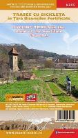
MB06 Radtouren im Land der Kirchenburgen - verschiedene Maßstäbe: 1:40.000, 1:45.000, 1:50.000, 1:55.000, 1:60.000, 1:65.000, 1:70.000, 1:75.000, 1:80.000, 1:90.000 Topographische Radwanderkarte - Mountainbikekarte Schubert & Franzke Rumänien
Cycling trails in the land of the fortified churches
EAN / ISBN: 5948490930702
Preis: EUR 15.90
|
|


