Willkommen bei MapFox
Wurde Ihre Bestellung bestätigt? Wenn nicht - gab es evtl. ein SERVER-Problem! Bitte kontaktieren Sie uns! +++ Buchhändler-Anfragen erwünscht +++
Warenkorb
Artikel: 0 - € 0.00
Zur Kasse
Impressum Kontakt Versandkosten AGB
250 Parco delle Colline di Brescia 1:25.000 - Topographische Wanderkarte - Italien - 4land
<< 4land - Wanderkarten Italien
 
Cover

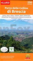
Doppelseitig bedruckte, topographische Wanderkarte des Parco delle Colline, der Stadt Brescia. Die Rückseite der Karte enthält 5 einzelne Kartenausschnitte von Bovezzo, Brescia, Cellatica, Rezzato und Rodengo Saiano mit entsprechenden Wanderwegen. Die touristischen Informationen auf der Karte sind auf Italienisch.

Blattübersicht 1:50.000

Sentiero Italia und Einzelblätter

Blattübersicht 1:25.000 und detaillierter

Westalpen Mittlere Alpen: Südtirol, Dolomiten

Toskana

Mittelitalien

Sardinien

Kartenbeispiel

250 Parco delle Colline di Brescia 1:25.000 - Topographische Wanderkarte - Italien - 4land
EAN / ISBN: 9791280496539
Preis: EUR 16.90

Bestellartikel: versandfertig in ca. 1-3 Wochen. Dieser Artikel wird speziell für Sie bestellt. Keine Rücknahme!
Produkt EUR Anzahl Bestellen
250 Parco delle Colline di Brescia 1:25.000 - Topographische Wanderkarte - Italien - 4land 16.90
Versandkostenfrei in Deutschland ab 30,- Bestellwert

incl. MwSt.

Stichworte, die bei der Suche nützlich sein könnten:
Monte Delma topographische Wanderkarte - Sentiero delle Pozze - Brescia - Bovezzo - Monte Poffa topographische Wanderkarte - Rifugio Valle di Mompiano - Castello - Monte Spina - Rodenga Saiano - Mazzano - Cellatica - Parco delle Colline di Brescia - Collebeato - Rezzato - Monteclana - Sentiero dei Brüsacc - Monte Bonaga - 4land - Vierland - Alpen Wanderkarten - Südtirol - Südtirol Wanderkarten - Apennin Wanderkarten

Zuletzt angesehene Artikel:

Cover250 Parco delle Colline di Brescia 1:25.000 - Topographische Wanderkarte - Italien - 4land

Noch kein Cover vorhandenM-34-28-C/D Przedborz Amtliche topographische Landkarte Polen 1:50.000
M-34-28-C/D Przedborz - Mapa Topograficzna Polski Glowny Geodeta Kraju

Cover208 Appennino Tosco-Emiliano 1:25.000 - Dal Passo del Cerreto al Lago Santo Modenese - Topographische Wanderkarte - Italien - 4land

Cover58/5-6 Viroinval NGI 1:25.000 Topographische Landkarte Belgien

CoverL3532 Mieste Topographische Karte 1:50.000 Landesamt für Vermessung und Geoinformation Sachsen-Anhalt (Landesvermessungsamt)

CoverGorski kotar 2 - Nationalpark Risnjak mit Wanderwegen und Radwegen - Wanderkarte - Fahrradkarte 1:35.000 Kroatien - ProjektNord
Gorski kotar 2 - Nacionalni park Risnjak ProjektNord

CoverHistorische Karte: EUROPA - Die REICHE der KAROLINGER - um 850 (Plano) Das Frankenreich. Die Teilung zu Verdun im August 843 - von Hassenstein, Bruno (Kartograf) Spruner, Karl von (Herausgeber) Rockstuhl, Harald (Sonstige) - Verlag Rockstuhl

CoverE4 Touristischer Wanderweg Witoscha - Werila - Rila - Pirin - Slavyanka Wanderführer E4 Balkangebirge (bulgarisch)
Туристически Маршрут Е4 Oilaripi Bulgarien

CoverChile - Argentinien 1:2 Mio. Straßenkarte (Blatt 788)
Chili - Argentina Michelin

Noch kein Cover vorhandenPickaway County County-Straßenkarte 1:63.000 (Ohio - USA)
Pickaway County county map GIS / Cartography & Publishing Services / GM Johnson

Noch kein Cover vorhandenM-34-35-C/D Chelm Amtliche topographische Landkarte Polen 1:50.000
M-34-35-C/D Chelm - Mapa Topograficzna Polski Glowny Geodeta Kraju

CoverTJ06 Paloona 1:50.000 Topographische Landkarte Tasmanien - Australien - Tasmap (Tasmanien)

CoverNeumünster Nord Topographische Wanderkarte mit Wanderwegen und Radwegen 1:25.000 Schleswig-Holstein - ProjektNord

Noch kein Cover vorhandenVærøy - Lofotodden - Seekarte Norwegische Küste 1:50.000 - (Blatt 71) Den Norske Kyst
Sjøkart - Hovedkart (sjø) Statens Kartverk Sjø - Norwegen

Noch kein Cover vorhanden7 Husum - Friedrichstadt - Tönning - du Platsche Karte 1804-1805 Topographische Karte des Herzogtums Schleswig - Reproduktion 1:100.000

CoverLe Vie del Sale (Blatt 3) - Torriglia e le Valli Scrivia, Trebbia e Aveto - Wanderkarte Italien 1:25.000 dall´Oltrepo Parvese al Mare - Topographische Wanderkarte Studio Cartografico Italiano - Italien

Cover60/3-4 HOUFFALIZE NGI 1:25.000 Topographische Landkarte Belgien

Noch kein Cover vorhandenM-35-49-C/D Sokal Amtliche topographische Landkarte Polen 1:50.000
M-35-49-C/D Sokal - Mapa Topograficzna Polski Glowny Geodeta Kraju

Noch kein Cover vorhandenM-33-34-C/D Wroclaw - West Amtliche topographische Landkarte Polen 1:50.000
M-33-34-C/D Wroclaw - West - Mapa Topograficzna Polski Glowny Geodeta Kraju

Noch kein Cover vorhandenM-34-5-C/D Rawa Mazowiecka Amtliche topographische Landkarte Polen 1:50.000
M-34-5-C/D Rawa Mazowiecka - Mapa Topograficzna Polski Glowny Geodeta Kraju