Willkommen bei MapFox
Wurde Ihre Bestellung bestätigt? Wenn nicht - gab es evtl. ein SERVER-Problem! Bitte kontaktieren Sie uns! +++ Buchhändler-Anfragen erwünscht +++
Warenkorb
Artikel: 0 - € 0.00
Zur Kasse
Widerruf Impressum Kontakt Versandkosten AGB
Island - Tektonische Landkarte 1:600.000
Iceland Tectonic Map FORLAGID - Island
<< Island
 
Cover

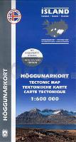
The Tectonic map of Iceland gives a new view of the country`s geology. The rocks are classified by age, but not by type or compostion. Volcanic systems including central volcanoes and fissure and dyke swarms, both active and extinct, are shown, as are the island`s principal fracture zones and the dip of rock layers. The map thus gives a useful insight into the geological structure of the country.

Furthermore, this map contains information and explanations of the geological terms such as Pleistocene, Tertiary, Lava Shield Crater, etc.

Legend and texts in Icelandic, English, German and French language

Kartenbeispiel

Island - Tektonische Landkarte 1:600.000
Iceland Tectonic Map FORLAGID - Island
EAN / ISBN: 9789979330455
Preis: EUR 21.50

Bestellartikel: versandfertig in ca. 1-3 Wochen. Dieser Artikel wird speziell für Sie bestellt. Keine Rücknahme!
Produkt EUR Anzahl Bestellen
Island - Tektonische Landkarte 1:600.000
Iceland Tectonic Map FORLAGID - Island
21.50
Versandkostenfrei in Deutschland ab 30,- Bestellwert

incl. MwSt.

Stichworte, die bei der Suche nützlich sein könnten:
Island Tektonische Karte - Iceland - Iceland Map - Island Karte - Island Landkarte - Island Tektonik - Island - Island - Iceland

Zuletzt angesehene Artikel:

CoverIsland - Tektonische Landkarte 1:600.000
Iceland Tectonic Map FORLAGID - Island

CoverStefan Loose Travel Handbücher Irland - Isle of Man von Biege, Bernd

CoverTeheran Stadtplan 1:15.000 und Nord Iran Landkarte 1:1.8 Mio. (engl.)
Tehran and Northern Iran ITMB International Travel Maps (engl.)

CoverÄmter Wittenberg / Gräfenhainichen 1749 - Historische Landkarte Nachdruck Planokarte - gerollt von Schenk, Peter - Verlag Rockstuhl

CoverAlicante Landkarte 1:200.000 Spanien - Provinzkarte - CNIG
Alicante - Mapa Provincial Centro Nacional de Información Geográfico