 Range of 30 AA sheet maps utilising the 1:25.000 data supplied by the Ordnance Survey. The maps have the familiar look and style of OS mapping, with improved coverage of the featured areas. Aimed at outdoor enthusiasts in particular, the level of details ensures nothing gets missed and you won’t get lost. Features:
? Optimised map coverage centred on the more popular areas of the country for walking
? The majority of maps in the series are double-sided for ease of use
? Trusted and reliable Ordnance Survey data at a scale of 1:25.000
? Contours at 5 and 10 metre intervals shown
? Tourist and leisure information marked
? Public rights of way clearly identified  Kartenausschnitt Kartenausschnitt
Kartenbeispiel
|
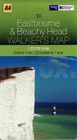
30 Eastbourne & Beachy Head Wanderkarte 1:25.000 Großbritannien AA Automobile Association / OS Ordnance Survey Großbritannien
EAN / ISBN: 9780749573171
Preis: EUR 14.90
|
| 
