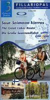
| << Finnland: Fahrradkarten und Radwanderführer << Genimap / Karttakeskus Finnland |
  | |
Zuletzt angesehene Artikel:
![]() | Die Große Seenrundfahrt *** SCHNÄPPCHEN *** Radwanderführer 1:100.000 Suur-Saimaan kierros fillariopas / The Great Lakes Route cycling guide Finland Karttakeskus / Genimap Finnland |
![]() | 1188 Rudau Topographische Karte 1:25.000 Messtischblatt des Deutschen Reiches - Preußische Landesaufnahme / Reichsamt für Landesaufnahme - Faksimile ProjektNord |
![]() | P4234 Salamajärvi Topographische Karte 1:25.000 EUREF (Peruskartta) Maanmittauslaitos / Lantmäteriverket Finnland - ProjektNord |
![]() | 57 Fuhlsbüttel - Alstertal - Varendorfsche Karte 1789-1792 Topographisch Militärische Charte des Herzogtums Holstein - Reproduktion 1:25.000 |
![]() | Fränkischer Kreis 1707 - Historische Landkarte Nachdruck Planokarte - gerollt von Homann, J. Baptist - Verlag Rockstuhl |
![]() | Deutschland Nordost - Mecklenburg-Vorpommern - Berlin - Sachsen-Anhalt - Brandenburg Straßenkarte 1:350.000 (Blatt 542) Michelin Regional |
![]() | Eurovelo 3 Aachen - Paris ADFC-Radreiseführer 1:75.000, wetter- und reißfest, GPS-Tracks zum Download, E-Bike geeignet : Entlang an Flüssen, Kanälen und über ehemalige Bahntrassen entspannt nach Paris. Eine Radtour durch die Geschichte - von Otmar Steinbicker - BVA BikeMedia |
![]() | 5802 Sevenig (Our) - Wanderkarte mit Wanderwegen (geplottete Ausgabe) ProjektNord - Grundlage Amtliche topographische Karte Landesamt für Vermessung und Geobasisinformation Rheinland-Pfalz |
![]() | L4414 Myrskylä-Mörskom Topographische Karte 1:25.000 EUREF (Peruskartta) Maanmittauslaitos / Lantmäteriverket Finnland - ProjektNord |
![]() | USA - Kanada - Mexiko Straßenatlas Scenic Drives edition USA / Canada / Mexico road atlas Scenic Drives edition National Geographic - USA |
![]() | Peak District Nord - Wanderkarte 1:40.000 (wasser- und reißfest) Ultramap XT40 Peak District North - hiking map (durable, tear-resistent and 100% waterproof) HARVEY MAPS - Großbritannien |
![]() | M5133 Konnunsuo Topographische Karte 1:25.000 EUREF (Peruskartta) Maanmittauslaitos / Lantmäteriverket Finnland - ProjektNord |
![]() | Mountain Biking in Slovenia Mountainbikeführer - Cicerone by Rob Houghton Julian Alps - Gorensjka and Soča Valley, South, Central and North East |
![]() | 50-539 Stuttgart Südwest 1:25.000 - Wanderkarte - Renningen, Sindelfingen, Böblingen, Leinfelden-Echterdingen, Weil i.Schönbuch NaturNavi |
![]() | Ostfriesland Leer, Emden, Krummhörn, Norden, Aurich, Wittmund und Ostfriesische Inseln. Mit Oldenburg und Wilhelmshaven - von Wiese, Enno - TRESCHER Reiseführer |
![]() | USA Nordwest - Pazifik Nordwest 1:3 Mio. (Blatt 1) Straßenkarte Borch laminiert USA 1 Northwest - Pacific Northwest |
![]() | Parc del Gennargentu - Sardinien 1:100.000 (Blatt V229) Touristische Landkarte Italien mit touristischer Begleitbroschüre - Belletti Editore |
![]() | 4271 Rozdrazewo Topographische Karte 1:25.000 Messtischblatt des Deutschen Reiches - Preußische Landesaufnahme / Reichsamt für Landesaufnahme - Faksimile ProjektNord |
![]() | Caribbean Islands Explorer 1:4 Mio. / Landkarte Landkarte der Karibischen Inseln mit Karte 1:1.1 Mio. von den Inseln unter dem Winde und den Inseln über dem Winde (Antillen) Visitor`s Map of the Caribbean Islands and Map of the Leeward and Windward Islands Nigel Sitwell - Ocean Explorer Maps |
![]() | Evo - Päijänne - Ilvesvaellus Outdoorkarte 1:25.000 Wanderkarte Karttakeskus - Finnland Evo Päijänne Ilvesvaellus - ulkoilukartta |


