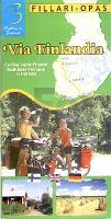
| << Finnland: Fahrradkarten und Radwanderführer << Genimap / Karttakeskus Finnland |
  | |
Zuletzt angesehene Artikel:
![]() | Via Finlandia *** SCHNÄPPCHEN *** Radwanderführer 1:100.000 Via Finlandia fillariopas / cycling guide Finland Karttakeskus / Genimap Finnland |
![]() | 5405 Mechernich (geplottete Ausgabe) Amtliche topographische Karte 1:25.000 Landesvermessungsamt Nordrhein-Westfalen |
![]() | Übernachtung im Freien 55°Nord / Dansk Cyklist Forbund Overnatning i det fri 2016/2017 - Over 1.500 teltpladser og naturlejrpladser i Danmark - Dänemark |
![]() | 5711 Boppard - Wanderkarte mit Wanderwegen (geplottete Ausgabe) ProjektNord - Grundlage Amtliche topographische Karte Landesamt für Vermessung und Geobasisinformation Rheinland-Pfalz |
![]() | Razavi-Chorasan - Touristische Landkarte - Provinz-Straßenkarte 1:650.000 (Blatt 115) Landkarte / Straßenkarte (englisch) The Tourism Map of Khorasan-e Razawi - خراسان رضوی Iranshenasi - Iran |
![]() | NL 33-05 Ljubljana 1:250.000 Klagenfurth am Wörthersee - Leibnitz - Maribor - topographische Landkarte - BEV - Österreich |
![]() | 6810 Hornbach - Wanderkarte mit Wanderwegen (geplottete Ausgabe) ProjektNord - Grundlage Amtliche topographische Karte Landesamt für Vermessung und Geobasisinformation Rheinland-Pfalz |
![]() | NL 33-04-08 (3108) Sillian Österreichische Karte 1:50.000 mit Wegmarkierungen (topographische Wanderkarte - UTM) - BEV - Österreich |
![]() | Mount Rogers High Country - Grayson Highlands State Park 1:35.000 (Blatt 318) California Landkarte wasserfest - Trails Illustrated Map - National Geographic - USA National Geographic |
![]() | E11 Pegnitz - mit Creußen, Ahorntal, Pottenstein, Glashütten, Hummeltal, Schnabelwaid ATK25 Topographische Karte 1:25.000 (Atkis) Bayern Landesvermessungsamt Bayern - Wanderkarte |
![]() | Hirschberg plus 5 Stadtplan 1:20.000 (Krummhübel - Schmiederberg - Lauban - Schreiberhau - Bad Flinsberg) Jelenia Gora plus 5 (Karpacz - Kowary - Luban - Szklarska Poreba - Swieradow) DEMART - Polen |
![]() | 5803 Leidenborn - Wanderkarte mit Wanderwegen (geplottete Ausgabe) ProjektNord - Grundlage Amtliche topographische Karte Landesamt für Vermessung und Geobasisinformation Rheinland-Pfalz |
![]() | Thailand - Vietnam - Laos & Kambodscha Atlas 1:1.1 Mio. Thailand - Vietnam - Laos & Cambodia Atlas ITMB International Travel Maps (engl.) |
![]() | Rhein-Radweg 5, Köln - Rotterdam Leporello Radtourenkarte mit Ausflugszielen, Einkehr- & Freizeittipps, wetterfest, reissfest, abwischbar, GPS-genau. 1:50000 - von - Freytag-Berndt und ARTARIA Publicpress |
![]() | 5413 Westerburg - Wanderkarte mit Wanderwegen (geplottete Ausgabe) ProjektNord - Grundlage Amtliche topographische Karte Landesamt für Vermessung und Geobasisinformation Rheinland-Pfalz |
![]() | 6309 Birkenfeld Ost - Wanderkarte mit Wanderwegen (geplottete Ausgabe) ProjektNord - Grundlage Amtliche topographische Karte Landesamt für Vermessung und Geobasisinformation Rheinland-Pfalz |
![]() | 5613 Schaumburg - Wanderkarte mit Wanderwegen (geplottete Ausgabe) ProjektNord - Grundlage Amtliche topographische Karte Landesamt für Vermessung und Geobasisinformation Rheinland-Pfalz |
![]() | Teheran - Touristische Landkarte - Provinz-Straßenkarte 1:260.000 (Blatt 119) Landkarte / Straßenkarte Tehran Iranshenasi - Iran |
![]() | 6610 Homburg - Wanderkarte mit Wanderwegen (geplottete Ausgabe) ProjektNord - Grundlage Amtliche topographische Karte Landesamt für Vermessung und Geobasisinformation Rheinland-Pfalz |
![]() | Rund um das Frische Haff - 1:100.000 Landkarte vom Bereich Königsberg / Kaliningrad bis Elbing / Elblag - Braunsberg / Braniewo bis Bartenstein / Bartoszyce - Ortsnamenkarte von Dirk Bloch - BLOCHPLAN |


