Willkommen bei MapFox
+++ Buchhändleranfragen willkommen! Tel. 0431-666 75 99 +++
Warenkorb
Artikel: 0 - € 0.00
Zur Kasse
Impressum Kontakt Versandkosten AGB
Namibia Road Map - Straßenkarte The only road map of Namiba that shows the official road network of the Roads Authority Namibia - von Prof. Dr. Jäschke, Uwe - Huber Kartographie
<< Namibia
<< Huber Kartographie
 
Cover

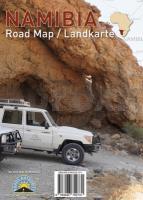
The Namibia Campsite Edition map at a scale of 1: 2,000,000 is in English and is the only road map of Namiba that shows the official road network of the Roads Authority Namibia. The map contains the most important campsites and outdoor tips as well as a distance table. The map also depicts western Botswana with the UNESCO World Heritage Okavango Delta. A list of the most important places of interest with plan squares complements the map. The geography is illustrated by means of coloured elevation layers. In addition the map shows the city maps of Windhoek and Swakopmund as well as an overview of the Etosha National Park.

Namibia Road Map - Straßenkarte The only road map of Namiba that shows the official road network of the Roads Authority Namibia - von Prof. Dr. Jäschke, Uwe - Huber Kartographie
EAN / ISBN: 9783943752731
Preis: EUR 14.00

Bestellartikel: versandfertig in ca. 1-3 Wochen. Dieser Artikel wird speziell für Sie bestellt. Keine Rücknahme!
Produkt EUR Anzahl Bestellen
Namibia Road Map - Straßenkarte The only road map of Namiba that shows the official road network of the Roads Authority Namibia - von Prof. Dr. Jäschke, Uwe - Huber Kartographie 14.00
Versandkostenfrei in Deutschland ab 30,- Bestellwert

incl. MwSt.

Stichworte, die bei der Suche nützlich sein könnten:
Kartographie Huber - Huber Kartografie - Huber - Albanien Landkarten - Balkan Landkarten - Rumänien Landkarten - Namibia - Namibiakarten - Namibia Landkarten - Namibia Atlanten - Namibia Straßenkarten - Namibia Kartografie - Namibia Karten - Namibia Radwanderführer - Namibia Reiseführer - Namibia Wanderkarten - Namibia Kartographie - Namibia Fahrradkarten - Namibia Radwanderkarten - Namibia Landkartenverkauf - Südwestafrika

Zuletzt angesehene Artikel:

CoverNamibia Road Map - Straßenkarte The only road map of Namiba that shows the official road network of the Roads Authority Namibia - von Prof. Dr. Jäschke, Uwe - Huber Kartographie

CoverAfrika politisch PLANO-Karte 1:14.244 Mio. (Format: 60 x 78 cm) - gerollt im Plastikrohr
Africa political flat map National Geographic

CoverDramburg Stadtplan und Gemeinde-Karte :1:15.000/1:55.000 Wanderkarte
Drawsko Pomorskie miasto i gmina - mapa turystyczna EKO-Map - Polen

Noch kein Cover vorhanden87/104 Valuiki / Troitskaia - Amtliche topographische Landkarte 1:100.000 der Ukraine Kiewskaja Wojenno-Kartografitscheskaja Fabrika Ukraine

CoverC5506 Bonn (geplottete Ausgabe) Topographische Landkarte 1:100.000 Landesvermessungsamt Nordrhein-Westfalen

Noch kein Cover vorhanden1119 Süderlügum - Gestern und Heute - Historische Überlagerung 1932-1950 Topographische Landkarte 1:25.000 im Vergleich - Landesvermessungsamt Schleswig-Holstein / ProjektNord

Noch kein Cover vorhandenSubacius (65-69/55-59) Topografische Karte Litauen 1:50.000
Lietuvos Respublikos Topografinis Zemelapis 1:50.000 - Nacionaline Zemes Tarnyba - Litauen

CoverNantahala & Cullasaja gorges Trail - North Carolina (Blatt: 785) 1:70.000 wasserfest Landkarte / Trekkingkarte - Trails Illustrated Map - National Geographic - USA

CoverDie Berge Pokutiens 1:50.000 Topografische Wanderkarte 1:50.000 Karpaten - Ukraine
Pokutski Mountains / Pokutski Hory - paperova mapa ASSA / Karpatski Steszky - Ukraine

Noch kein Cover vorhanden2126 Kisdorf - Gestern und Heute - Historische Überlagerung 1932-1950 Topographische Landkarte 1:25.000 im Vergleich - Landesvermessungsamt Schleswig-Holstein / ProjektNord

Noch kein Cover vorhanden1620 Friedrichstadt - Gestern und Heute - Historische Überlagerung 1902-1930 Topographische Landkarte 1:25.000 im Vergleich - Landesvermessungsamt Schleswig-Holstein / ProjektNord

Cover4520 Warburg - Wanderkarte mit Wanderwegen (geplottete Ausgabe) Topographische Landkarte Hessen 1:25.000 - ProjektNord (geplottete Ausgabe)

CoverMount Everest - zum 50. Jahrestag der Erstbesteigung Laminierte PLANO-Karte 1:90.000 (Format: 119 x 78 cm) - gerollt im Plastikrohr
Mount Everest 50th Anniversary flat map - laminated National Geographic

Cover5116 Eibelshausen - Wanderkarte mit Wanderwegen (geplottete Ausgabe) Topographische Landkarte Hessen 1:25.000 - ProjektNord (geplottete Ausgabe)

CoverUK 50-36 Landkreis Dingolfing-Landau - Deggendorf - Plattling - Osterhofen - Vilstal Wanderkarte Bayern 1:50.000 mit Wanderwegen, mit Radwanderwegen, GPS-Gitter Bayerisches Landesvermessungsamt

CoverOberschwaben - Isny - Wangen - Leutkirch (Nr. 187) 4in1 Wanderkarte 1:50000 mit Aktiv Guide und Detailkarten inklusive Karte zur offline Verwendung in der KOMPASS-App. Fahrradfahren. - von KOMPASS-Karten GmbH

CoverQ15 Reit im Winkl - Grassau, Marquartstein, Schleching, Unterwössen, Bergen, Kössen ATK25 Topographische Karte 1:25.000 (Atkis) Bayern Landesvermessungsamt Bayern - Wanderkarte - Radwanderkarte

CoverSüdöstliches Hochsauerland, Winterberg - Medebach - Hallenberg Wanderkarte mit Ausflugszielen, Einkehr- & Freizeittipps, wetterfest, reissfest, abwischbar, GPS-genau. 1:25000 - von - Freytag-Berndt und ARTARIA PUBLICPRESS

Cover6019 Babenhausen - Wanderkarte mit Wanderwegen (geplottete Ausgabe) Topographische Landkarte Hessen 1:25.000 - ProjektNord (geplottete Ausgabe)

CoverJohannisburg (Masurische Seen II) Kreiskarte des Deutschen Reiches 1:100.000 (KDR 100 KK) - Faksimile Reichsamt für Landesaufnahme