| << Deutschland: Historische Karten und Stadtpläne (im Bereich der heutigen Bundesrepublik) << Rockstuhl |
||
|
||
Zuletzt angesehene Artikel:
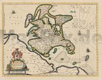
 | Rügen 1647 - Historische Landkarte Nachdruck Planokarte - gerollt von Lubin, Eilhard - Verlag Rockstuhl |
 | Gran Paradiso (Blatt 1) 1:50.000 Topographische Wanderkarte - 1:500.000 Touring-Club Italiano (TCI) Italien |
 | Kiew Stadtplan 1:15.000 (ukrainisch - kyrillische Schrift) Kyiv - Plan Goroda Kartografija - ukrmap Ukraine |
 | TopMaps Sachsen Topographische Karte 1:25.000 Präsentationsgrafik Ausgabe auf DVD - Landesvermessungsamt Sachsen |
 | 5812 St. Goarshausen Topographische Karte 1:25.000 - Landesamt für Vermessung und Geobasisinformation Rheinland-Pfalz |
 | 7518 Horb am Neckar Topographische Landkarte 1:25.000 - Landesvermessungsamt Baden-Württemberg |
 | Pirineu Occidental 1:100.000 (Blatt 1) Topographische Landkarte Katalonien Spanien - ICGC - Institut Cartogràfic i Geològic de Catalunya |
 | Kaiserwinkl - Walchensee - Kössen - Schwendt - Rettenschöss (Blatt 460) - Wanderkarte Walter Mayr - KOMPASS |
| 057 N Hedmarken NORD 1:50.000 - Amtliche Topographische Landkarte Norwegen - Startens Kartverk |
 | 2824 Schneverdingen Amtliche topographische Karte 1:25.000 Landesvermessungsamt Niedersachsen |
 | Mexico Nordost 1:1 Mio. Straßenkarte Mexico North East ITMB International Travel Maps (engl.) |
| 5044 Frankenberg/Sa. Amtliche Topographische Landkarte 1:25.000 (Präsentationsgrafik) - Landesvermessungsamt Sachsen |
| 4234 Aschersleben Topographische Karte 1:25.000 Landesamt für Vermessung und Geoinformation Sachsen-Anhalt (Landesvermessungsamt) |
 | 6811 Pirmasens Süd Topographische Karte 1:25.000 - Landesamt für Vermessung und Geobasisinformation Rheinland-Pfalz |
 | 1092 USTER 1:25.000 - Greifensee - Pfäffikersee - Wila - Topographische Landeskarte der Schweiz - swisstopo |
 | 2826 Egestorf Topographische Wanderkarte 1:25.000 Niedersachsen mit Wanderwegen - ProjektNord |
 | Polnische Tatra - Wanderkarte 1:30.000 (Blatt 412) TATRY POLSKIE kompaktowe Cartomedia - Polen |
 | Trebon (Blatt 47) - Wasserfest auf Pretex Topographische Wanderkarte 1:25.000 Třeboňsko Geodezie On Line - Tschechien |
 | Nordfrankreich - Benelux DKV-Kanuführer Ausland (Band 6) Deutscher Kanuverband |
 | DuMont Reise-Handbuch Reiseführer Australien, Der Osten und Tasmanien mit Extra-Reisekarte - von Dusik, Roland - DuMont Reiseverlag |