| << Reise-Know-How Verlag - world mapping project << Reisen allgemein: Fremdsprachen, Verständigung und Kultur |
  | |
Zuletzt angesehene Artikel:
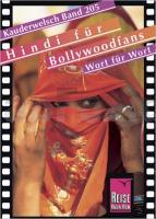
![]() | Hindi für Bollywoodfans - Wort für Wort Kauderwelsch-Sprachführer (Band 205) Indien - Reise-Know-How Verlag |
![]() | L-34-26-B Százhalombatta Amtliche Topographische Karte Ungarn 1:50.000 |
![]() | 5914 Eltville Topographische Landkarte Hessen 1:25.000 - ProjektNord (geplottete Ausgabe) |
![]() | Suwalki-Land 1:85.000 Laminierte touristische Landkarte Suwalszczyzna ExpressMap Polen |
![]() | Cayman-Inseln 1:37.500 / Jamaika 1:250.000 Landkarte - ITMB International Travel Maps (engl.) Cayman Islands - Jamaica |
![]() | Prättigau (Blatt 3) 1:50.000 Topographische Skitourenkarte der Schweiz - SNOW TRAIL MAP |
![]() | 3518 Diepenau Topographische Wanderkarte 1:25.000 Niedersachsen mit Wanderwegen - ProjektNord |
![]() | Slowakisches Paradies - 1:50.000 / 1:25.000 (Blatt 5005) Wanderkarte (englische Ausgabe) The Slovak Paradise TatraPlan - Slowakei |
![]() | 1311OT Ste-Mére-Eglise - Utah-Beach Topographische Wanderkarte Frankreich 1:25.000 TOP 25 IGN - (GPS) |
![]() | Hawaii PLANO-Karte 1:773.000 (Format: 88 x 58 cm) - gerollt im Plastikrohr Hawaii flat map National Geographic |
![]() | IJsselroute - 11 fietsrondritten & 7 stadswandelingen - spiral Fahrradführer Niederlande Buijten & Schipperheijn |
![]() | 3650 Fürstenwalde (Spree) Sonderausgabe mit Wanderwegen - Topographische Wanderkarte Brandenburg 1:25.000 ProjektNord |
![]() | C13 Sørkapp Spitzbergen / Svalbard / Spitsbergen - Topographische Karte 1:100.000 Norsk Polarinstitutt |
![]() | Côte d`Azur - Esterelmassiv / Französische Riviera 1:100.000 Straßenkarte Frankreich zoom (Blatt 115) Michelin Côte d`Azur - Massif de l`Esterel / French Riviera - Esterel |
![]() | D4 Gotiahalvøya Spitzbergen / Svalbard / Spitsbergen - Topographische Karte 1:100.000 Norsk Polarinstitutt |
![]() | Breslau Stadtplan 1:20.000 Touristenkarte Wrocław plan miasta Artglob Polen |
![]() | E6 Wilhelmøya Spitzbergen / Svalbard / Spitsbergen - Topographische Karte 1:100.000 Norsk Polarinstitutt |
![]() | Freiberger Mulde - Rechenberg-Bienenmühle (Blatt 26) Topographische Wanderkarte 1:25.000 mit Wanderwegen - ProjektNord |
![]() | Breslau Stadtplan 1:20.000 Touristenkarte Wrocław mapa turystyczna EkoGraf - Polen |
![]() | Shropshire Way topographische Wanderkarte 1:40.000 (wasserfest und reißfest) National Trail Map XT40 - HARVEY MAPS Shropshire Way - Shropshire Hills Sections - Long Distance Route - XT40 |


