 Extra colour mapping, in stage sections (one stage per page) also including trail profiles showing the climbs and descents to help you plan your walk each day 16pp colour introductory section - making it even more attractive to the reader PLUS - 57 maps - 4 town plans and 53 large-scale walking maps - at just under 1:20,000 - showing route times, gradients, where to stay, interesting features, fully-edited maps drawn by walkers for walkers. Plus downloadable GPS points.
- Itineraries for all walkers - whether walking the route in its entirety over one week, or sampling the highlights on day walks and short breaks.
- Practical information for all budgets - Glasgow through to Fort William: where to stay (campsites, hostels, B&Bs, pubs and hotels), where to eat, what to see.
- Public transport information for all budgets - all access points on the path.
- Fully updated - the entire route has been re-walked and all details re-checked for this new edition.
 Übersicht der Trailblazer Wanderführer Großbritannien Übersicht der Trailblazer Wanderführer Großbritannien Kartenausschnitt
Kartenbeispiel
|
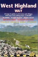
West Highland Way (Glasgow to Port William) Wanderführer englisch Trailblazer
EAN / ISBN: 9781912716296
Preis: EUR 19.90
|
|


