Willkommen bei MapFox
+++ Buchhändleranfragen willkommen! Tel. 0431-666 75 99 +++
Warenkorb
Artikel: 0 - € 0.00
Zur Kasse
Impressum Kontakt Versandkosten AGB
The Mountains of Ronda and Grazalema Grazalema and La Sierra de las Nieves Natural Parks - Wanderführer Cicerone Großbritannien (englisch)
<< Spanien: Wanderführer, Radwanderführer und Reiseführer
<< Cicerone
 
Cover

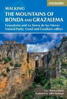
The dramatically situated town of Ronda can make a great base for a walking holiday in the mountains of Andalucia, as can any one of the picturesque `pueblos blancos` (white villages) that nestle among the surrounding hills. This guidebook presents 32 mainly circular walks in the Ronda region, covering the town and its environs, the Natural Parks of La Sierra de Grazalema and La Sierra de las Nieves (both UNESCO biosphere reserves), and the Genal and Guadiaro Valleys. Ranging from 3.5-16.5km (2-10 miles), many walks are graded easy or moderate and nearly all can be done from mid-September through to mid-June, thanks to the area`s comparatively mild winters. Clear route description is illustrated with mapping, and the route summary table and `at a glance` information boxes make it easy to choose the right walk. In addition to practical information on transport and bases, the introduction offers an overview of Andalucian plants and wildlife, geology and history, and the routes themselves include notes on points of interest, from trees to chapels and from summits to local traditions. Useful contacts, accommodation listings and a short Spanish-English glossary can be found in the appendices. While Ronda itself is famed for its striking gorge and Moorish architecture, the surrounding countryside boasts magnificent scenery at every turn. With dramatic limestone peaks, fertile river valleys and ancient groves of almonds and olives, the natural beauty of Ronda and Grazalema won`t fail to impress.

Kartenausschnitt

Kartenbeispiel

The Mountains of Ronda and Grazalema Grazalema and La Sierra de las Nieves Natural Parks - Wanderführer Cicerone Großbritannien (englisch)
EAN / ISBN: 9781786312433
Preis: EUR 25.90

Bestellartikel: versandfertig in ca. 3-7 Tagen. Dieser Artikel wird speziell für Sie bestellt. Keine Rücknahme!
Produkt EUR Anzahl Bestellen
The Mountains of Ronda and Grazalema Grazalema and La Sierra de las Nieves Natural Parks - Wanderführer Cicerone Großbritannien (englisch) 25.90
Versandkostenfrei in Deutschland ab 30,- Bestellwert

incl. MwSt.

Stichworte, die bei der Suche nützlich sein könnten:
Grazalema Wanderführer - La Sierra de las Nieves Wanderführer - Ronda Reiseführer - Spanien Wanderführer - Grazalema - Spanien - Ronda - La Sierra de las Nieves - Ronda Wanderführer - Grazalema Reiseführer - La Sierra de las Nieves Reiseführer - Spanien Reiseführer - Spanien Wanderführer - Spanien Radwanderführer - Spanien Fahrradführer - Spanien Reiseführer - Cicerone - Cicerone Radwanderführer - Cicerone Wanderführer - Großbritannien Radwanderführer - Großbritannien Wanderführer - Cicerone Großbritannien

Zuletzt angesehene Artikel:

CoverThe Mountains of Ronda and Grazalema Grazalema and La Sierra de las Nieves Natural Parks - Wanderführer Cicerone Großbritannien (englisch)

Cover01 Sappada - San Stefano - Forni Avoltri Topographische Wanderkarte 1:25.000 - Casa Editrice Tabacco - Italien

Cover156 Saxmundham - Aldeburgh & Southwold - Wanderkarte Großbritannien 1:50.000 LANDRANGER MAP - Ordnance Survey

CoverSaariselkä - Hammastunturi Wanderkarte 1:25.000 / 1:50.000 - Finnland - Calazo Förlag

CoverBayerische Alpen - Zwischen Inn und Lech - 60 Skitouren für Einsteiger und Genießer - Rother Skiführer - Bergverlag Rother

Noch kein Cover vorhandenBD31pt Topographische Landkarte Neuseeland 1:50.000 Land Information New Zealand

Cover193 Taunton & Lyme Regis - Chard & Bridport - Wanderkarte Großbritannien 1:50.000 LANDRANGER MAP - Ordnance Survey

Cover1222 Flensburg Süd Topographische Landkarte 1:25.000 Landesvermessungsamt Schleswig-Holstein

Cover2 Al Hoceima - Melilla - Taourirt Topographische Straßenkarte 1:250.000 - Marokko ProjektNord

CoverNorth Annapurna Base Camp Trekkingkarte 1:60.000 *** SCHNÄPPCHEN *** Himalayan MapHouse - Nepal

CoverLonquimay 1:100.000 Trekking- und Reisekarte
Lonquimay - Trekking & Travel Map Viachile Editores - Chile

CoverMit dem Kinderwagen durch die Pfalz 34 babyfreundliche Wanderungen - von Fuchs-Risch, Christina Fuchs, Philipp - Pfälzische Verlagsanstalt GmbH

Cover12 Gruppo del Monte Cucco 1:25.000 - Parco del Monte Cucco - Monte della Strega - Monte le Siere - Wanderkarte Italien - Monti Editore

CoverKastillien - Leon - Madrid Straßenkarte 1:400.000 (Blatt 575)
Castilla y Leon - Madrid Michelin Regional

Cover95 Media Valmarecchia 1:25.000 (wasserfest) Topographische Wanderkarte l`Escursionista Editore - Italien
Carta escursionistica e per mountain bike della Media Valmarecchia e dell`Alta valle dell`Uso

CoverBuenos Aires - Milongas 1:18.000 Stadtplan - Argentinien
Buenos Aires City Map DeDios Editores

CoverC5142 Chemnitz - Topografische Karte 1:100.000 Normalausgabe mit UTM-Gitter (WGS84) - Landesvermessungsamt Sachsen