Willkommen bei MapFox
Wurde Ihre Bestellung bestätigt? Wenn nicht - gab es evtl. ein SERVER-Problem! Bitte kontaktieren Sie uns! +++ Buchhändler-Anfragen erwünscht +++
Warenkorb
Artikel: 0 - € 0.00
Zur Kasse
Impressum Kontakt Versandkosten AGB
The Ceredigion and Snowdonia Coast Paths - Cardigan Bay on the Wales Coast Path Wanderführer (englisch) Cicerone Großbritannien
<< Großbritannien: Wanderführer + Kletterführer
<< Cicerone
 
Cover

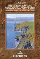
In 16 day stages from Porthmadog to St Dogmaels, this guidebook offers all the information walkers need to complete the 233km (145 miles) section of the Wales Coast Path that curve down Cardigan Bay, passing through a range of contrasting landscapes.

Linking the Llyn Peninsula Coast Path with that of the Pembrokeshire Coastal Path, this section takes in Snowdonia National Park’s splendid coastal plains, leads inland through beautiful hill country around the Dyfi Estuary and follows some of the finest coastline in all of Wales on the Ceredigion Coast Path.

Untouched fishing villages mingle with university towns and medieval castles, ensuring plentiful sights and seascape views, from sandy beaches, dramatic cliffs, peaceful estuaries and coastal hills. And with excellent public transport links, you don`t have to tackle it all at once. It`s easy to split into short breaks and day walks as suits your schedule.

Kartenausschnitt

The Ceredigion and Snowdonia Coast Paths - Cardigan Bay on the Wales Coast Path Wanderführer (englisch) Cicerone Großbritannien
EAN / ISBN: 9781852847388
Preis: EUR 19.90

Dieser Titel ist momentan nicht lieferbar.
Produkt EUR Anzahl Bestellen
The Ceredigion and Snowdonia Coast Paths - Cardigan Bay on the Wales Coast Path Wanderführer (englisch) Cicerone Großbritannien 19.90
Versandkostenfrei in Deutschland ab 30,- Bestellwert

incl. MwSt.

Stichworte, die bei der Suche nützlich sein könnten:
Snowdonia Coast Paths - Cardigan Bay - the Wales Coast Path - The Ceredigion Coast Path - Cicerone - Cicerone Radwanderführer - Cicerone Wanderführer - Großbritannien Radwanderführer - Großbritannien Wanderführer - Cicerone Großbritannien - Großbritannien - Großbritannien Wanderführer - Großbritannien Trekkingführer - Großbritannien Klettern - Großbritannien Kletterführer

Zuletzt angesehene Artikel:

CoverThe Ceredigion and Snowdonia Coast Paths - Cardigan Bay on the Wales Coast Path Wanderführer (englisch) Cicerone Großbritannien

CoverMount Elgon - Wanderkarte und Wanderführer (engl.) Mount Elgon - Massaba (Kenya Uganda) map and guide 1:50.000 1:125.000 WEST COL PRODUCTIONS

CoverMount Kenya Wanderkarte mit Wanderführer 1:50.000 / Gipfelbereich 1:25.000 Mt Kenya Map and Guide 1:25 000 1:50.000 WEST COL PRODUCTIONS

Cover012 Thurso & Wick, John O`Groats - Wanderkarte Großbritannien 1:50.000 Active Laminiert LANDRANGER MAP - Ordnance Survey

CoverHistoric Walks in Cheshire A collection of 20 scenic walks - Wanderführer North West England - Cicerone Großbritannien (englisch)

CoverDuMont Reise-Handbuch Kenia - Tansania von Eiletz-Kaube, Daniela u. Jorke, Sabine, Kordy, Steffi

CoverFernwanderweg Weserbergland-Weg von Hann. Münden nach Porta Westfalica - Hikeline Wanderführer - Verlag Esterbauer

CoverLivingston (West Lothian) Fahrradkarte 1:15.000 HARVEY MAPS
Livingston (West Lothian) for Cyclists

CoverFolyMaps Harz Weserbergland 1:250.000 - Straßen- und Tourenkarte - TVV Touristik-Verlag GmbH

CoverLake Manyara & Tarangire National Park Tourist Map 1:200.000 - von Harms, Harald K.H. HarmsLawall, Klaus-Peter - harms-ic-verlag

Cover426S Speer 1:50.000 - Tanzboden - Tweralpspitz - Toggenburg - Topographische Skitourenkarte SSV der Schweiz - swisstopo