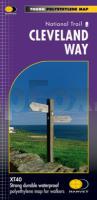
 174km (109 miles) from Helmsley across the North York Moors National Park to Saltburn and along the coast via Scarborough ending at Filey.
Information on finding accommodation, camping, food. Directions to the start. Also Ranger Service contact numbers and enlargements of towns/villages showing facilities available and tips on weather and clothing
Detailed mapping, full legend. National Grid - can be used with GPS. 1:40,000 scale. Waterproof. Supplied in clear plastic pocket  Kartenausschnitt Kartenausschnitt
Kartenbeispiel
|
Cleveland Way National Trail - XT40 Wanderkarte 1:40.000 waterproof - HARVEY MAPS Großbritannien
EAN / ISBN: 9781851374892
Preis: EUR 23.90
|
|


