 Series of maps taken from the British War Office GSGS.4525 maps published in 1945. Introduction in English by Alan Godfrey, with a summary in German. At a scale of approx 1:19,000 the map is especially good at showing industry, collieries and transport at the time. Einführung in englischer Sprache von Alan Godfrey, mit einer Zusammenfassung in deutscher Sprache.  Kartenbeispiel aus der Serie Kartenbeispiel aus der Serie
Kartenausschnitt
|
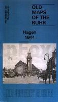
Hagen & Herdecke 1944 1:19.000 (Blatt 18) Alte Landkarten des Ruhrgebiets
18 Hagen & Herdecke - Old maps of the Ruhr Alan Godfrey Maps
EAN / ISBN: 9781847846907
Preis: EUR 8.95
|
| 


